Crêtes de l’Arselle Raquette
Grenoble
Easy raquette route at Chamrousse
Hiking Easy
- Distance
- 6 km
- Ascent
- 160 m
- Descent
- 150 m
- Duration
- 1-2 hrs
- Low Point
- 1.6 km
- High Point
- 1.7 km
- Gradient
- 7˚
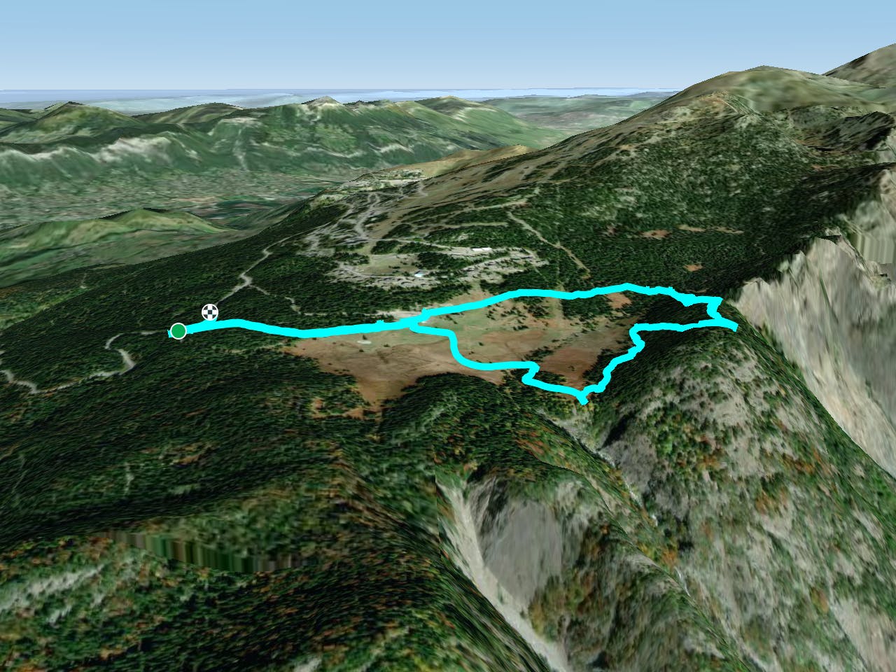
This is a popular hiking route which is generally considered to be easy. It's not remote, it features low exposure and is typically done between January and March. From a low point of 1.6 km to the maximum altitude of 1.7 km, the route covers 6 km, 160 vertical metres of ascent and 150 vertical metres of descent.
Description
Easy hike around the Plateau de l'Arselle (marked #1), with views down the romanche valley and back across the plateau. The Chamrousse map claims 3.4km 90m climb, but that's from the base at the plateau. From the car park, it's 6km 160m climb.
Difficulty
Easy
Walking along a well-kept trail that’s mostly flat. No obstacles are present.
Low Exposure

The path is on completely flat land and potential injury is limited to falling over.
Remoteness
Close to help in case of emergency.
Best time to visit
Features
- Picturesque
- Family friendly