4.6 km away
Traverse Plan de la Lai to Les Mottets via Col des Fours
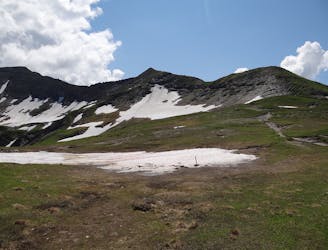
A straightforward route offering a multitude of alpine highlights along the way.
Moderate Hiking
- Distance
- 18 km
- Ascent
- 1.3 km
- Descent
- 1.2 km
Treicol, presset, col bonhomme, Roselend
Hiking Difficult

This is a popular hiking route which is generally considered to be difficult. It's not remote, it features low exposure and is typically done between July and September. From a low point of 1.5 km to the maximum altitude of 2.7 km, the route covers 49 km, 3129 vertical metres of ascent and 3136 vertical metres of descent.
Treicol, presset, col bonhomme, Roselend, 3 days hikking
Difficult
Hiking trails where obstacles such as rocks or roots are prevalent. Some obstacles can require care to step over or around. At times, the trail can be worn and eroded. The grade of the trail is generally quite steep, and can often lead to strenuous hiking.

The path is on completely flat land and potential injury is limited to falling over.
Close to help in case of emergency.
4.6 km away
A straightforward route offering a multitude of alpine highlights along the way.
Moderate Hiking
8.8 km away
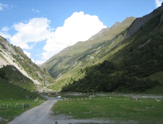
Day 4: A long day with a gradual climb and an equally gradual descent which takes you on the first border crossing of the Tour du Mont Blanc, from France to Italy via the wide and bleak-feeling Col de la Seigne.
Difficult Hiking

14 routes · Hiking