7.1 km away
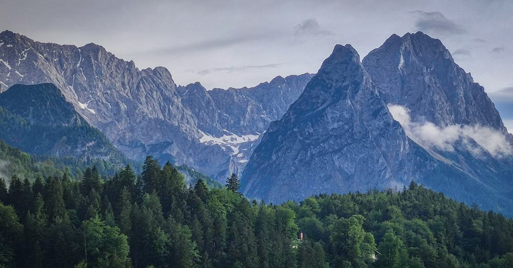
Sonnenspitze South Ridge
A multi sport day culminating in a long ridge climb up a beautifully positioned peak
Severe Alpine Climbing
- Distance
- 19 km
- Ascent
- 1.1 km
- Descent
- 1.5 km
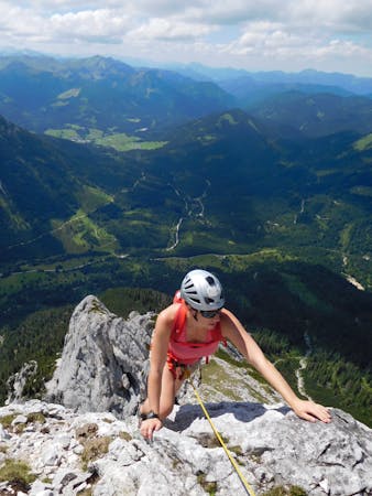
From the höllental Hütte to the summit of Germany's highest mountain, via ferrata and short glacier crossing. Moderate for more experienced/difficult for beginners. In bad weather circumstances this can become a very challenging route, so always check the weather forecast!
Alpine Climbing Difficult

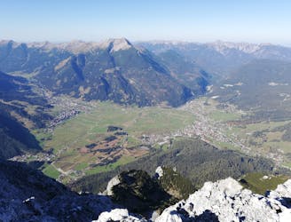
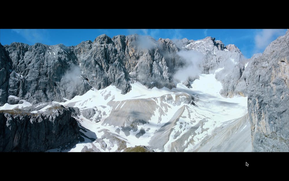
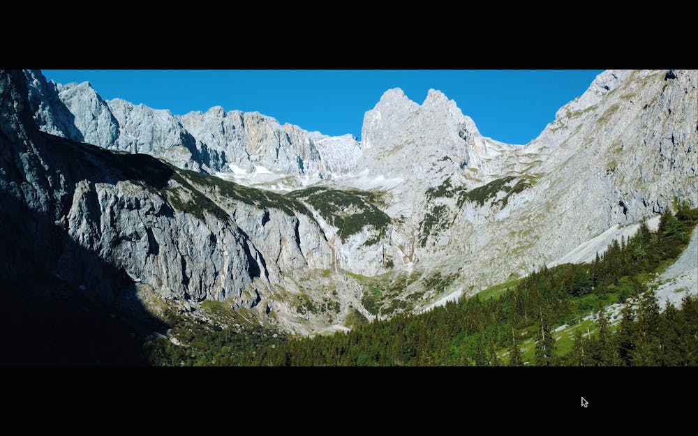
Amazing al round mountaineering route for those who want to have a true alpine experience for the first time, but do not underestimate this route if you push the summit in one single day, because you need a decent fitness level to do so! I did this walk from the village of Garmisch Partekirchen in one day and it took me around 9 to 10 hours to reach the summit. usually they start from hammersbach and you can reach the Höllental Hütte in about 3 hours from there. Easier option is to stay over in the hut and walk it in 2 days, instead of 2300 hight meters, this second stage requires around 1686 hight meters and is still not a normal walk. You will pass 2 different via ferrata stages: 1 after leaving the hut, where you pass "Das Brett" with stunning views into the Höllental Valley. After that some rock scrambling, but never difficult untill you reach shortly after that the Schneeferner Glacier. I used my crampons and ice axe. It was in the beginning of June and it took me around 45 min to reach the 2e stage of the via ferrata. A more steep climb. and the beginning is usually a start with a metal ladder, but because of the changing glacier structure it was moved a few meters up with new cables. From there you leave the glacier behind and push for the last part up to the summit.
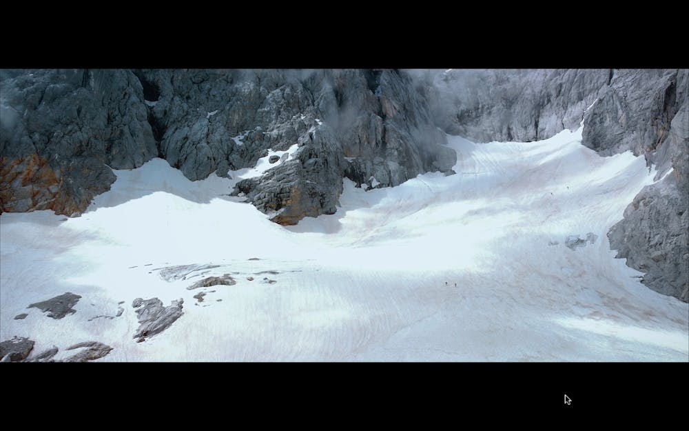
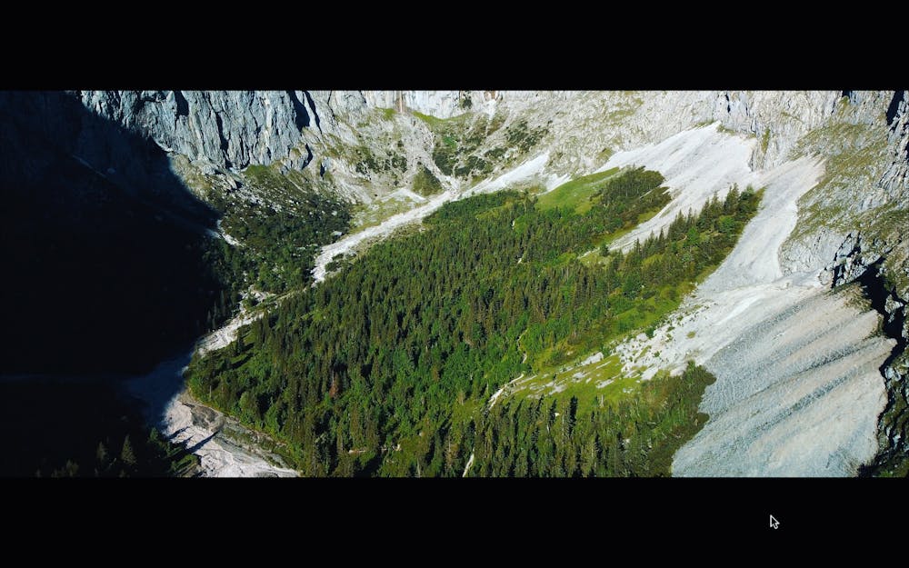
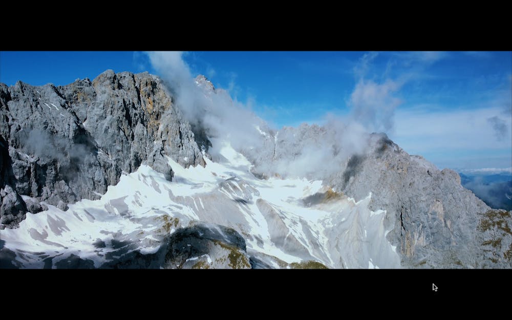
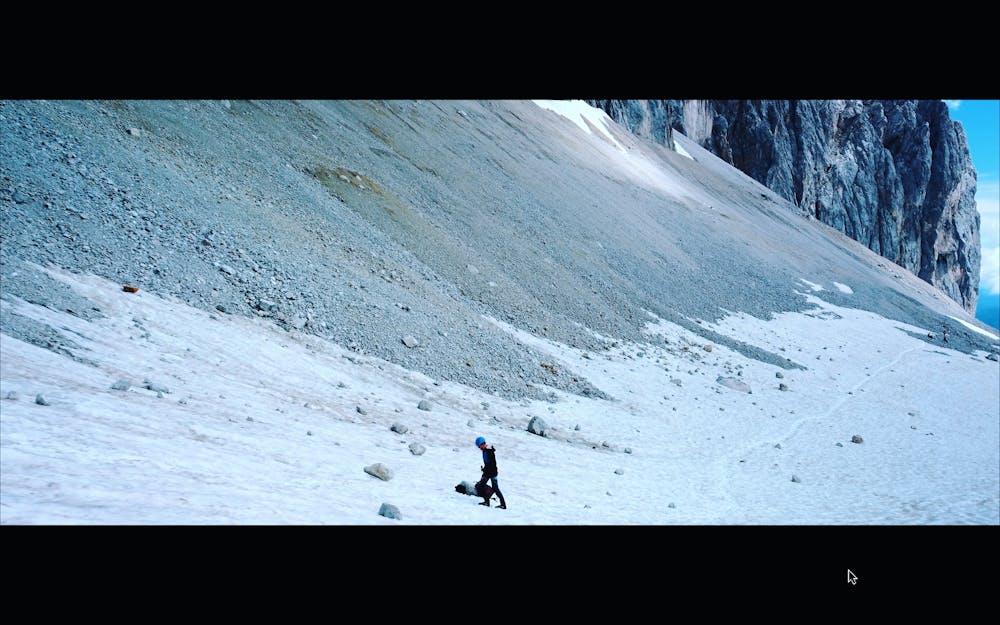
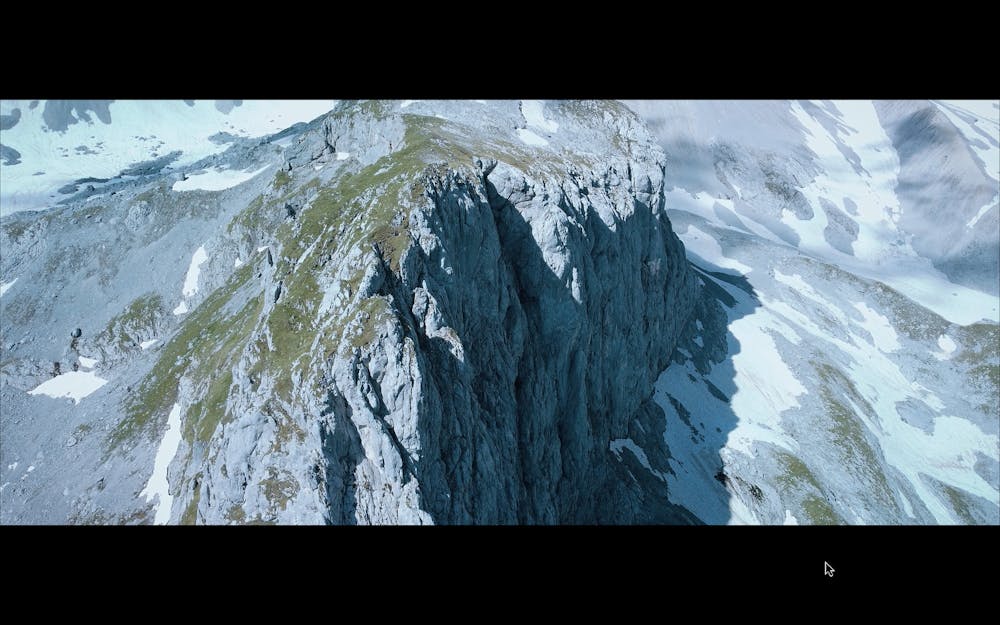
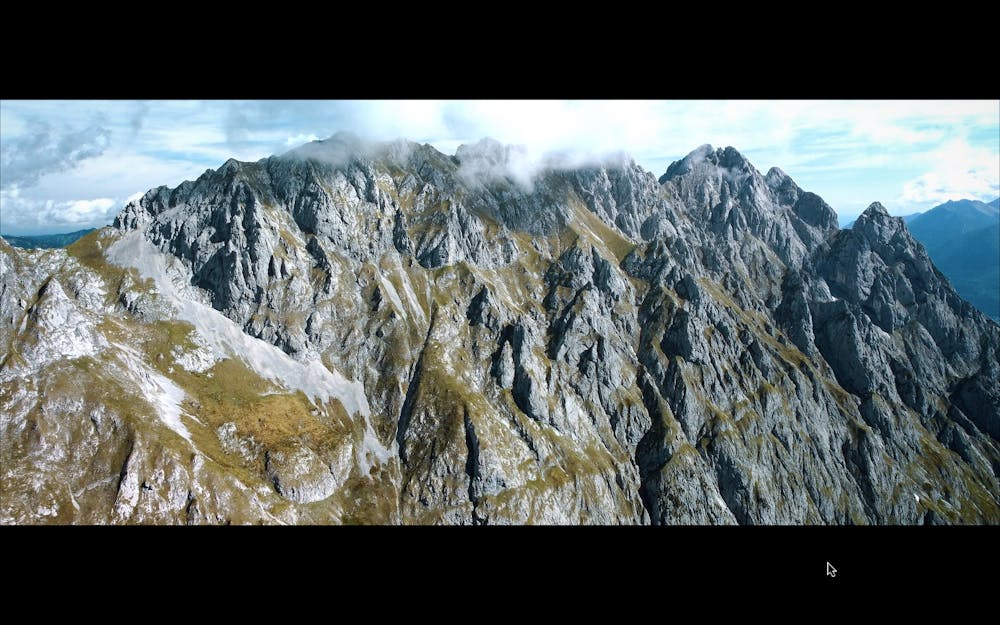
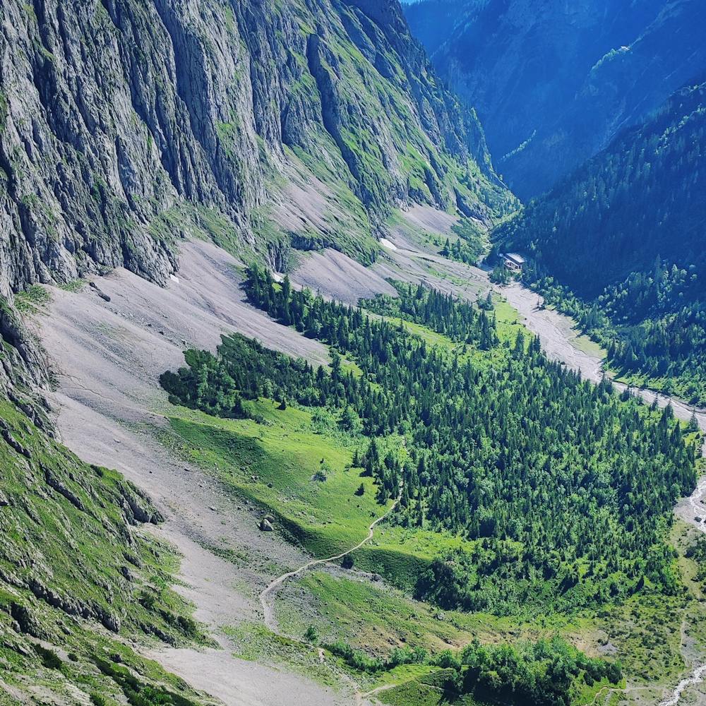
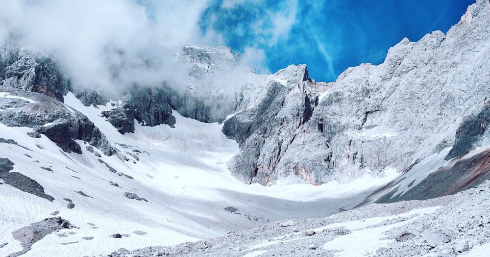
I took some drone shots during this journey and i will send the link underneath this description where you get some good feel what it looks like. Simply beautiful area!
Difficult
The beginning of truly technical terrain which might involve pitched climbing on rock and/or ice, exposed terrain and complex route finding in ascent and descent. Equivalent to AD, AD+

The route features some exposed and/or difficult to protect sections.
Away from help but easily accessed.
7.1 km away
A multi sport day culminating in a long ridge climb up a beautifully positioned peak
Severe Alpine Climbing
6 routes · Alpine Climbing