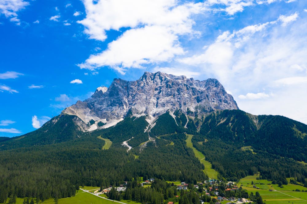
Zugspitze Summit Hike
Garmisch-Partenkirchen
Hike to the top of Germany's highest peak!
Hiking Difficult
- Distance
- 22 km
- Ascent
- 2.4 km
- Descent
- 208 m
- Duration
- 1 day +
- Low Point
- 729 m
- High Point
- 2.9 km
- Gradient
- 21˚

A long and challenging hike to the highest peak in Germany!
- •
- •
- •
Description
There are several hiking routes leading you to the summit of the highest mountain in Germany, this one being one of the longest.
Between June and September are your best times to hike this route with minimal snow.
The route is possible in one day but requires a very early start. Other options are to divide it into two days and stay at one of the 3 huts along the route:
– Partnachalm at 983 m / 3225 ft – Reintalangerhütte at 1369 m / 4491 ft – Knorhütte at 2,052 m / 6732 ft
You'll be doing about 23km / 14 miles and 2200m / 7200 ft of elevation.
The start of the hike is along the beautiful Partnach river in the Reintal Valley and is very easy going.
You'll pass both the Partnachalm and Reintalanger huts, great places for a break but also check the opening times.
Approaching and past the Knorrhütte the route gets steeper and more challenging - good hiking boots required!
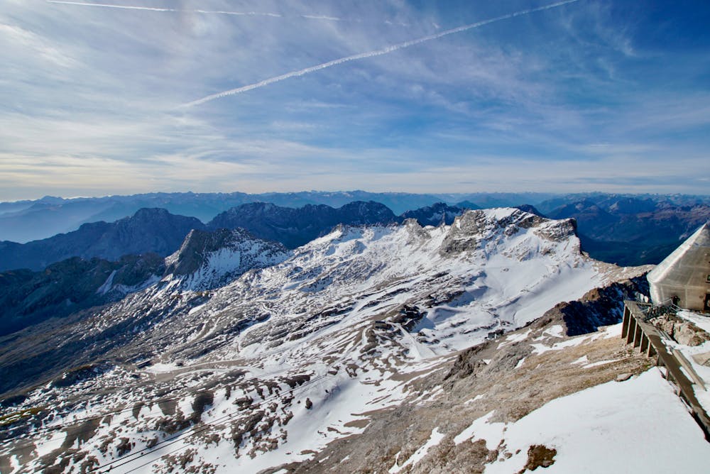
The final section is the hardest part, but you are rewarded with incredible views as you approach the Münchner Haus and the summit of the Zugspitze.
It is very rocky and loose with some sections of Via Ferrata, so don't forget your gloves.
Once at the Münchner Haus it's a very short last section to reach the summit and enjoy 360 degree views of the German and Austrian Alps.
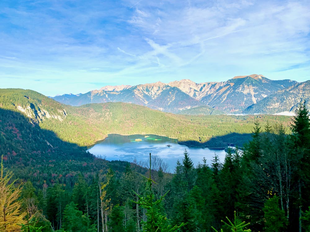
If you don't feel like walking back down, you can take the Zugspitze Cable Car to get down and enjoy the wonderful view over Eibsee Lake.
Difficulty
Difficult
Hiking trails where obstacles such as rocks or roots are prevalent. Some obstacles can require care to step over or around. At times, the trail can be worn and eroded. The grade of the trail is generally quite steep, and can often lead to strenuous hiking.
Medium Exposure

The trail contains some obstacles such as outcroppings and rock which could cause injury.
Remoteness
Away from help but easily accessed.
Best time to visit
Features
- Alpine
- Wildlife
- Picturesque
- Summit Hike
- Dog friendly
- Wild flowers
- Water features
- Forestry or heavy vegetation