Laugavegur Trail
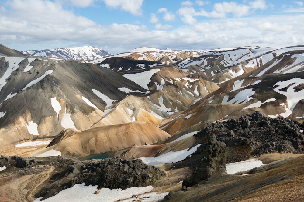
Landmannalaugar
Iceland's Southern Highlands
Trail Running Moderate
- Distance
- 52 km
- Ascent
- 2.1 km
- Descent
- 2.5 km
- Duration
- 1 day +
- Low Point
- 220 m
- High Point
- 1.1 km
- Gradient
- 15˚

Laugavegur is a long-distance trail in southern Iceland. It runs from the Landmannalaugar geothermal springs to the Þórsmörk nature reserve. The wide, dramatic valley of Þórsmörk sits at the foot of Eyjafjallajökull, an active volcano. The trail leads through striking landscapes spanning gorges, glaciers and multicolored rhyolite mountains.
Difficulty
Moderate
Medium Exposure

The trail contains some obstacles such as outcroppings and rock which could cause injury.
Remoteness
Away from help but easily accessed.