46 m away
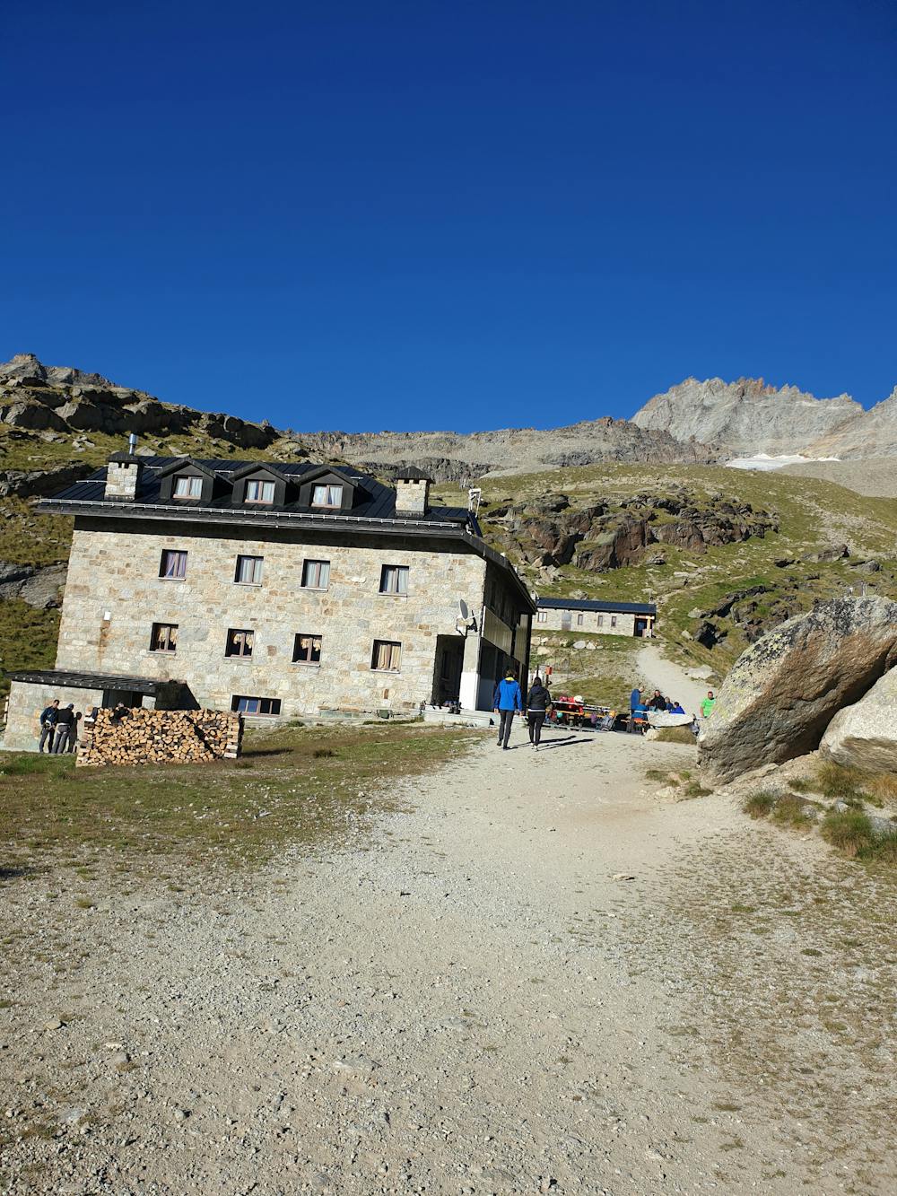
Approach to the Chabod Hut, 2750m
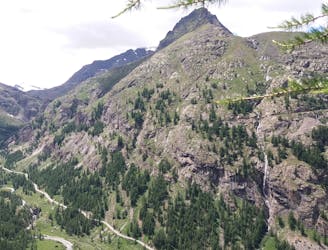
A well made path through beautiful larch forest to a stunning hut
Difficult Hiking
- Distance
- 5.8 km
- Ascent
- 879 m
- Descent
- 0 m
First day Partenca Sentiero Federico Chabod to Federico Chabod hut. Second day starting from Federico Chabod to Summit
Hiking Difficult
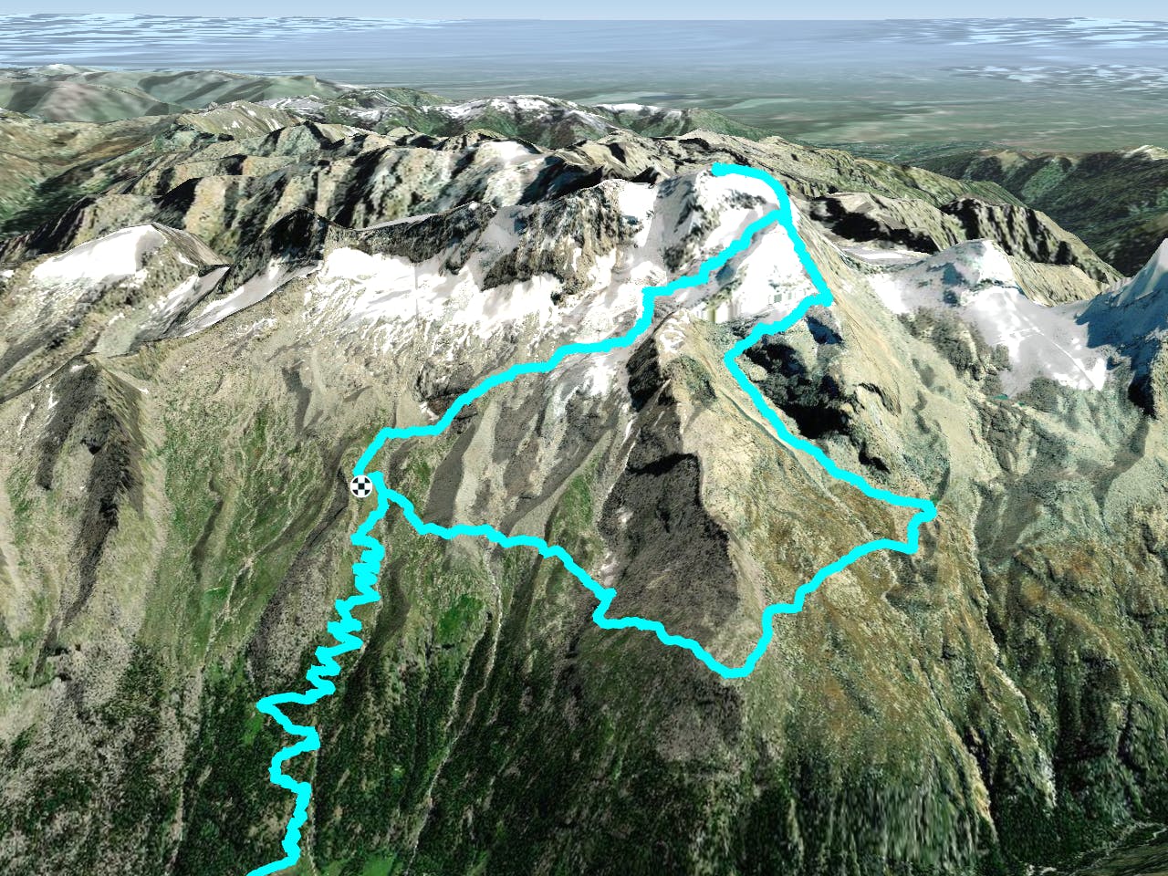
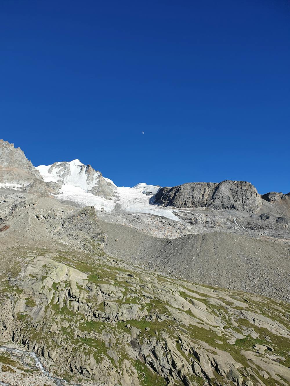
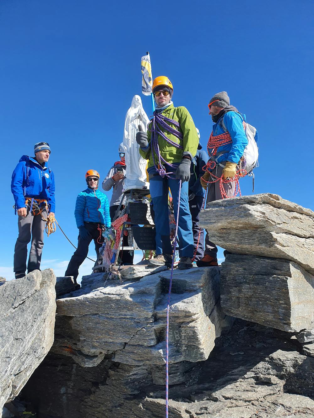
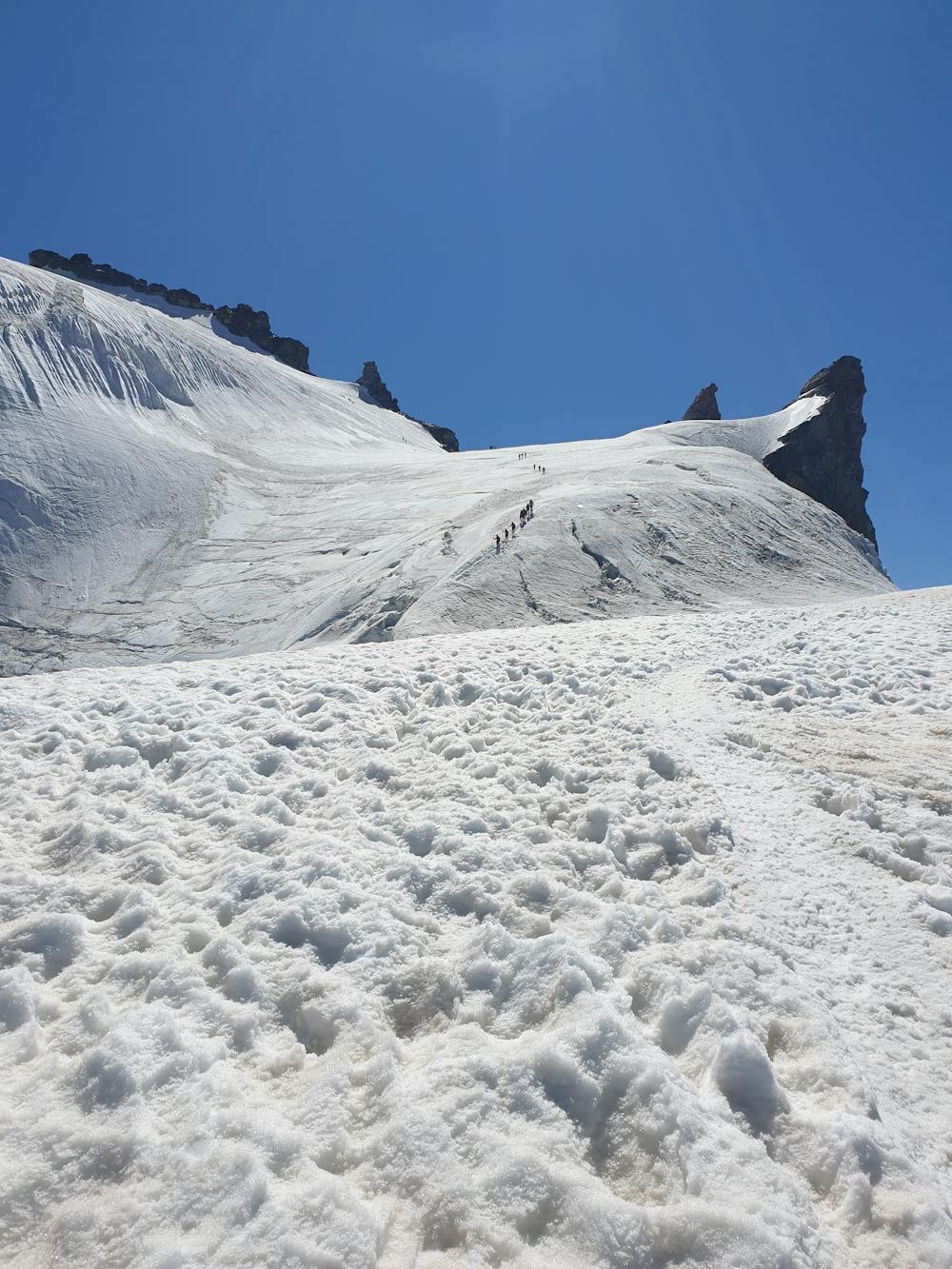
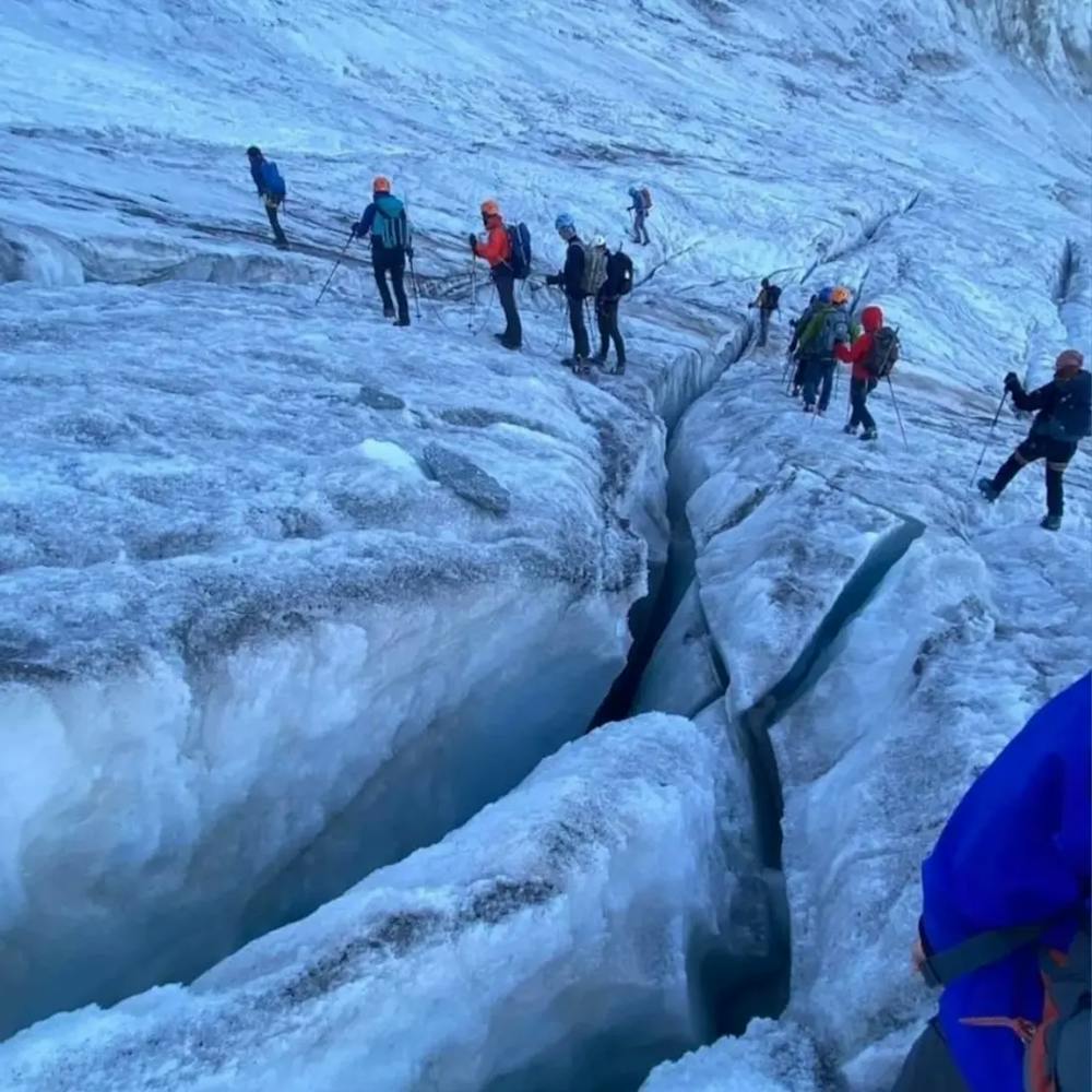
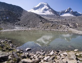
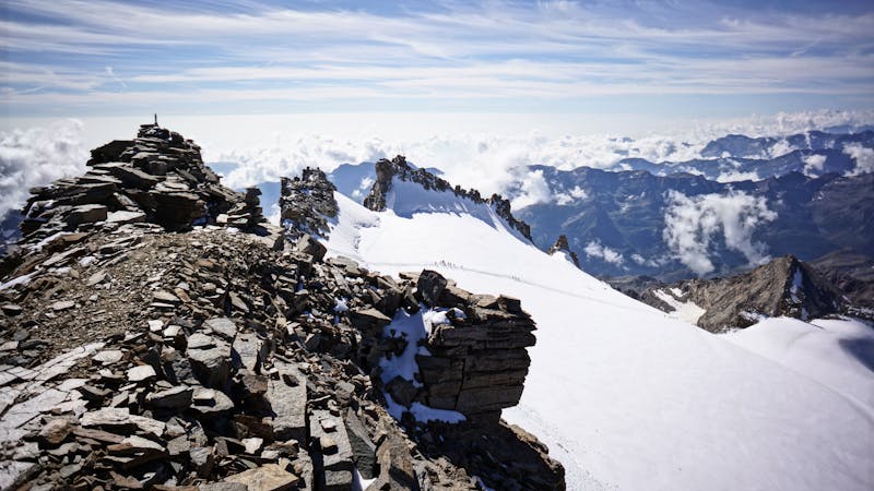
Gran Paradiso is the highest mountain in Italy. It is located withing National Parc of Gran Paradiso. Actually there are two routes used to ascend it. The most common route is from Pont Breuil and Rifugio Vittorio Emanuele II as the terrain does not have much ice and is less dangerous. The other path is from Federico Chabod hut 2710m. The best way to do it is by reaching the Rifugio the first day and second day very early in the morning start continue to the Summit. First day after parking at the trail point we started our hike from ’’Partenca Sentiero Federico Chabod’’ altitude 1835m and reached Federico Chabod Hut in 2h. The path lengh is 5 - 6 km very easy to follow, it is like a ’’hiking motorway’’. Second day we started very early on the morning, best would be to start around 4:30 - 5:00 so as to be sure that snow has not started to melt. The path continued for 2km on rock terrain and after that start the icy part. Here is the point where we put on Crampons and tied the rope to our Harness. This part till before reaching Schiena d´Asino is full of Crevasses and it is very dangerous. One should be very carefull where he walk. Some 100m before reaching Schiena d´Asino we were hearing water flowing beneath which means that glacier has starte to melt. Close to the summit we faced 30 miutes hikers traffic. Before the summit we released our crampons. When you are closed to the summit the best path to reach the summit is on the left side, reach the summit and proceed according to the ridge. On this way the traffic can be reduced. You should stand On our way down we decided to proceed from the other path, the one from Rifugio Vittorio Emanuele II as it was already more than 11 o’clock and it is very dangerous to descend at Federico Chabod hut when glacier has melted. After reaching Rifugio Vittorio Emanuele II we continued the path that led to Chabod. Some data. Path length from’’Partenca Sentiero Federico Chabod’’ till Federico Chabod hut 5-6km Federico Chabod hut till Gran Paradiso is approx. 6.5 km and can be hiked in 5-6 h. Gran Paradiso to Rifugio Vittorio Emanuele II is approx. 6km and we descended in 3h. Enjoy!
Difficult
Hiking trails where obstacles such as rocks or roots are prevalent. Some obstacles can require care to step over or around. At times, the trail can be worn and eroded. The grade of the trail is generally quite steep, and can often lead to strenuous hiking.

Some trail sections have exposed ledges or steep ascents/descents where falling could cause serious injury.

Close to help in case of emergency.
46 m away
A well made path through beautiful larch forest to a stunning hut
Difficult Hiking
2.4 km away
A steep walk through a larch forest to the largest mountain hut in the area, serving the Gran Paradiso
Difficult Hiking
6 routes · Alpine Climbing · Hiking

9 routes · Alpine Climbing · Hiking