8.5 km away
Lago di Pilato from Foce
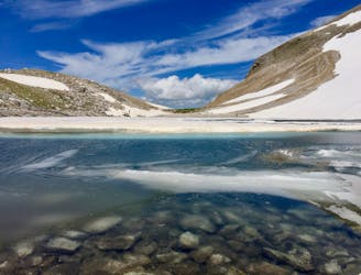
A gorgeous, yet moderately-strenuous, climb to the magical, mysterious, and only natural lake in Le Marche.
Difficult Hiking
- Distance
- 12 km
- Ascent
- 1 km
- Descent
- 1 km
Abetito - Piandelloro
Hiking Difficult

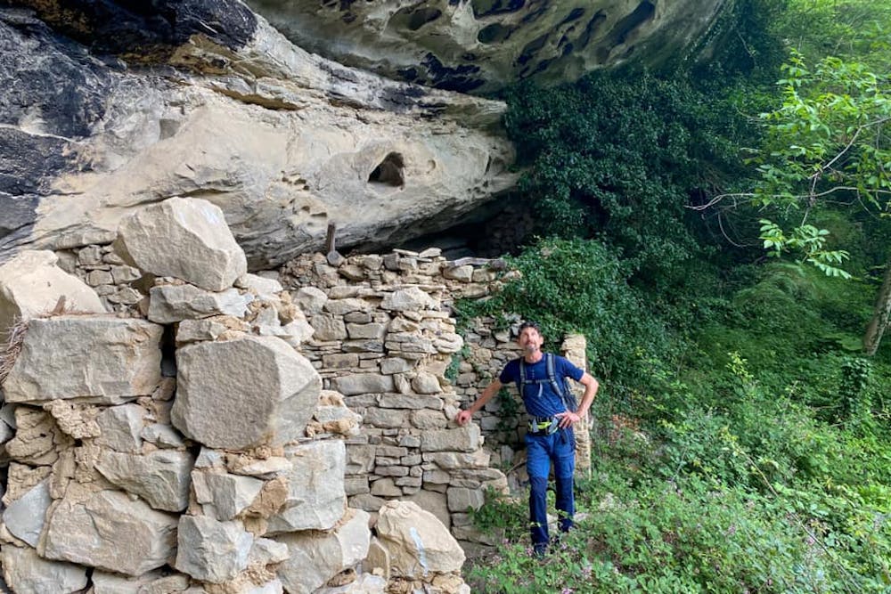
Questa è la tappa dove la natura trionfa. Ci troviamo all’interno della meravigliosa e incontaminata area dell’Appennino Perduto, all’interno del gruppo montuoso del Ceresa, dove incontrerete molti borghi abbandonati. Attraverserete castagneti e faggete fino ad arrivare a 1200 metri di altitudine dove potrete godere di vedute straordinarie sul massiccio del Vettore e sulla valle del Fluvione. Interessantissimi gli insediamenti rupestri di Piandelloro, caratteristiche abitazioni costruite a ridosso delle pareti di roccia arenaria con vani adibiti a stalle e fienili. La tappa terminerà a Forcella, paese abbarbicato su una terrazza rocciosa.
Difficult
Hiking trails where obstacles such as rocks or roots are prevalent. Some obstacles can require care to step over or around. At times, the trail can be worn and eroded. The grade of the trail is generally quite steep, and can often lead to strenuous hiking.

Some trail sections have exposed ledges or steep ascents/descents where falling could cause serious injury.
Little chance of being seen or helped in case of an accident.
8.5 km away
A gorgeous, yet moderately-strenuous, climb to the magical, mysterious, and only natural lake in Le Marche.
Difficult Hiking
9.1 km away
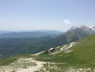
A magnificent high alpine ridge line hike to two incredible vantage points.
Moderate Hiking