8.6 km away
Alta Via Dei Monti Liguri: Caprauna to Mallare
Stage 3 of the magnificent high alpine trail through Liguria.
Difficult Hiking
- Distance
- 56 km
- Ascent
- 2.9 km
- Descent
- 3 km
Garessio (Valle Tanaro, Alpi Liguri)
Hiking Difficult
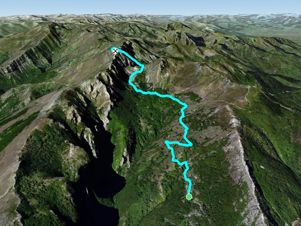
L'itinerario ha inizio nella frazione alpina di Valdinferno (1213m), ai piedi della chiesa di San Ludovico, edificata nel XIX secolo. Percorrendo una strada in cemento si attraversa l'abitato, passando per Case Bosso (1366m) e Case Mulattieri (1407m). Da qui un sentiero boschivo conduce fino al suggestivo valico di Colla Bassa (1851m), che mette in comunicazione la Valle Tanaro con la Valle Casotto. Imboccando una rapida salita tra bassi arbusti si giunge alla sommità del Monte Antoroto (2144m).
Valdinferno https://it.wikipedia.org/wiki/Valdinferno
Monte Antoroto https://it.wikipedia.org/wiki/MonteAntoroto
Difficult
Hiking trails where obstacles such as rocks or roots are prevalent. Some obstacles can require care to step over or around. At times, the trail can be worn and eroded. The grade of the trail is generally quite steep, and can often lead to strenuous hiking.

The trail contains some obstacles such as outcroppings and rock which could cause injury.
Away from help but easily accessed.
8.6 km away
Stage 3 of the magnificent high alpine trail through Liguria.
Difficult Hiking
8 routes · Hiking