5 km away
Monte Alpe
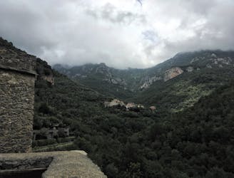
A challenging half day hike to a beautiful viewpoint, and an even more challenging climb to the top of Monte Alpe with a tough bushwack down the ridge.
Extreme Hiking
- Distance
- 9.9 km
- Ascent
- 922 m
- Descent
- 923 m
Anello di Conscenteco vista sulla piana
Hiking Easy

This is a popular hiking route which is generally considered to be easy. It's not remote, it features low exposure and is typically done in March, April, September and October. From a low point of 80 m to the maximum altitude of 543 m, the route covers 7 km, 503 vertical metres of ascent and 435 vertical metres of descent.
Camminata piacevole nel bosco. La salita è dolce per la maggior parte del percorso. Abbiamo impiegato 5 ore considerando un'ora e 30 di pranzo sulla Rocca Liverna
Easy
Walking along a well-kept trail that’s mostly flat. No obstacles are present.

The path is on completely flat land and potential injury is limited to falling over.
Close to help in case of emergency.
5 km away
A challenging half day hike to a beautiful viewpoint, and an even more challenging climb to the top of Monte Alpe with a tough bushwack down the ridge.
Extreme Hiking