8.2 km away
Bernina Haute Route: Coaz Hut to Pontresina
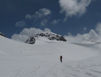
Traverse of the Chaputschins
Difficult Ski Touring
- Distance
- 18 km
- Ascent
- 846 m
- Descent
- 1.7 km
3 Tage - Durchquerung - 2 Nordwände
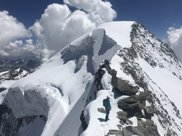
Ski Touring Extreme

This is a popular ski touring route which is generally considered to be extreme. It's extremely remote, it features extreme exposure (e4) and is typically done in undefined. From a low point of 1.6 km to the maximum altitude of 3.6 km, the route covers 35 km, 4524 vertical metres of ascent and 4525 vertical metres of descent. You'll need rope, skins, ice axe, crampons and glacier kit to complete it safely.

Tourenbericht, Fotos und Infos: https://www.suedtirolalpin.it/bergell
Extreme
Extreme skiing terrain above 45 degrees. These routes are reserved for experienced experts.

In case of a fall, the skier faces certain death.
In the high mountains or remote conditions, all individuals must be completely autonomous in every situation.
8.2 km away
Traverse of the Chaputschins
Difficult Ski Touring
9.4 km away
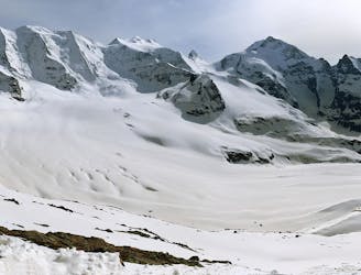
Steady climb to Piz Sella at 3511m, followed by an airy traverse and great glacial descent.
Difficult Ski Touring
5 routes · Ski Touring