4.6 km away
Alta Via 2 - Rifugio Boe to Rifugio Viel dal Pan
A good day of hiking with an incredible viewpoint!
Severe Hiking
- Distance
- 7.9 km
- Ascent
- 418 m
- Descent
- 860 m
A big day for those chasing another vertical via ferrata!
Hiking Extreme
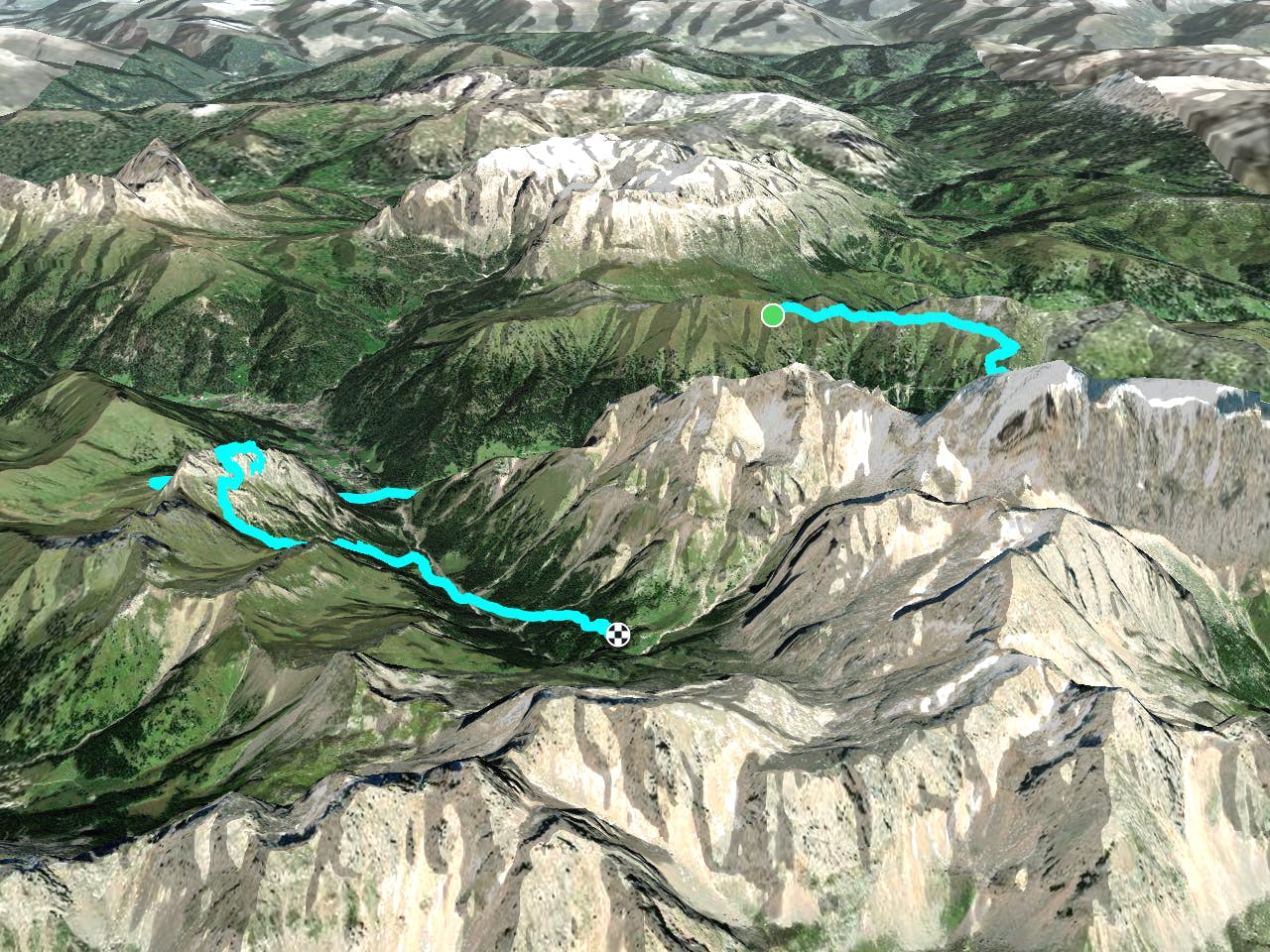
Starting Location: Rifugio Viel dal Pan Ending Location: Rifugio Contrin Optional Routes: (A) Take path 602A to avoid via ferrata and follow signs for Rif. Contrin Regional Map: Tabacco Map 07 Path Numbers: 601, 605, Alba – Ciampac Gondola, 646, 602 Places to eat/drink on route: Rifugio Castiglioni, Penia
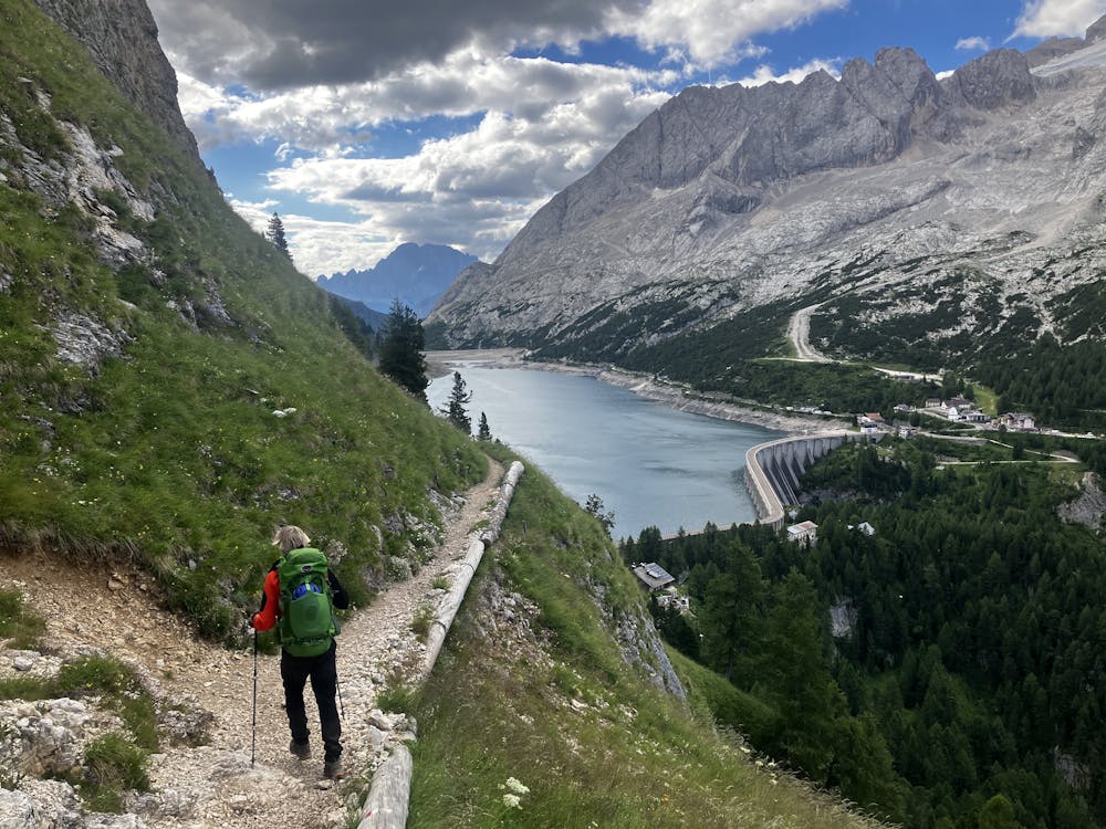
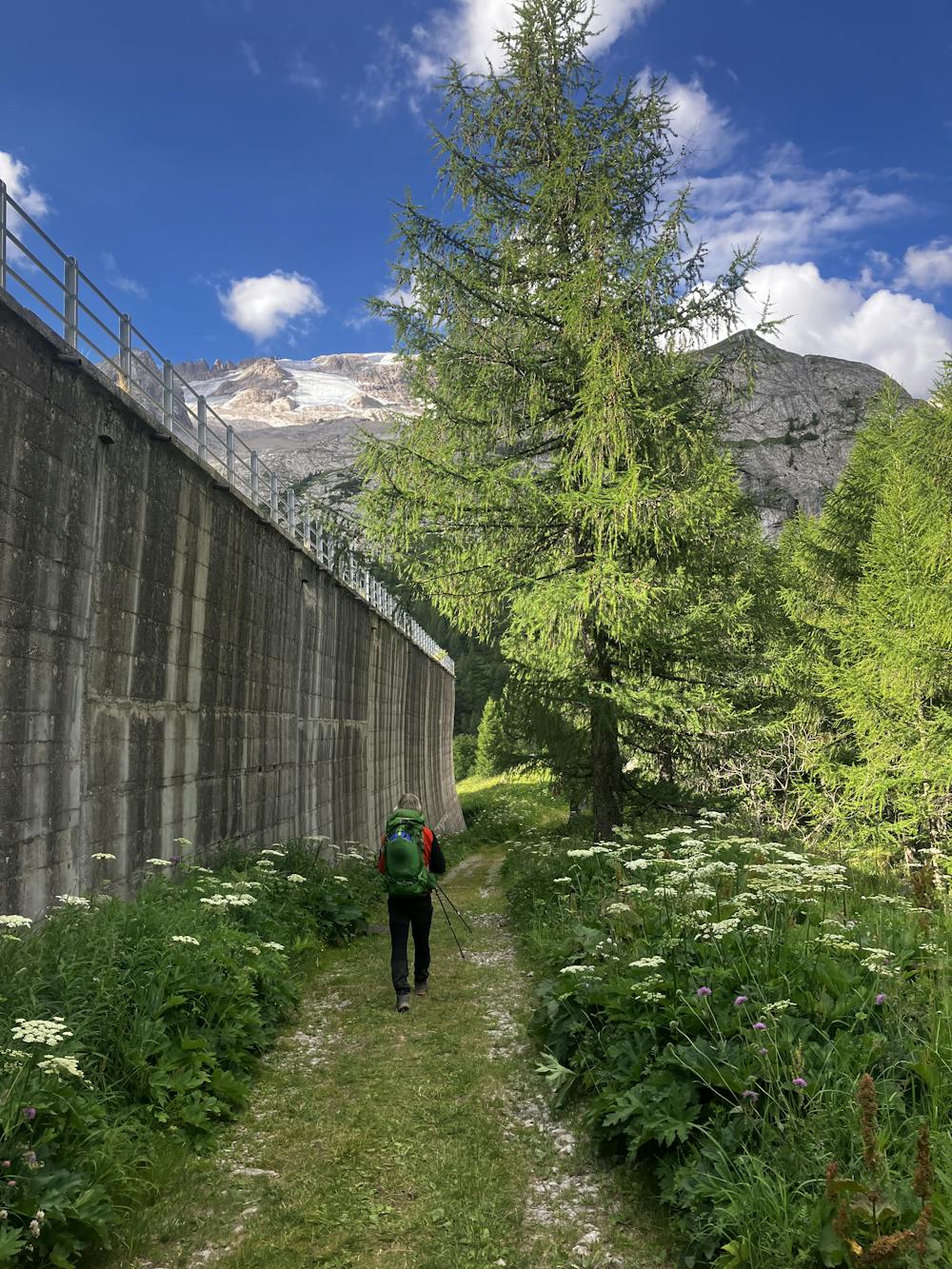
Another big day on the AV2 and another via ferrata that gets the arms pumping. From Rifugio Viel dal Pan, take path 601 that snakes its way around the valley before dropping steeply towards Lago di Fedaia. At the lake, take the path that disappears behind the dam following signs for Penia.
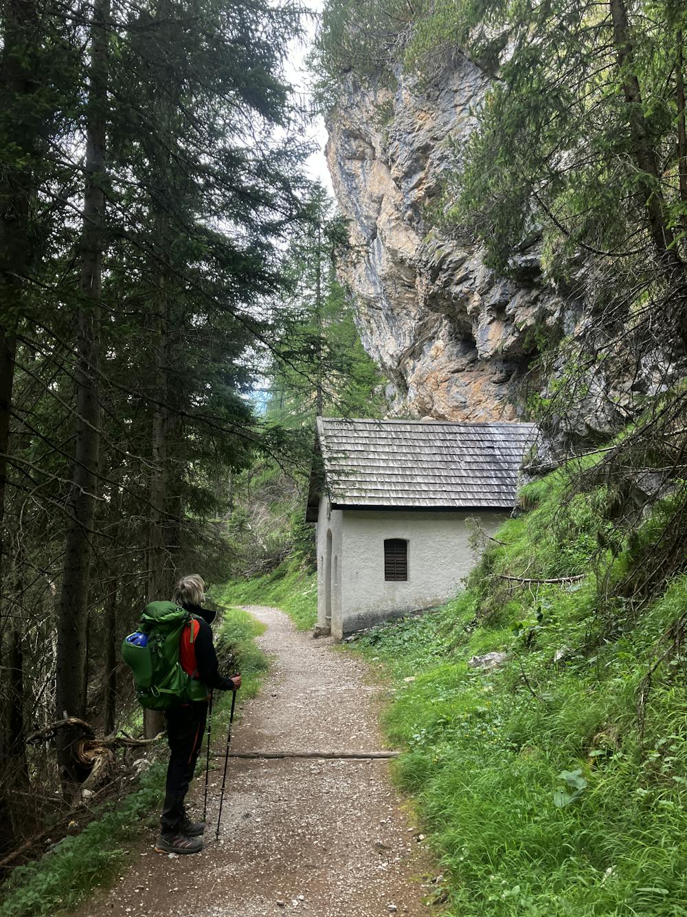
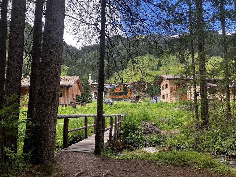
Path 605 meanders its way down to the small town of Penia. On route, you’ll pass many religious shrines and even a small church in this remote area of woodland. The path eventually comes to a road. Counterintuitively, walk back up the road for around 100m as it snakes right to join the path again on the right-hand side of the road over the bridge. Continue down the trail towards Penia.
For those wishing to resupply, Penia has a little food and drinks venue called Bar Penia that was a nice stop. Just up the road is the local supermarket with some basic food supplies.
Optional Route (A) – For those not wanting to take part in the via ferrata, from Penia walk back down the road to the bridge that you used to cross the river into Penia. Take path 605 that eventually merges onto path 602A and 602 that ascends through the woods and follow signs for Rifugio Contrin. This route will take you roughly 1hour 30 minutes from the bridge into Penia.
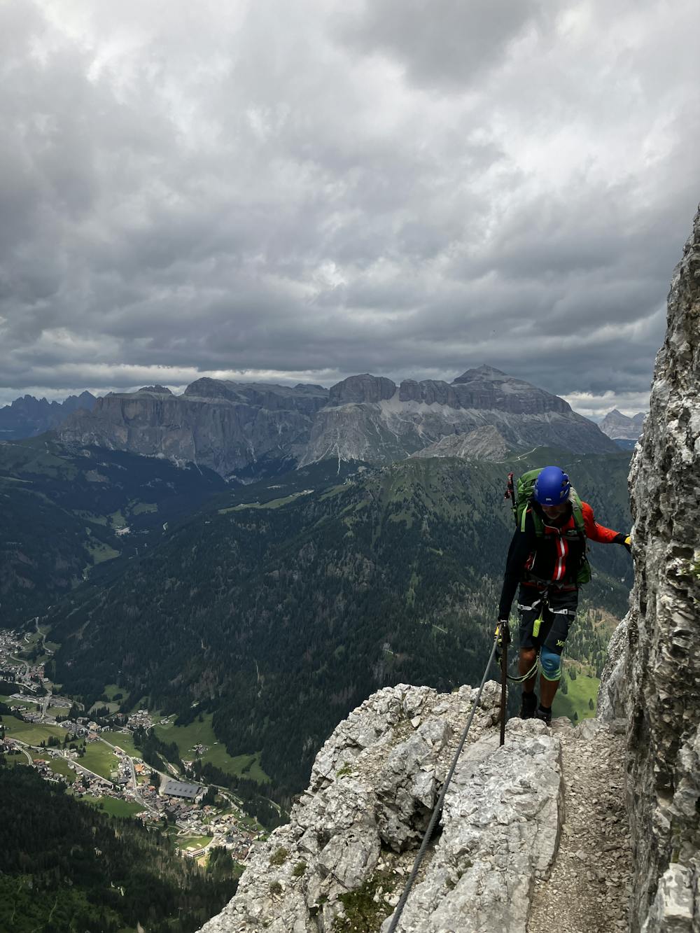
For those interested in a ‘moderately difficult’ graded via ferrata, follow the GPX file that takes you towards the Alba – Ciampac Gondola. Take the gondola … you’ll thank me later. For opening times and prices see here:
https://www.fassa.com/EN/Lifts-opening-times-and-prices/
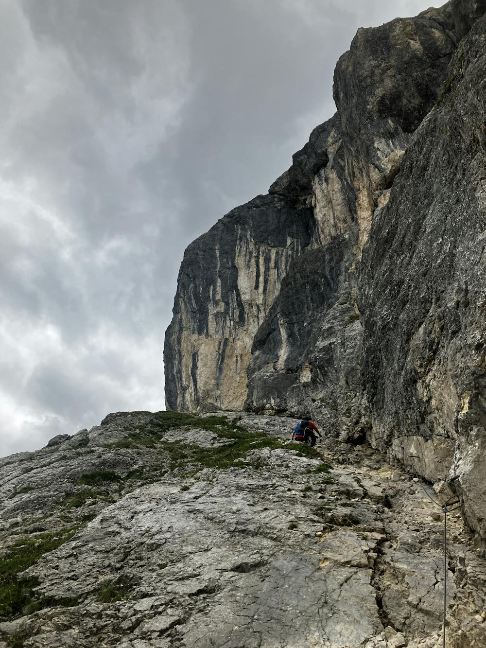
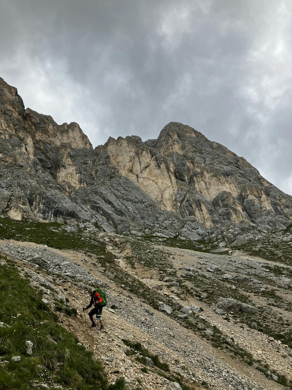
From the top station, walk uphill before banking left and following signs for via ferrata dei finanzien. Walk past the artificial lake and up to the start of the climb. This via ferrata is not recommended for beginners and it does contain vertical and one mildly overhanging section. Areas on the route have poor hand/foot holds so some climbing strength is needed to pass through these sections. The route is also very exposed. For more information on via ferrata dei finanzien, follow this link:
https://www.ferrate365.it/en/vie-ferrate/ferrata-finanzieri-colac/
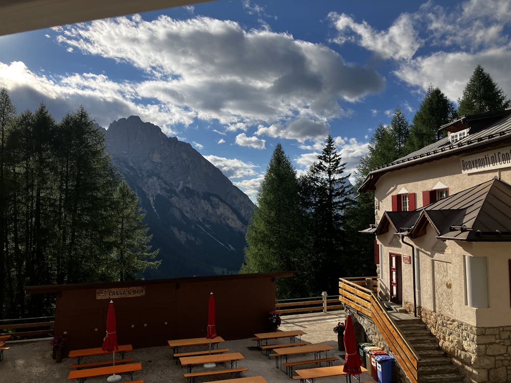
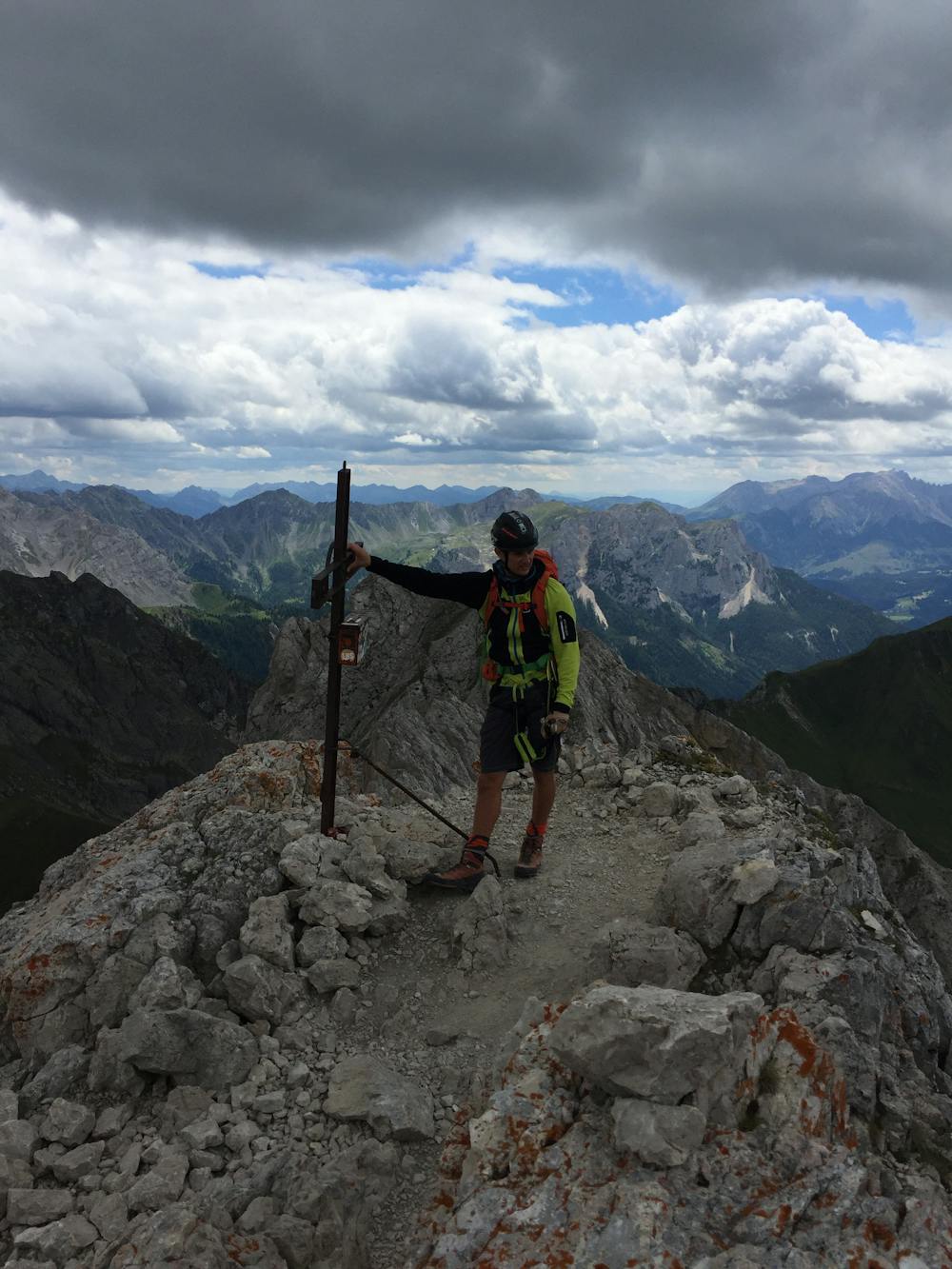
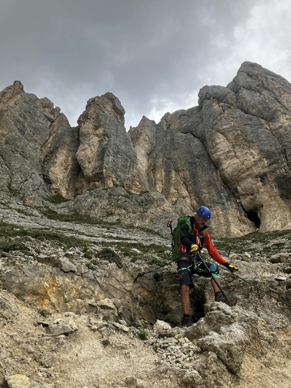
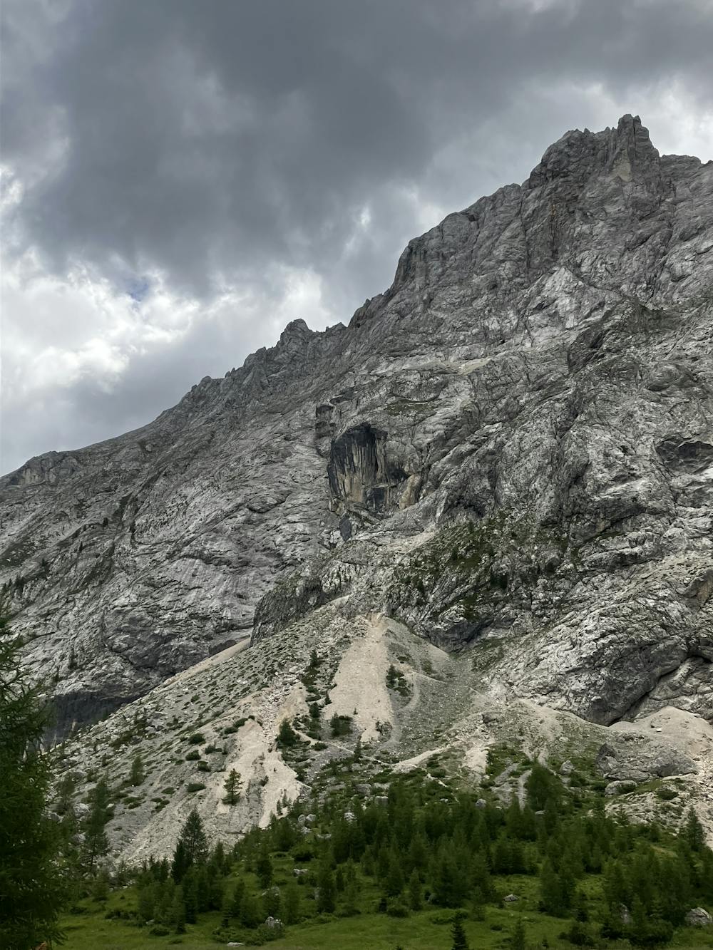
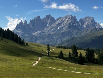
Summit Monte Colac (2,715m) and descend off the other side. The descent is steep but drops altitude quickly. Keep an eye on the GPX file here as the route the main path wants you to take will mean you’ll be travelling further than you need to. Path 646 is steep and destroys the knees but it’s the quickest way off the east face of Colac. Enjoy the beautiful wildflowers in the woods. Join path 602, turn right and dig deep as it is a meandering slog to finish at the beautiful Rifugio Contrin.
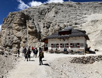
Rifugio Contrin http://www.rifugiocontrin.it/en/
This hike and guide were completed during summer weather conditions. This is just one opinion of this route. Make sure to do your own research by consulting internet resources, guidebooks or mountain guides to evaluate other opinions so you can be best prepared for the terrain.
A Guide by Red
Extreme
Scrambling up mountains and along technical trails with moderate fall exposure. Handholds are necessary to navigate the trail in its entirety, although they are not necessary at all times. Some obstacles can be very large and difficult to navigate, and the grades can often be near-vertical. The challenge of the trail and the steepness of the grade results in very strenuous hiking. Hikes of this difficulty blur the lines between "hiking" and "climbing".

Some trail sections are extremely exposed where falling will almost certainly result in serious injury or death.
In the high mountains or remote conditions, all individuals must be completely autonomous in every situation.
4.6 km away
A good day of hiking with an incredible viewpoint!
Severe Hiking
5.1 km away
Another long day out on the AV2 trail!
Severe Hiking
7 km away
A shorter day for those heading to Rifugio Boe and Piz Boe summit. A mega day for those wanting some vertical action!
Extreme Hiking

11 routes · Hiking