5.3 km away
Tour de Soleil: Fald to Mittlenberg Hut
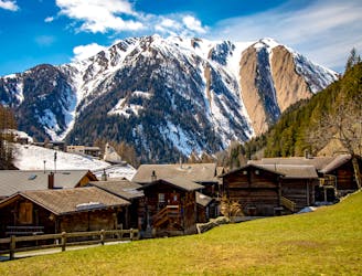
Day 1: A positioning day up the wild and beautiful Binntal to a lovely hut
Difficult Ski Touring
- Distance
- 6.3 km
- Ascent
- 909 m
- Descent
- 71 m
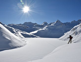
Day 2: Ascent of the Ofenhorn, 3236m
Also in Valais, Switzerland
Ski Touring Severe

This is a classic ski peak but can be omitted if the weather is poor, to simply link the 2 huts.
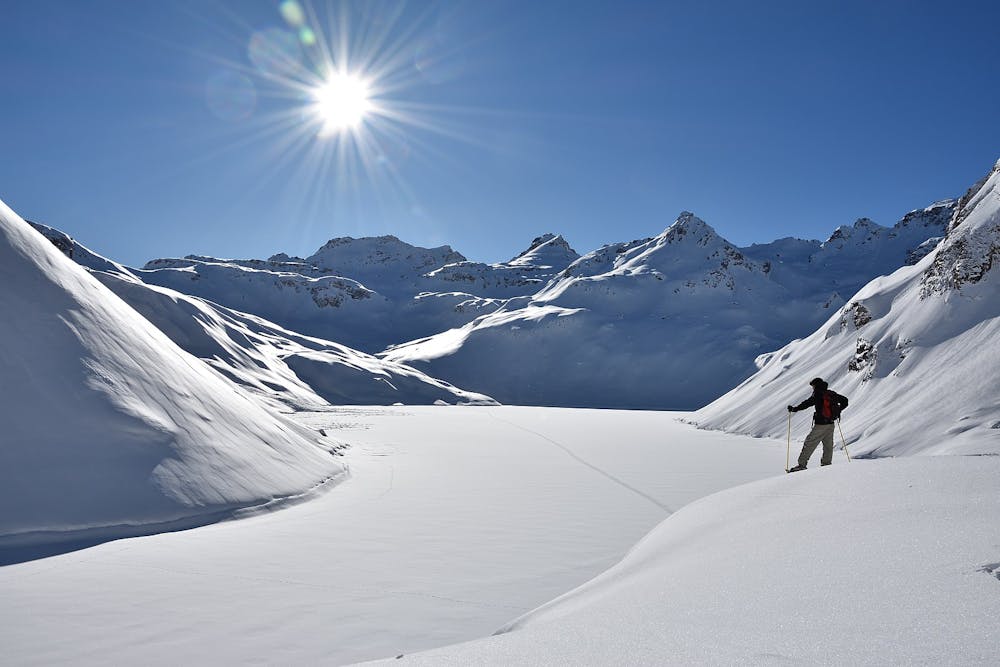
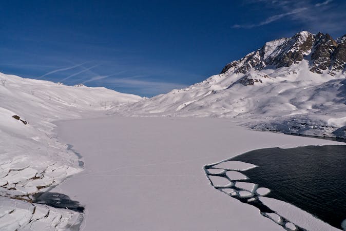
From the hut traverse NE under the slopes of the Mittleberg into a hanging valley that leads more easily to the Hohsandjoch pass at 2901m on the Italian border. From here take the open glaciated slopes in an arc leading around a rocky spur descending from the Ofenhorn, then more steeply up NE facing slopes to the summit of this classic ski peak at 3236m. There is an optional steeper descent to the N, or more easily down your line of ascent. There is then a choice of descents either side of the Torre del Vannino, the more northerly one being on colder snow if there is powder. The more southerly descent faces SE and is a better choice if it is predominantly spring snow conditions. Both involve small flat sections towards the end across different frozen lakes to get to the Margaroli Hut at 2194m.
Severe
Steep skiing at 38-45 degrees. This requires very good technique and the risk of falling has serious consequences.

In case of a fall, death is highly likely.

In the high mountains or remote conditions, all individuals must be completely autonomous in every situation.
5.3 km away
Day 1: A positioning day up the wild and beautiful Binntal to a lovely hut
Difficult Ski Touring
6.7 km away
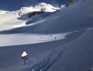
Day 3: Margaroli Hut to Maria Luisa Hut
Difficult Ski Touring
6.7 km away
A beautiful ski tour as far as All'Acqua followed by a long flat valley
Difficult Ski Touring
6 routes · Ski Touring