1.3 km away
Monte Rosa Haute Route: Margherita Hut and the Grenz Glacier
Day 4: Margherita Hut and the Grenz Glacier, beginning at Gnifettti Hut and ending at Neue Monte Rosa Hut
Difficult Ski Touring
- Distance
- 12 km
- Ascent
- 1 km
- Descent
- 1.8 km
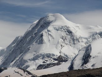
Normal route for this peak
Ski Touring Moderate

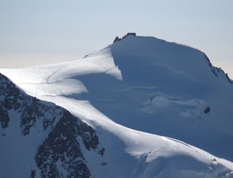
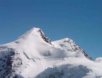
Piramide Vincent is an evident peak that is placed under Rifugio Gnifetti. it's often crowded since a lot of people want to reach this 4000m peak. It offers an amazing 360 view on Monte Rosa and it's really nice to ski down
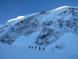
In order to reach this peak you have to climb up from Indren, heading for the refuges, Mantova first then Gnifetti, then up towards Colle del Lys. Although this seems an easy part that can be done with skins be aware that you're on a glacier! Crevasses could be open and you need to cross some. So technical skills and equipment are required!
Once you reach the north face of Piramide Vincent a last short steep part (crampons could be required) will take you to the summit. 3 - 3h 30 minutes total.
Technical gear required! Ice axe, crampons, rope (40m), harness, ice screws, showed, probe and beacon!
Moderate
Slopes become slightly steeper at around 25-30 degrees.

As well as the slope itself, there are some obstacles (such as rock outcrops) which could aggravate injury.

In the high mountains or remote conditions, all individuals must be completely autonomous in every situation.
1.3 km away
Day 4: Margherita Hut and the Grenz Glacier, beginning at Gnifettti Hut and ending at Neue Monte Rosa Hut
Difficult Ski Touring
5.4 km away
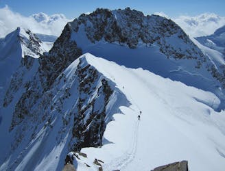
Day 3: Traverse of Passo del Naso of Lyskamm and summit of Pyramid Vincent, beginning at Rifugio Quintino Sella and ending at Capanna Gnifetti.
Severe Ski Touring
5.4 km away
Venture up Switzerland’s famously treacherous Liskamm 4000er, affectionately nicknamed the “people eater”.
Severe Ski Touring
6.5 km away
Day 5: A huge skin to a high col and optional climb up Europe's 2nd highest peak
Severe Ski Touring
6.8 km away

One of the most aesthetic couloirs on this side of the mountain
Severe Ski Touring
7.4 km away
Day 2: Traverse of Castor, optional extra summit of Pollux, beginning at Rifugio Guide d'Ayas and ending at Rifugio Quintino Sella
Severe Ski Touring

5 routes · Freeride Skiing · Ski Touring

5 routes · Ski Touring

16 routes · Ski Touring