1.5 km away
Monte Rosa Haute Route: Margherita Hut and the Grenz Glacier
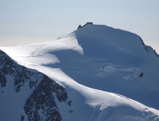
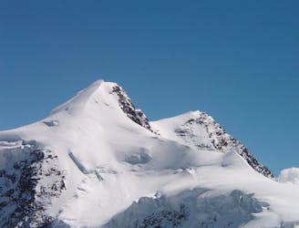
Day 4: Margherita Hut and the Grenz Glacier, beginning at Gnifettti Hut and ending at Neue Monte Rosa Hut
Difficult Ski Touring
- Distance
- 12 km
- Ascent
- 1 km
- Descent
- 1.8 km
One peak two couloirs
Ski Touring Severe

this couloir is a very aesthetic line that will give an amazing view all over Valsesia and Gressoney As for the other couloir reach the top of Punta Giordani, this couloir starts 80m under the top on your left. You will see a little rocky isle that drops into the couloir. Often here a rappel is required (35m), be aware of the anchor, the rocks could be unstable! As for the other couloir also this ends on a big cliff. It could be bypassed going all to your left (200m) or you can rappel the very narrow couloir that is at the very end of the main couloir.
Severe
Steep skiing at 38-45 degrees. This requires very good technique and the risk of falling has serious consequences.

In case of a fall, death is highly likely.

In the high mountains or remote conditions, all individuals must be completely autonomous in every situation.
1.5 km away
Day 4: Margherita Hut and the Grenz Glacier, beginning at Gnifettti Hut and ending at Neue Monte Rosa Hut
Difficult Ski Touring
5.8 km away
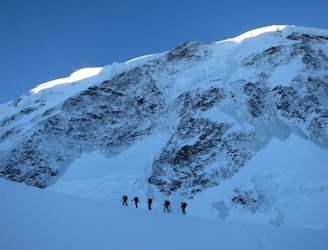
Day 3: Traverse of Passo del Naso of Lyskamm and summit of Pyramid Vincent, beginning at Rifugio Quintino Sella and ending at Capanna Gnifetti.
Severe Ski Touring
5.8 km away
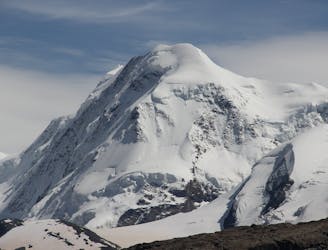
Venture up Switzerland’s famously treacherous Liskamm 4000er, affectionately nicknamed the “people eater”.
Severe Ski Touring
7 km away
Day 5: A huge skin to a high col and optional climb up Europe's 2nd highest peak
Severe Ski Touring
7.1 km away

One of the most aesthetic couloirs on this side of the mountain
Severe Ski Touring
8 km away
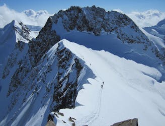
Day 2: Traverse of Castor, optional extra summit of Pollux, beginning at Rifugio Guide d'Ayas and ending at Rifugio Quintino Sella
Severe Ski Touring

5 routes · Freeride Skiing · Ski Touring

5 routes · Ski Touring

16 routes · Ski Touring