11 m away
Kozan no sawa (variation)

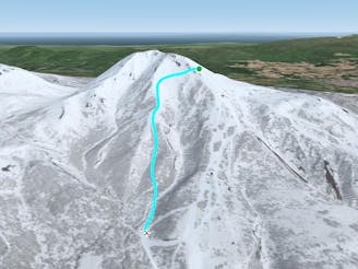
A 20 minute hike above the resort out of Gate 3, this line is a truly classic Niseko back bowl run.
Difficult Freeride Skiing
- Distance
- 2.1 km
- Ascent
- 0 m
- Descent
- 673 m
https://www.youtube.com/watch?v=kLND_KMT8Wo
Freeride Skiing Difficult

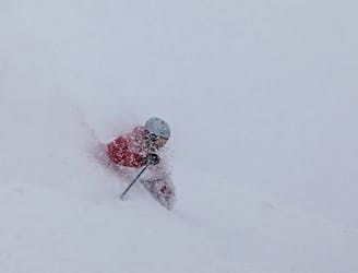
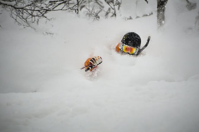
This is a popular freeride skiing route which is generally considered to be difficult. It's remote, it features medium exposure (e2) and is typically done between December and February. From a low point of 405 m to the maximum altitude of 1.3 km, the route covers 3.9 km, 0 vertical metres of ascent and 886 vertical metres of descent. It's graded 4.3 and Labande grade 4.
no snowshoes, only ride.
Difficult
Serious gradient of 30-38 degrees where a real risk of slipping exists.

As well as the slope itself, there are some obstacles (such as rock outcrops) which could aggravate injury.
Away from help but easily accessed.
11 m away
A 20 minute hike above the resort out of Gate 3, this line is a truly classic Niseko back bowl run.
Difficult Freeride Skiing
13 m away

A 20 minute hike above the resort out of Gate 3, this line is in the back bowls of Niseko and requires you to hike out.
Difficult Freeride Skiing
16 m away
A 20 minute hike above the resort out of Gate 3, this line is a classic Niseko back bowl run.
Difficult Freeride Skiing
16 m away

A 20 minute hike above the resort out of Gate 3, this line is in the back bowls of Niseko and requires a hike out.
Difficult Freeride Skiing
30 m away

A 20 minute hike above the resort out of Gate 3, this line is in the back bowls of Niseko and requires a short hike out.
Moderate Freeride Skiing
330 m away

A 20 minute hike above the resort out of Gate 2, this line is a classic Niseko back bowl run.
Difficult Freeride Skiing
457 m away

G3 is one of two of the essential hikes leading to the legendary Niseko Back Bowls
Difficult Freeride Skiing
624 m away

Upper mountain gate access (Gate 5) skiing with steeper gradients and a variety of tree densities with minimal hiking.
Difficult Freeride Skiing
715 m away

G2 is one of two of the essential hikes leading to the legendary Niseko Back Bowls
Difficult Freeride Skiing
720 m away
Upper mountain gate access skiing with interesting ridge features, steeper gradients, and a variety of tree densities with minimal hiking.
Moderate Freeride Skiing
12 routes · Freeride Skiing