2.6 km away
Comino Cirumnavigation
Hike around Malta's 3rd largest island in a single day!
Moderate Hiking
- Distance
- 7 km
- Ascent
- 157 m
- Descent
- 157 m
Go from Gozo's biggest port to one of its most popular beaches via some breathtaking clifftops.
Also in Fontana, Gozo, Malta • Għajnsielem, Malta • Munxar, Malta • Xewkija, Malta
Hiking Moderate

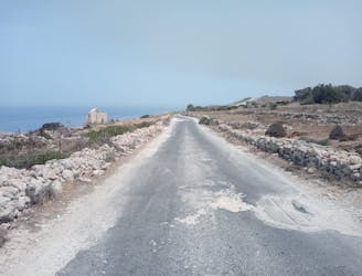
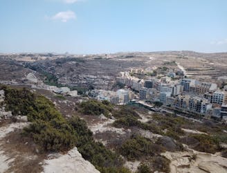
This is, for most hikers, the first stage of the Gozo Coastal Trail, and what a start it is! The day begins in the bustling port of Mgarr, where ferries come and go all day between Gozo and Malta, and there's always something to watch as you sip a coffee before your hike begins.
This is the longest stage of the Gozo Coastal Trail but it can be broken up by staying at Sannat village, about 2/3 of the way along the hike. Sannat is a quiet little place and there are far more hotels and restaurants in Xlendi, which is why most people push on and finish their day there, but the option to break up the day is there if required. There's also a bus connection from Sannat if you decide to stop there and then travel elsewhere on the island.
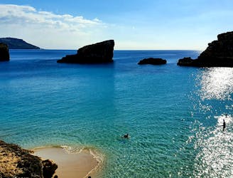
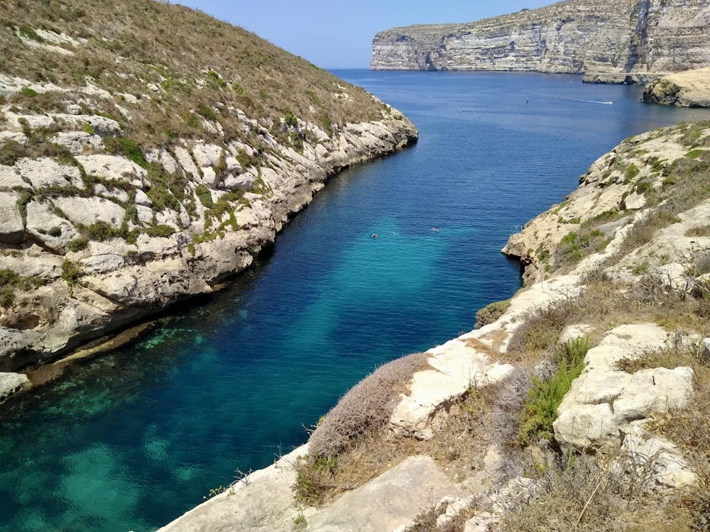
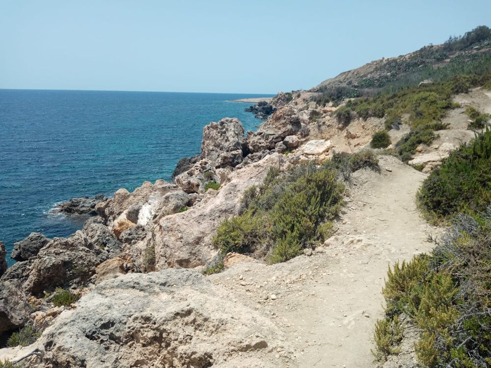
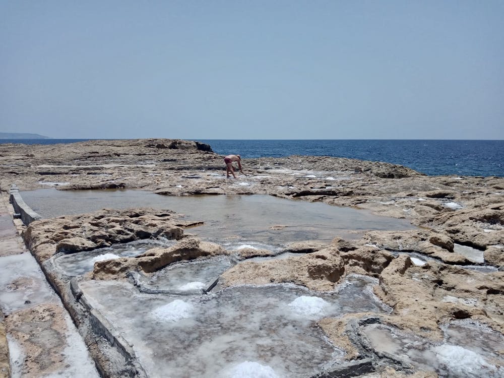
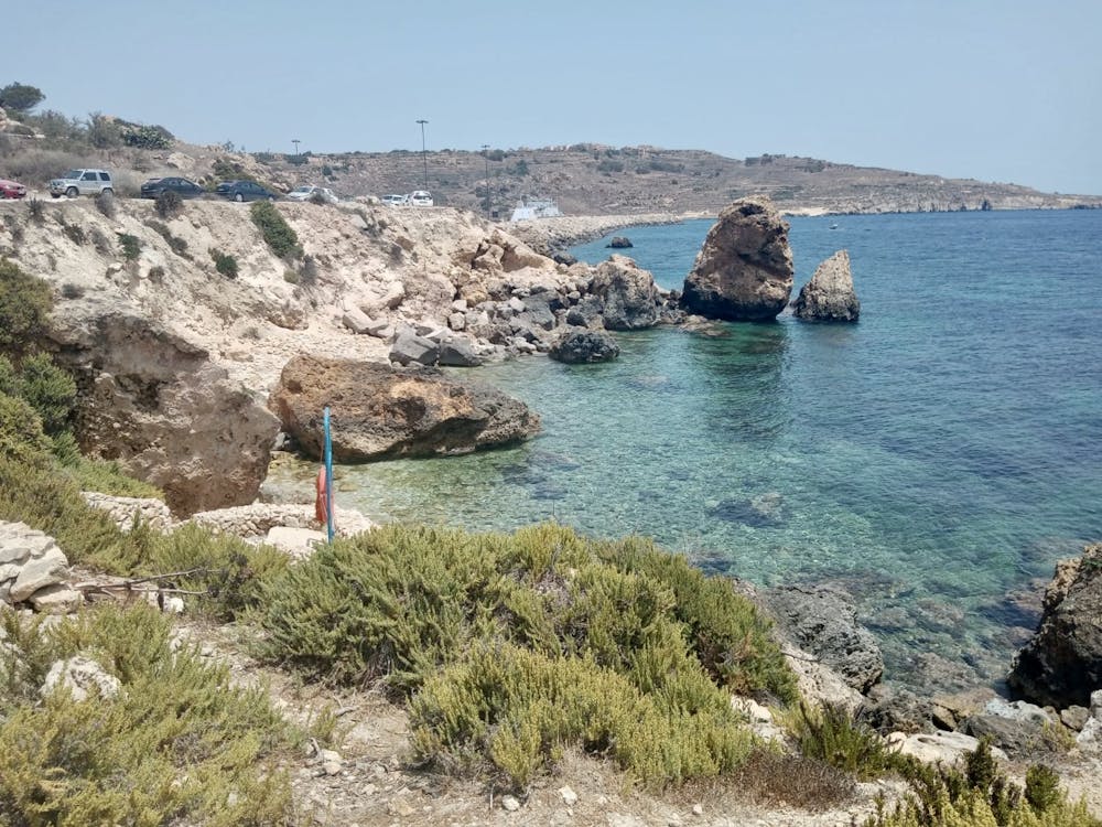
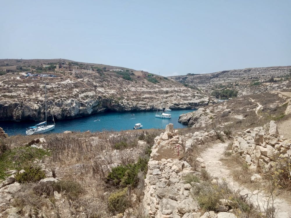
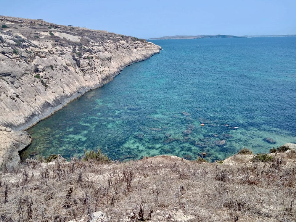
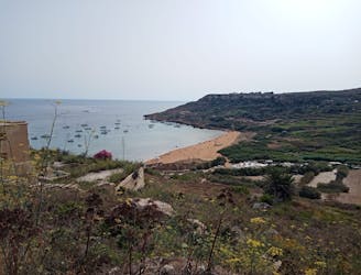
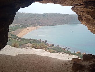
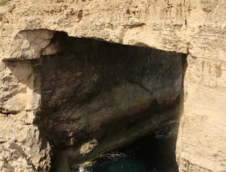
Start the day by following a lovely coastal path which quickly whisks you away from the busy-ness of Mgarr and onto Gozo's beautiful south coast. The trail hangs above the sea and even takes in a small metal walkway at the edge of Xatt I-Ahmar bay. There's some brilliant spots for a swim/snorkel, but the best of them all is probably the area around the Ras il-Ħobż saltflats. Follow the trail just above the sea round to Mgarr ix-Xini - one of the most beautiful inlets in Malta, if not the whole Mediterranean! There's a little cafe where you can grab some refreshment, and jumping into the wonderfully clear water after your drink is highly recommended.
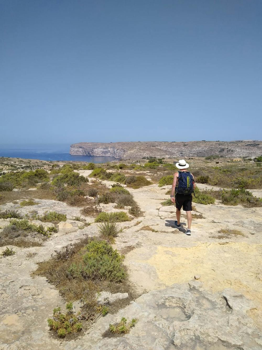
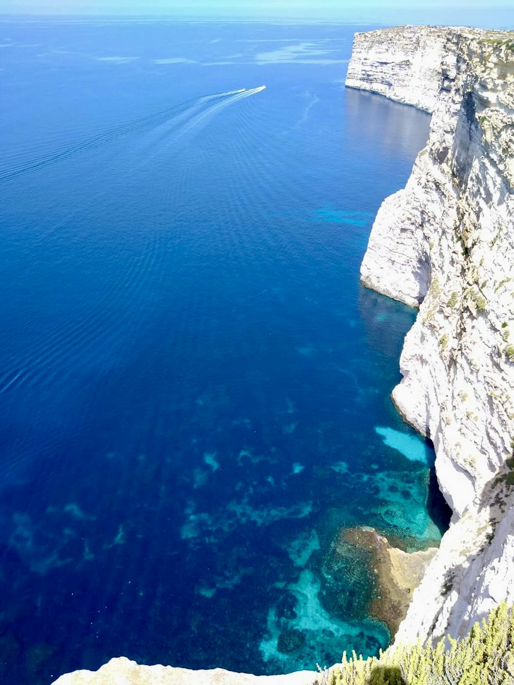
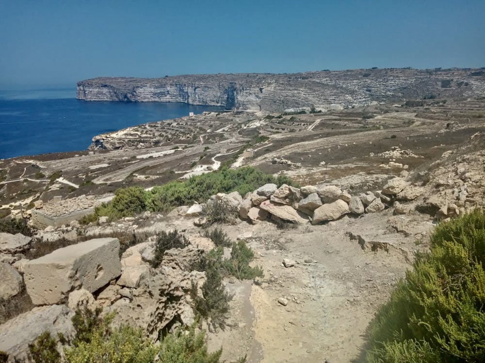
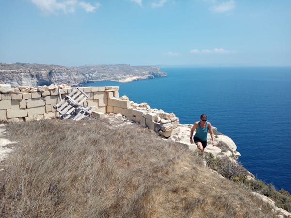
Follow the road out of Mgarr ix-Xini briefly and then cut left onto a rough track which climbs away from the inlet and onto some terraced fields. Stroll through these and make detours wherever required to enjoy the staggering views across the huge Ta Cenc cliffs. Once you're done staring at the cliffs, head onto the road briefly and go past the 5 star Ta Cenc Hotel before getting off road again and onto a clifftop path which traverses along the top of the spectacular Sannat Cliffs. At times you can go right up to the edge of the cliffs, but be incredibly careful when doing this - you wouldn't want to slip!
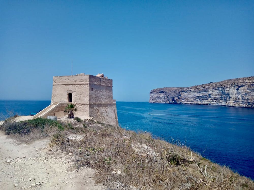
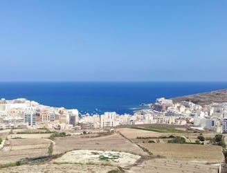
The path winds along past little farmer huts and endless big views - enjoy every step! Eventually you'll find yourself nearing the Xlendi tower, a well known landmark with a spectacular view across the cliffs north of Xlendi.
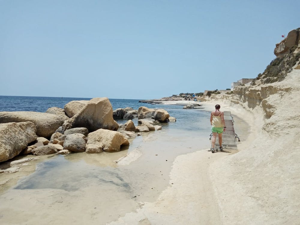
From the tower, wander into Xlendi via a gorgeous little inlet. Having grabbed a bite to eat, enjoy a swim in Xlendi bay. The best access point for your swim is the famous Xlendi diving board - a 3 metre high landmark which deposits you into some deep and perfectly clear water.
Moderate
Hiking along trails with some uneven terrain and small hills. Small rocks and roots may be present.

The trail contains some obstacles such as outcroppings and rock which could cause injury.
Away from help but easily accessed.
2.6 km away
Hike around Malta's 3rd largest island in a single day!
Moderate Hiking
2.7 km away
Travel between 2 of Gozo's main villages and visit 2 of its finest swimming spots.
Moderate Hiking
5.7 km away
A fun little mini-hike to a local landmark
Difficult Hiking
6.3 km away
A rugged hike to a gorgeous sandy beach and then back through peaceful dusty streets.
Difficult Hiking
6.3 km away
Go from seaside resort to peaceful village and pass through some fabulous scenery en route.
Difficult Hiking
7.4 km away
One of the finest hikes on Gozo which passes several of the island's best known landmarks.
Difficult Hiking
9.2 km away
Possibly the highlight of the Gozo Coastal Trail - this is a gorgeous hike along a wild coastline.
Moderate Hiking
5 routes · Hiking