42 m away
Sealy Range Traverse
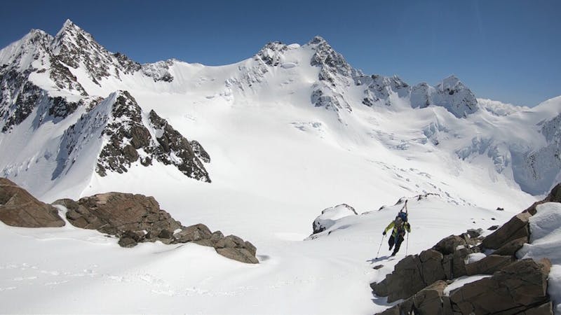
A few nice lines within the Sealy Range outside of the Mueller Hut
Difficult Ski Touring
- Distance
- 20 km
- Ascent
- 2.4 km
- Descent
- 2.4 km
A great line based out of the Mueller Hut
Ski Touring Difficult

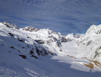
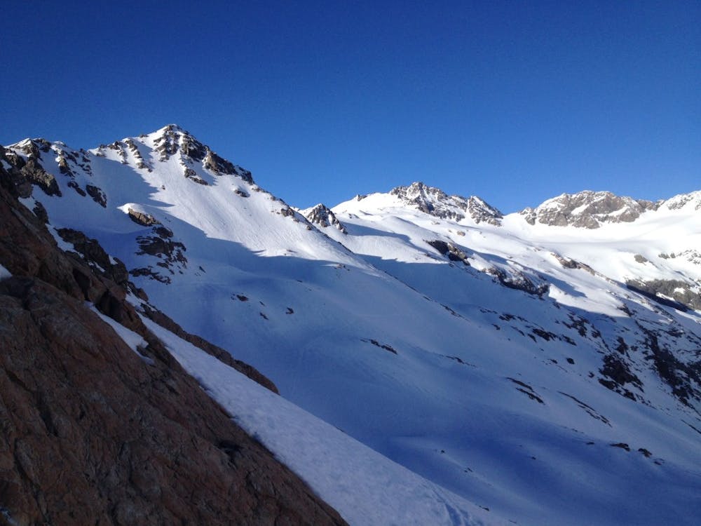
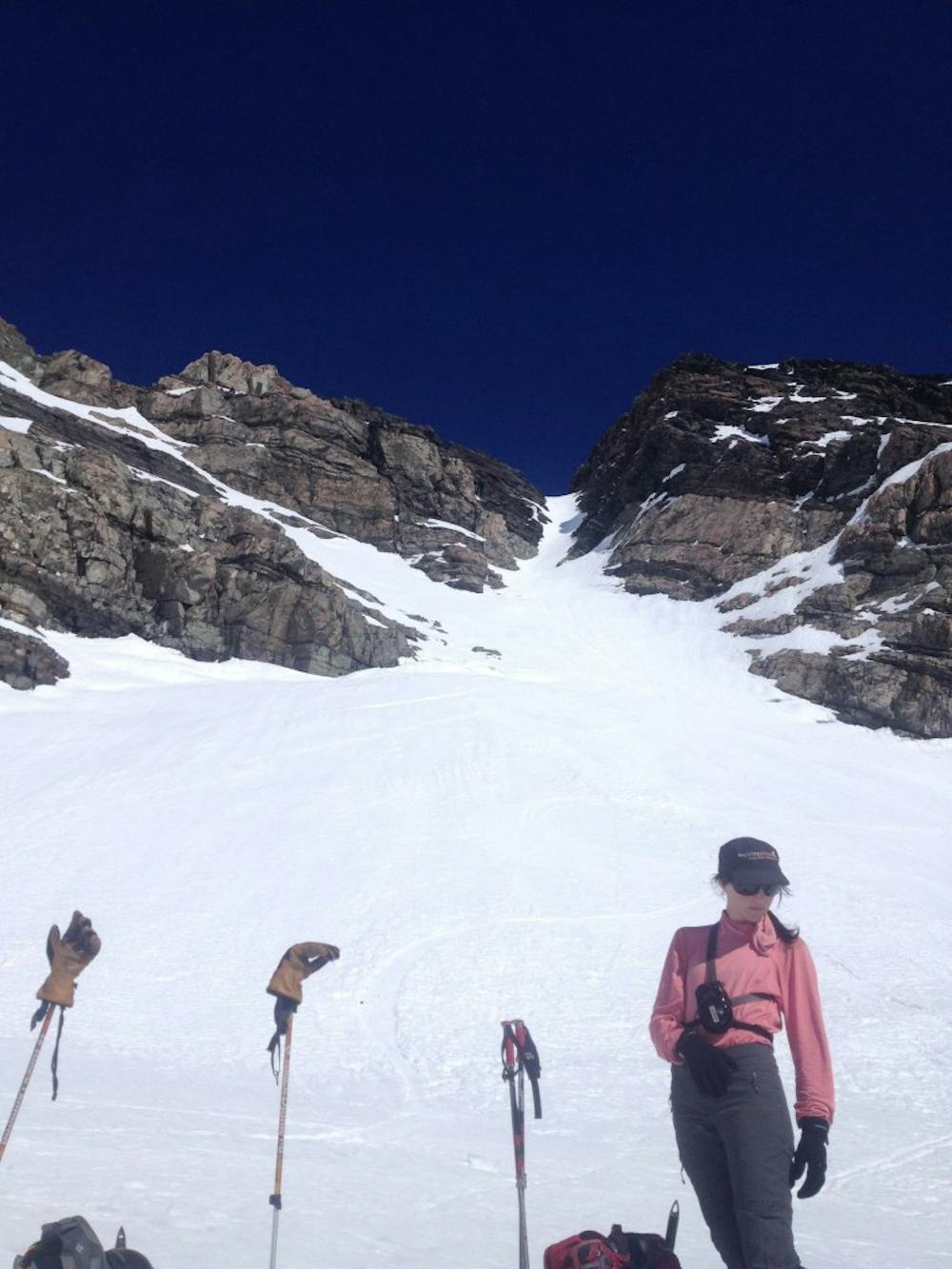
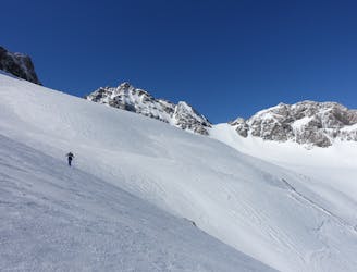
The Sealy couloir is a really nice line found on the Northern ridge of Mount Sealy and has fun and steep turns but doesn’t actually reach the summit itself. This is a good area to head out to if you feel confident in your ski touring skills as the approach is quite a long sidehill and the climb should be down with crampons. In my experience we did this trip in hope of finding good corn skiing so if weather is questionable I do not recommend this trip or really any ski tour as a white out in alpine terrain is incredibly dangerous.
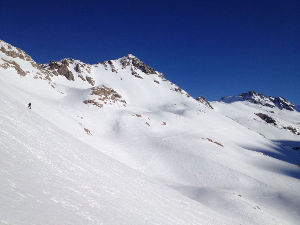
Leaving from the White Horse Parking Lot make your way up the Sealy Tarns Track which starts off steep in the bush but mellows out in the alpine area. Once arriving on the high ridge start heading south on the flat terrain and soon you will be arriving at the Muller Hut. It is now time to do a multiple kilometre sidehill where it starts mellow and becomes a nasty sidehill before mellowing out again.
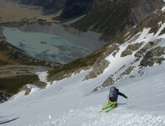
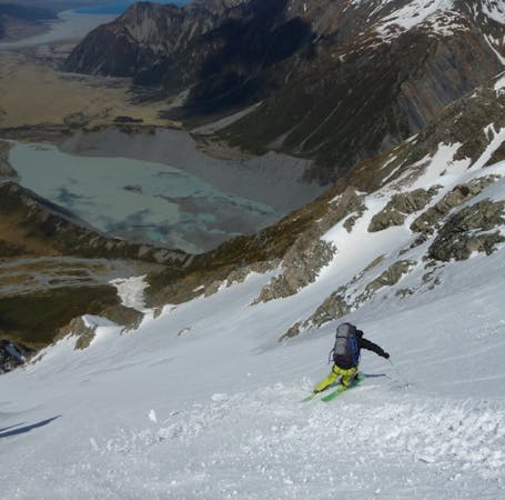
Sticking at around 1800 meters and heading south this is the elevation which offers the mellowest slopes. Before long you will arrive at the base of the Annette Plateau where it is time to start gaining elevation. At around 2100 meters you need to head West making your way over to the Metelille Glacier heading southwest. By now the couloir should be in plain view so make your way over to the base of it before switching to crampons and making the final climb to the high point.
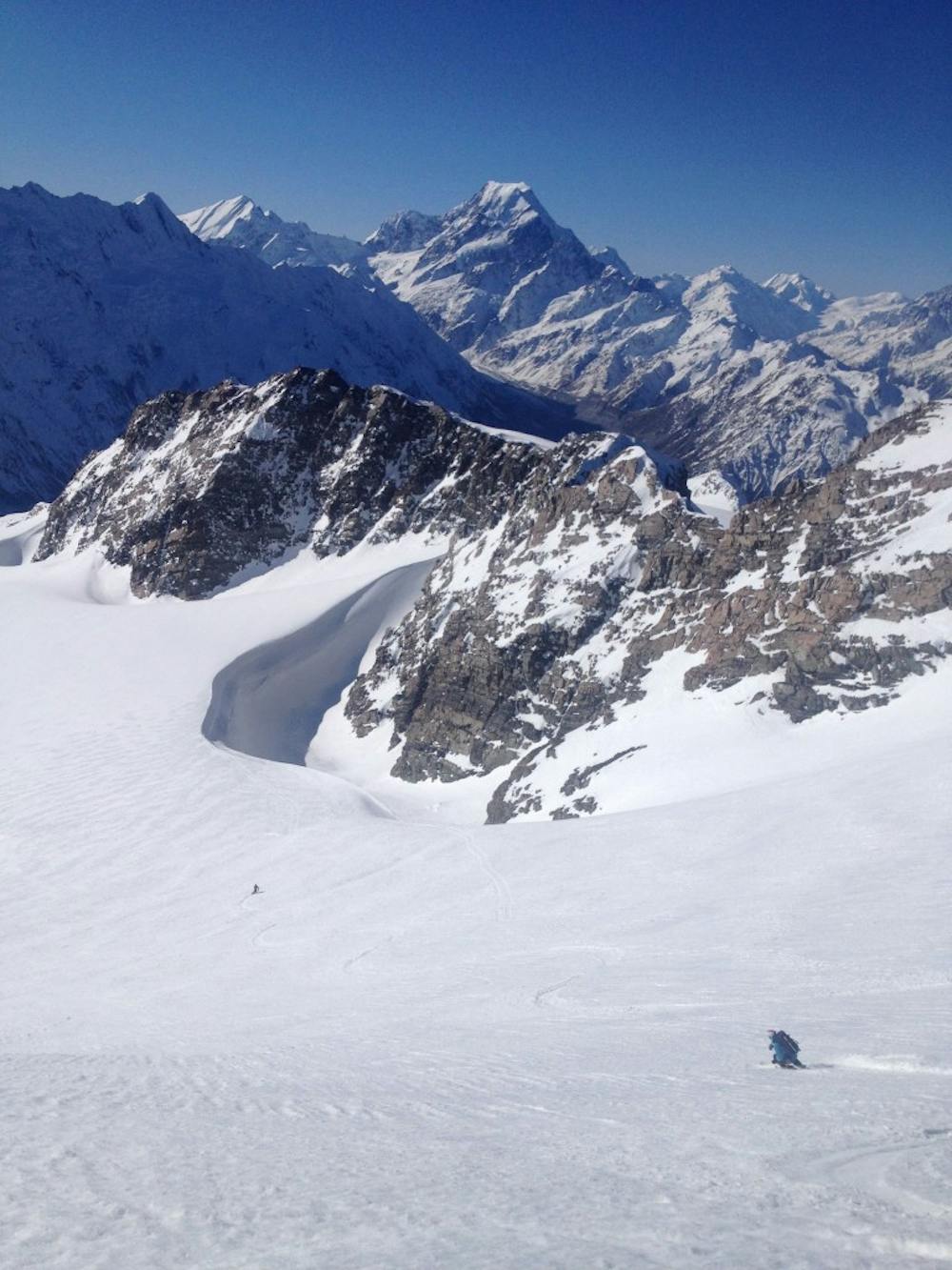
From your vantage point you will be looking out among the mountains of Mount Cook National Park before riding down the steep slopes onto the Glacier and traversing over to the Annette Plateau. From here it is a long and nasty sidehill descent for snowboarders all the way back to the Mueller Hut which could be broken down by climbing some of the other small peaks in the area. Once it is time to head back to the parking lot just make your way down the Sealy Tarns Trail.
For more pictures and the full story check out this link https://www.whereiskylemiller.com/new-zealand/muller-hut/
Difficult
Serious gradient of 30-38 degrees where a real risk of slipping exists.

As well as the slope itself, there are some obstacles (such as rock outcrops) which could aggravate injury.
Away from help but easily accessed.
42 m away
A few nice lines within the Sealy Range outside of the Mueller Hut
Difficult Ski Touring
71 m away
Convenient access into the beautiful Sealy Range
Moderate Ski Touring
172 m away
An engaging adventure with some some real New Zealand flavour.
Severe Ski Touring
5 routes · Ski Touring
17 routes · Ski Touring