31 m away
Mueller Hut via the Sealy Tarns Track
Convenient access into the beautiful Sealy Range
Moderate Ski Touring
- Distance
- 4.1 km
- Ascent
- 1.1 km
- Descent
- 7 m
A few nice lines within the Sealy Range outside of the Mueller Hut
Ski Touring Difficult

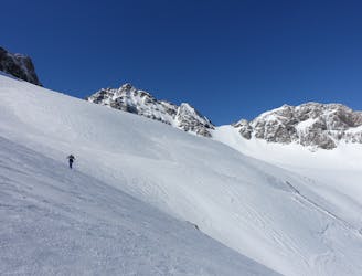
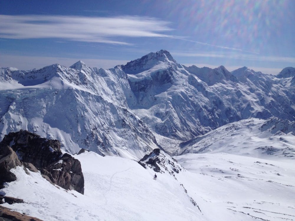
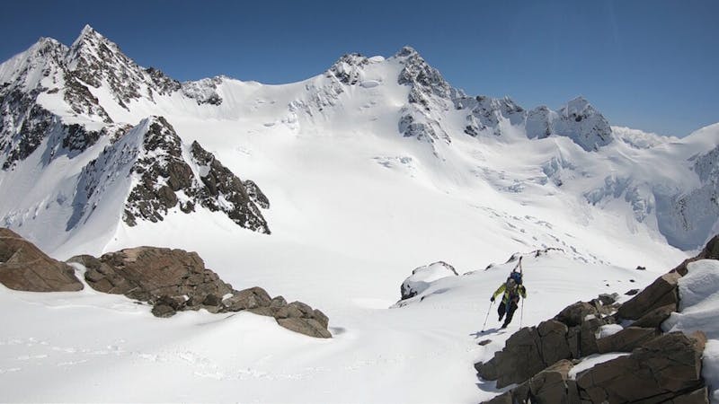
The Muller Hut is one of those places that sees people all year around. It is easy to see why as you get to the shelter with stunning views of Mount Sefton and a relatively straigthforeword climb up. With each step you take the better the views get with Mount Cook in the far distance and enough glaciers to make you dizzy with the potential climbs and all of which being technical. For most people the hut itself is the stopping point but this ski tour allows you to go beyond and explore the area. While not the most technical of places it should be said that it is not an easy area as you need to do some steep sidehilling to get further south along the Sealy Ridge but it offers some great ski turns and awesome views of the surrounding area.
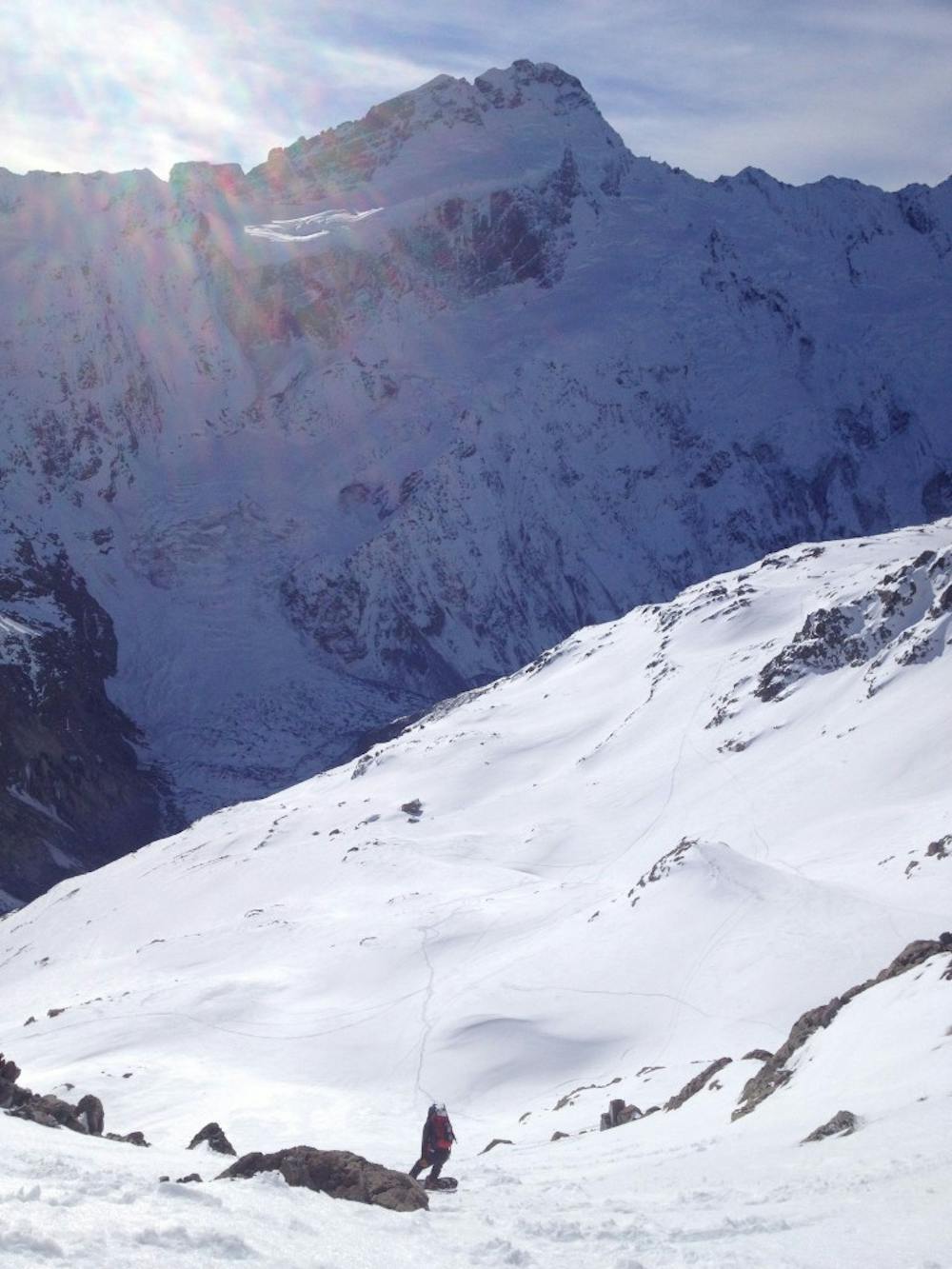
Leaving from the White Horse Hill Parking Lot head up the well beaten trail Northwest on the Sealy Tarns Track. This trail is steep but relatively easy working its way through the vegetation before reaching Sealy Tarns where it opens up to the alpine. Keep heading up and before long you will gain the ridge and start heading south towards the Muller Hut where you can call it a night and rest for the next day.
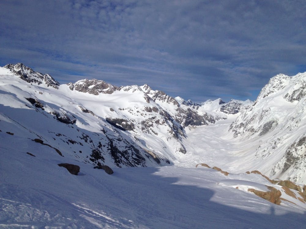
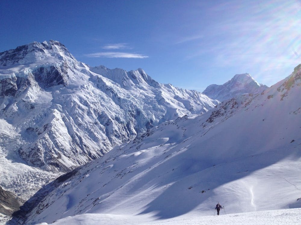
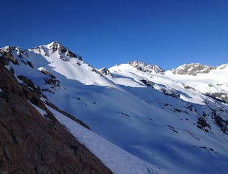
Leaving from the Muller Hut you want to start heading south which starts flat but becomes a nasty sidehill as you wrap around the westeren semi steep slopes of Mount Oliver before once again heading out to semi flat terrain. The trick to this ski tour is to traverse at around 1800 meters until reaching the base of the glacier covered slopes of the Annette Plateau. Once on there keep gaining elevation arriving on the Summit of Mount Annette before heading along the ridge to your high point of the day just north of Borrow Col.
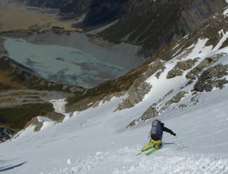
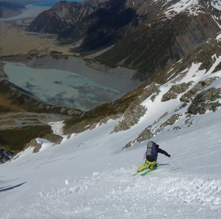
For your first ski descent drop into the northeast slopes and ride until you are just west of Waihi Pass. Now ascend up to the pass and head north along the ridge until arriving at the summit of Kitchener. Walk out to its northern point before descending the slopes a few hundred meters then start skinng up to the ridge just south of Mount Olliver and make your way to the summit where you can ride out to the Muller Hut. If you have time to spare you can make your way along the hikers trail to the open bowl above Sealy Tarns and get in a lap or two as the icing on the cake.
Once you’ve had enough of this breathtaking scenery just follow the Sealy Tarns Track back down to the Parking Lot.
For more pictures and the full story check out this link https://www.whereiskylemiller.com/new-zealand/muller-hut/
Difficult
Serious gradient of 30-38 degrees where a real risk of slipping exists.

As well as the slope itself, there are some obstacles (such as rock outcrops) which could aggravate injury.
Away from help but easily accessed.
31 m away
Convenient access into the beautiful Sealy Range
Moderate Ski Touring
42 m away
A great line based out of the Mueller Hut
Difficult Ski Touring
171 m away
An engaging adventure with some some real New Zealand flavour.
Severe Ski Touring
5 routes · Ski Touring
17 routes · Ski Touring