1.1 km away
Geitgallien South Couloir Loop
Lofoten's most spectacular ski touring summit
Difficult Ski Touring
- Distance
- 6.8 km
- Ascent
- 5 m
- Descent
- 5 m
A stunning line, one of Lofoten's finest
Ski Touring Extreme

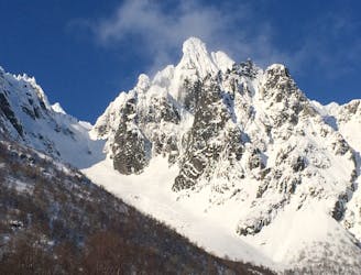
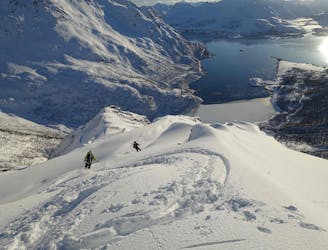
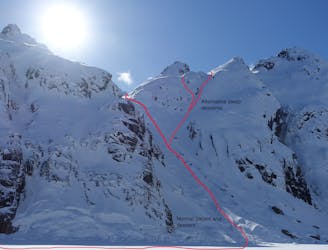
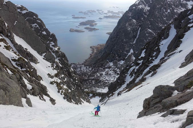
Higravtinden is a prominent peak next to the well-known and popular Geitgallien. Unlike Geitgallien however, there is no easy way to summit and ski Higravtinden. It is unlikely conditions will ever allow for a complete descent of Higravtinden from the summit, but by far the best line on the mountain is the eye-catching hanging couloir on its west side. Visible from a long way off, the West Couloir is a hanging ramp that starts from just below the main summit. Although not a big line by global standards, the terrain is somewhat complex, and the skiing is quite sustained by Lofoten standards. Higravtinden rises almost 1,200 meters above the Higrav valley, and since the climb starts at sea level, it’s good value for money. A successful descent of this line is sure to be a highlight for any ski mountaineer exploring Norway’s best terrain.
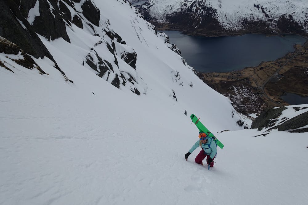

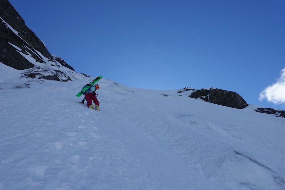
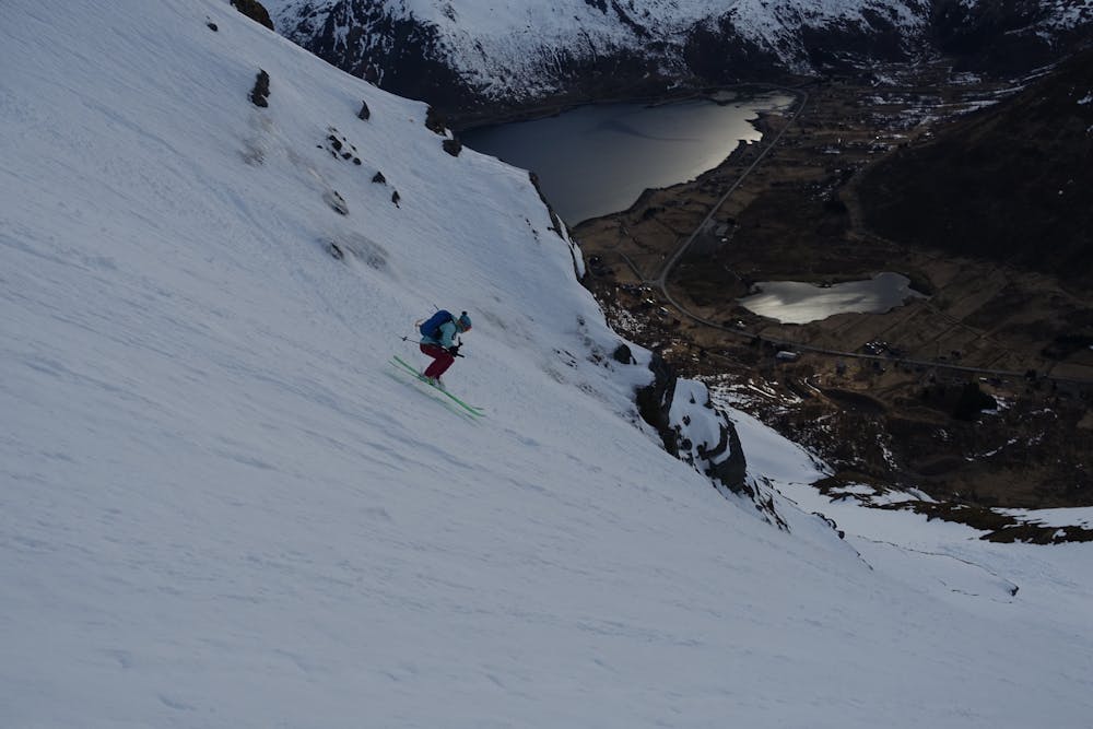
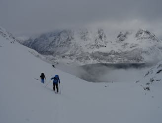
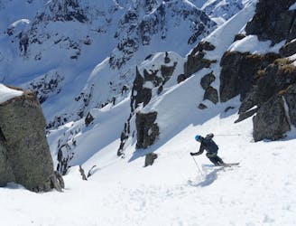
Starting from the hamlet of Eide, climb through the avalanche gully and up and leftwards. There is a lower steep rocky section which needs to be negotiated and can be climbed to the left or the right depending on conditions. A small rappel (possible small tree anchor) or at least a handline might be needed on the way down depending on snow cover. Once past this rock band the climbing is straightforward on 30-40 degree slopes which are also easy to ski down. There is then a small crux at half height where the upper ramp joins the lower couloir. Very good conditions are needed to ski through this step cleanly (briefly 55 degrees) and a rappel on a v-thread on the way down might well be needed. The upper ramp is simply stunning and sustained at around 45 degrees. This line can be timed with the afternoon light since it faces west. The skiing is technical but never too extreme. However, this is certainly a descent for experienced ski mountaineers and strong steep skiers only.
Extreme
Extreme skiing terrain above 45 degrees. These routes are reserved for experienced experts.

In case of a fall, death is highly likely.
Little chance of being seen or helped in case of an accident.
1.1 km away
Lofoten's most spectacular ski touring summit
Difficult Ski Touring
2.8 km away
Avoid the crowds by dropping into the wild east side
Difficult Ski Touring
5 km away
Accessible and fun terrain, a great shorter mission for when the weather isn't perfect!
Moderate Ski Touring
7.2 km away
Spectacular skiing with a big mountain ambiance
Difficult Ski Touring
7.3 km away
Spring couloir skiing at its finest if timed right
Severe Ski Touring

20 routes · Freeride Skiing · Ski Touring
5 routes · Ski Touring