3.4 km away
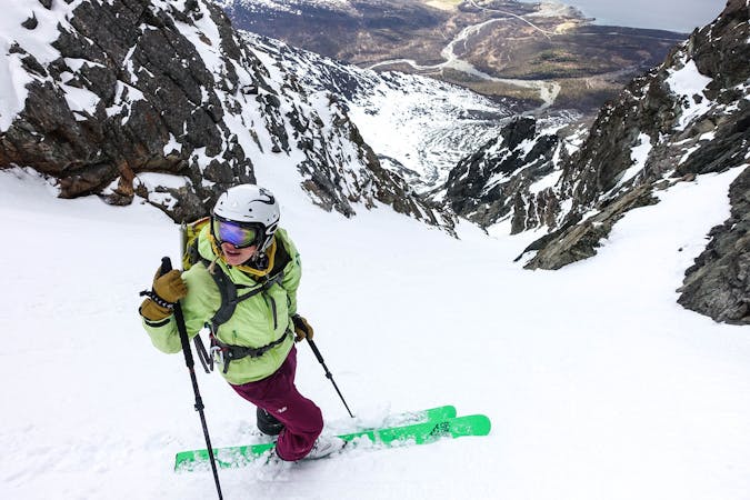
The Lambda couloir of Store Russetind
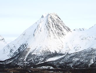
A striking feature on an impressive mountain
Extreme Ski Touring
- Distance
- 4.6 km
- Ascent
- 933 m
- Descent
- 933 m
Kremen av kremen
Ski Touring Severe

This is a popular ski touring route which is generally considered to be severe. It's an unknown remoteness, it features unknown exposure and is typically done in an unknown time of year. From a low point of 15 m to the maximum altitude of 1.5 km, the route covers 20 km, 2239 vertical metres of ascent and 1676 vertical metres of descent.
Kremen av kremen
Severe
Steep skiing at 38-45 degrees. This requires very good technique and the risk of falling has serious consequences.
3.4 km away
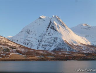
A striking feature on an impressive mountain
Extreme Ski Touring
3.4 km away
A Peak whose East face is one of the biggest adventure freeski lines in the region and whose normal route is one of the most beautiful, particularly in the midnight sun..
Extreme Ski Touring
9.6 km away
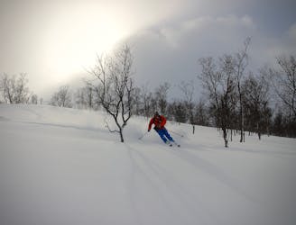
A large area of nicely spaced trees which are not threatened by avalanche and therefore suitable for high avalanche risk/low visibility days.
Moderate Ski Touring
8 routes · Ski Touring