4.8 km away
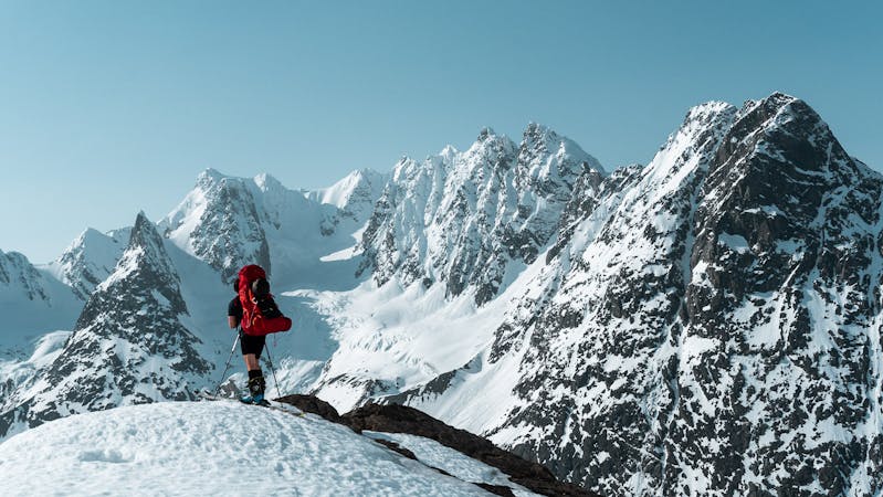
Storgalten (1219m)
One of the most spectacular viewpoints in the Lyngen Alps, as you can see all the sharp peaks on the northern part of the peninsula.
Moderate Ski Touring
- Distance
- 7.7 km
- Ascent
- 1.2 km
- Descent
- 1.2 km
A beautiful ridge traverse on Lyngen's northernmost peak and a tough descent down a west facing couloir
Ski Touring Severe

This is an exciting ridge traverse taking you along a narrow arete to the northernmost peak in the Lyngen Alps. As the ridge narrows it offers moderate exposure along with tremendous views looking out over the Norwegian Sea. This trip is recommended for anyone looking to up the ante with some technical alpine skills required and there's a test for your nerves too, with steep skiing down narrow couloirs. This trip can be completed in a matter of hours and provides awesome views for a sunset ski tour.
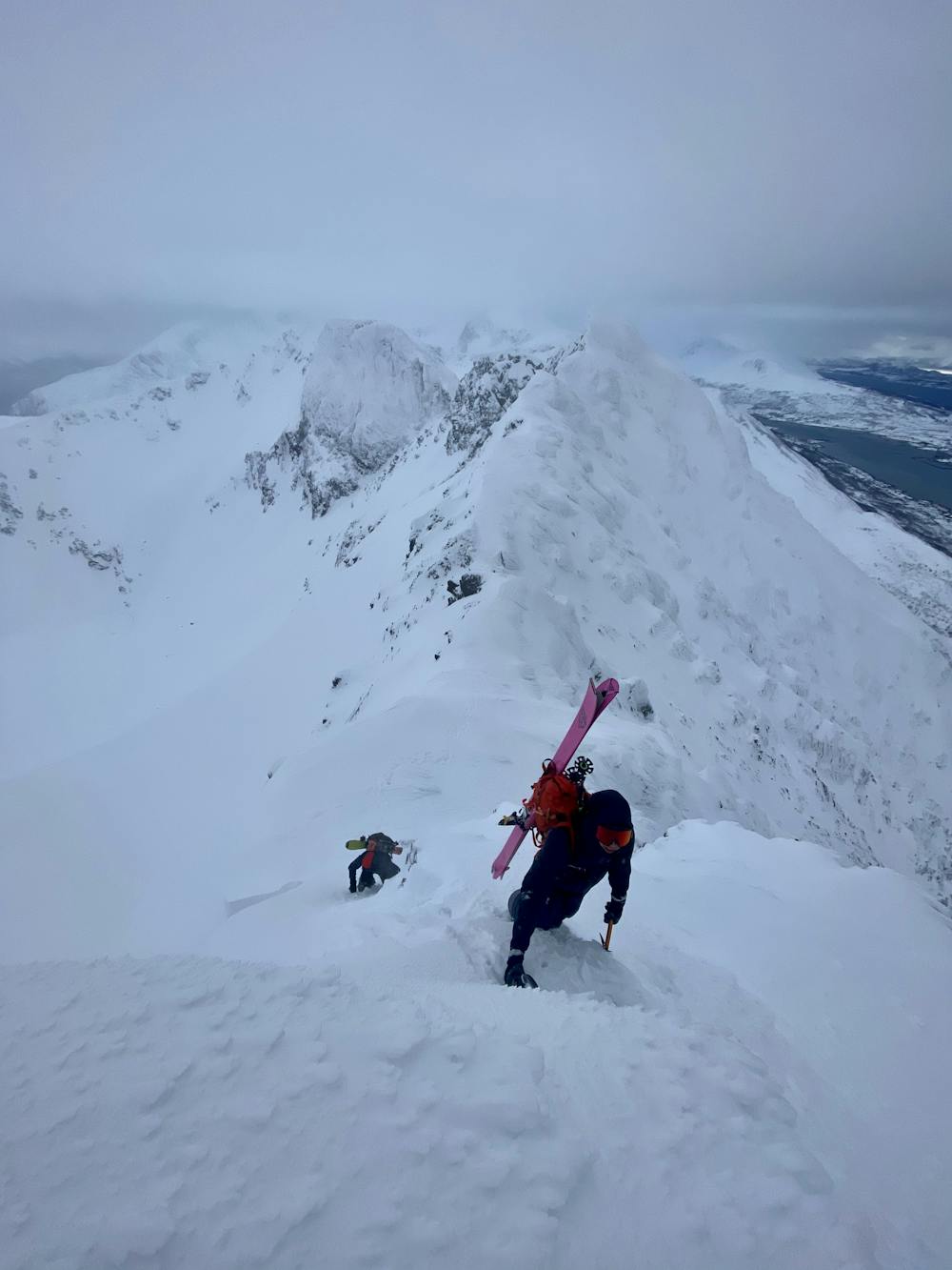
The trip starts as an easy ski tour towards the top of Russelvfjellet in the northernmost area of the Lyngen peninsula. There is an unmarked parking area along the west side of the road where you can park for the day. From here, head north a few hundred meters to the dirt road. After walking along the road and finding where to cross the stream, the uphill track to the ridge is an easy-to-follow route up a mellow face (<30°).
Once on the top of Russelvfjellet, the conditions can turn quite icy as the ridge is exposed to a lot of wind. It is often necessary to use crampons and ice axe along the traverse and it requires a rappel (~15m) to get down to the couloir. Also, this rappel may require building your anchor, since the existing anchor can be difficult to find or may not be in a condition worth using. It's a good idea to bring a long chord or sling and a few nuts, hexes or gear that you would be willing to leave.
When the snow conditions are more favourable the route could be completed starting from the North via some moderate scrambling without the need for a rope and rappel.
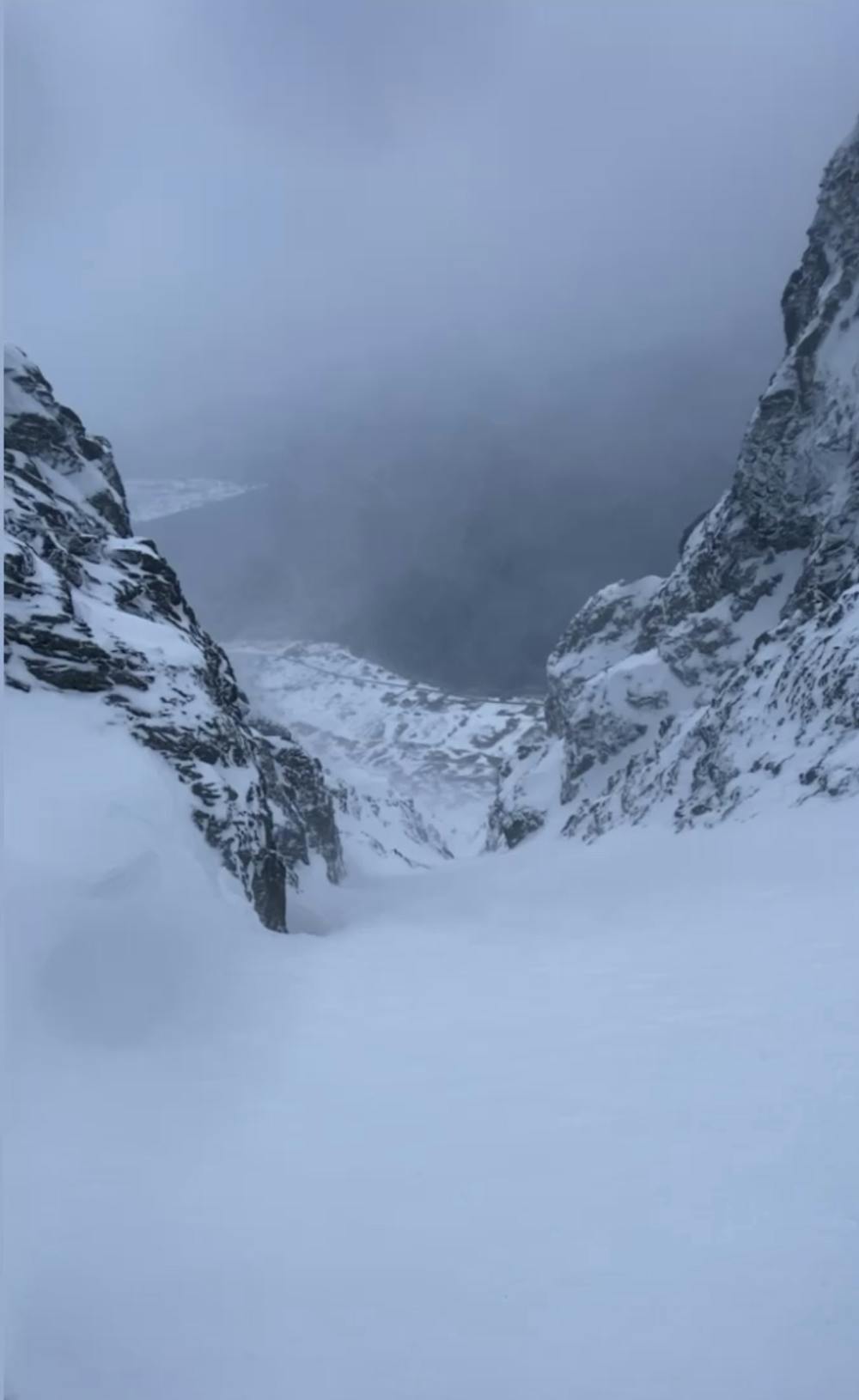
There are a number of different west-facing couloirs to choose to ski down, this one required some technical ski manoeuvring towards the bottom as there was a cliff (~4m) at the exit due to a low snowpack.
If the couloirs do not look safe then continue along the ridge and ski down the northeast facing slope and return to the road.
Severe
Steep skiing at 38-45 degrees. This requires very good technique and the risk of falling has serious consequences.

As well as the slope itself, there are some obstacles (such as rock outcrops) which could aggravate injury.
Away from help but easily accessed.
4.8 km away
One of the most spectacular viewpoints in the Lyngen Alps, as you can see all the sharp peaks on the northern part of the peninsula.
Moderate Ski Touring
10 routes · Ski Touring