3 km away
Midnight Trail Loop
An easily-accessible loop route connecting some of Collserola's most popular trails.
Moderate Trail Running
- Distance
- 13 km
- Ascent
- 441 m
- Descent
- 441 m
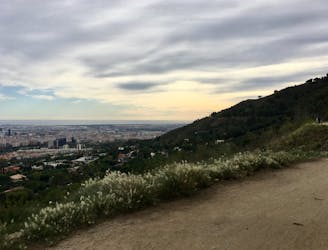
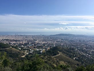
Run along a smooth gravel road with gorgeous views of Barcelona and the Mediterranean.
Trail Running Easy

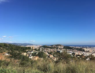
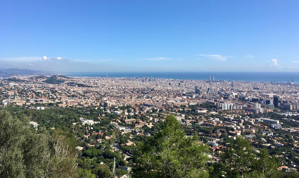
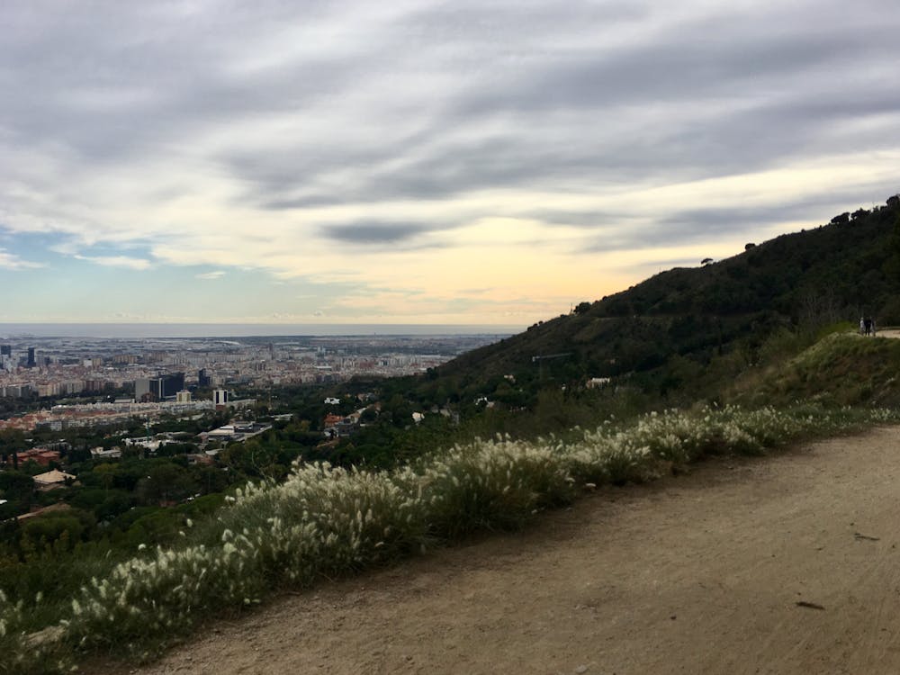
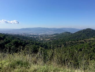
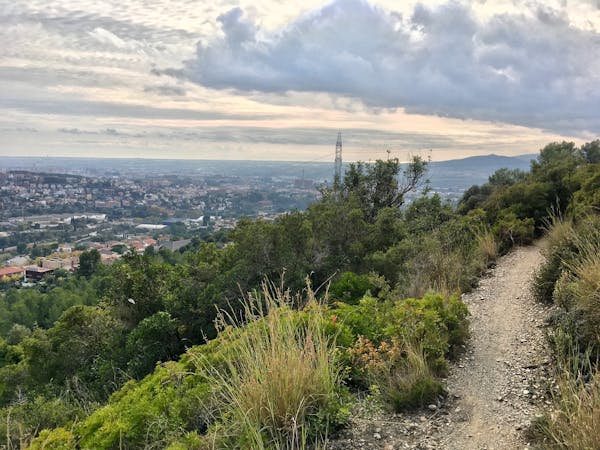
Carretera de Les Aigues is a flat gravel road that twists and turns along the side of the Collserola mountains. This flat gravel bench cut into the mountainside runs for miles at roughly the mid-mountain elevation. From the road, you’ll enjoy stunning views of Barcelona spread out below you, flanked by the bright blue waters of the Mediterranean!
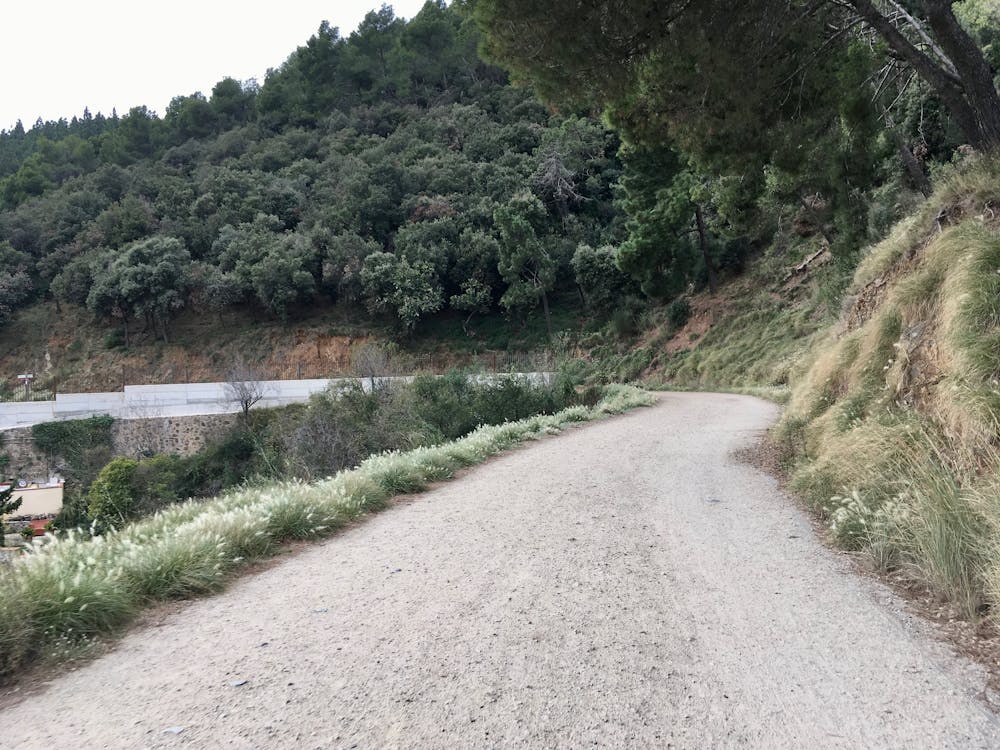
It’s pretty incredible how flat, smooth, and mellow this road is for being located halfway up the side of a mountain. While you will have to do a bit of climbing from the city to get up to the bench, once on Les Aigues it’s a flat, scenic run across the mountains until you drop back down to Barcelona.
The stunning scenery combined with the lack of challenge makes Carretera de Les Aigues an ultra-popular place to ride, walk, and run. You can expect to weave your way through tons of other Barcelona residents escaping the city for some exercise in the mountains. But thanks to the wide dirt road, and that most of the roadway is now off-limits to motor vehicles, you should have plenty of room to navigate through the crowds.
For an even easier run with virtually no climbing, you could choose to ride halfway up the funicular and get off at the mid-station. Carretera de Les Aigues crosses the funicular right at the mid-station, providing a convenient access point.
Easy

The path is on completely flat land and potential injury is limited to falling over.
Close to help in case of emergency.
3 km away
An easily-accessible loop route connecting some of Collserola's most popular trails.
Moderate Trail Running
3 km away
A mellow run with beautiful views of Barcelona
Easy Trail Running
3.2 km away
A short loop through the forest of Collserolla.
Easy Trail Running
7.3 km away
Barcelona Trail Races, also known as Ultratrail Collserola and Gran Trail Collserola, is Barcelona's backyard ultra trail race.
Severe Trail Running
7.3 km away

A medium-length loop through the northern reaches of Collserola.
Difficult Trail Running
7.4 km away
An inspiring point-to-point route running from Barcelona all the way to Sant Cugat del Valles.
Easy Trail Running
8 routes · Trail Running