8.8 km away
Chinyero loop
Circumnavigate a volcano!
Easy Trail Running
- Distance
- 15 km
- Ascent
- 447 m
- Descent
- 447 m
A stunning out & back run high above the gorge.
Trail Running Difficult

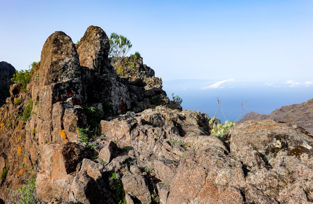
The Calzada de los Antiguos lies in a spectacular pocket of Tenerife. With multiple ‘barranchi’ – narrow winding gorges – all pointing towards the ocean, it’s easy to pick a trail and know it will be a winner. The unique landscape of this region has been shaped by steeply-dipped volcanic flows and trails here are ideal for those days where views and adventure trumps any training goals as the terrain is technical.
The most well-known of these trails - the Barranco de Masca - has been closed for reconstruction following landslides and when open, requires a ticket booked in advance to complete. However, don’t be dismayed as the path of Calzada de los Antiguos to Morro de la Galera is a worthwhile alternative for a very technical run with stunning ocean views. Ease of parking, a nearby bus stop and beginning and ending with a restaurant makes this out-and-back a hard one to beat.
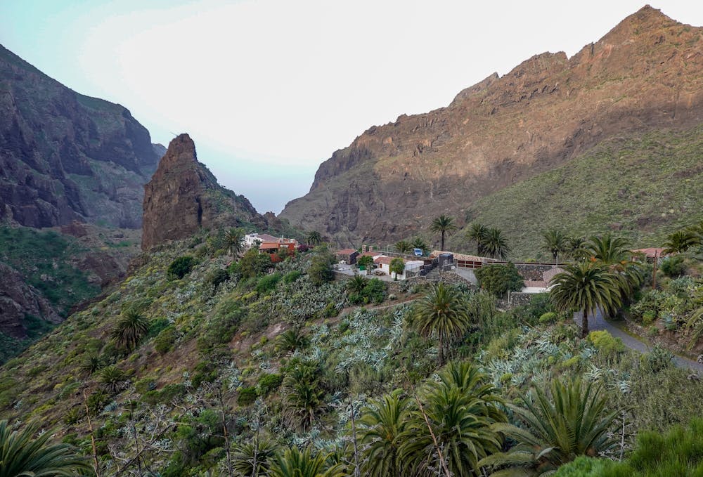
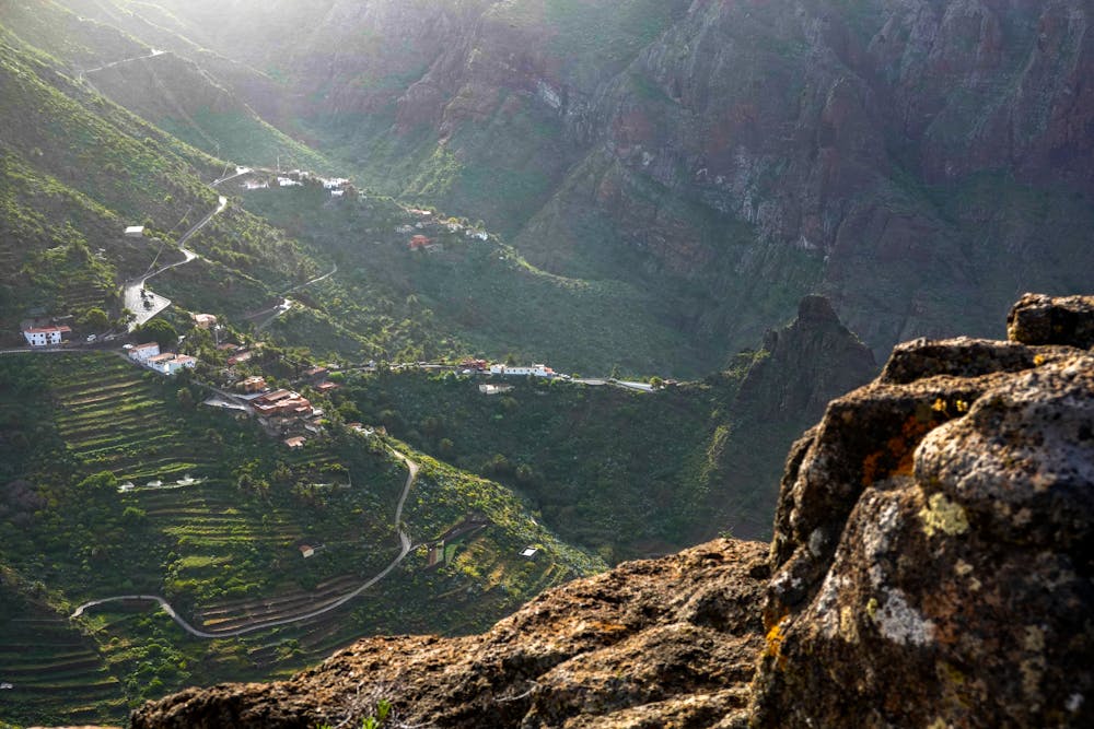
It’s worthwhile to stop in Masca for a peek at the beautiful village atop a ridge, before driving a few kilometres further to the Mirador de La Cruz de Hilda to start the route.
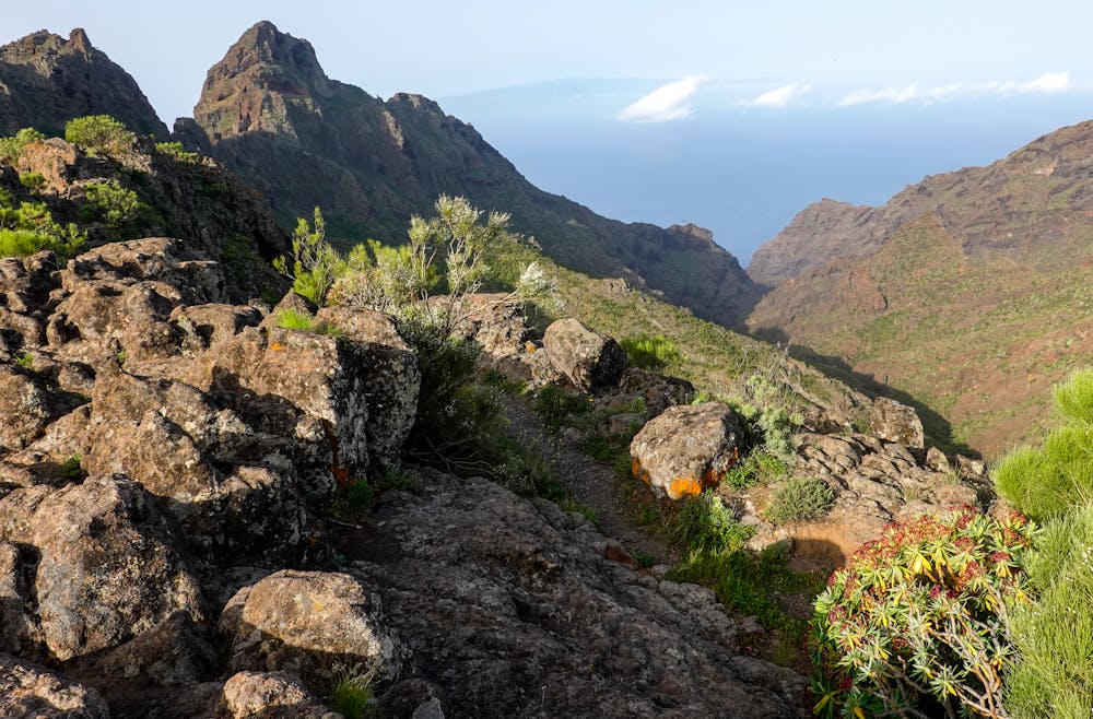
The first section of the trail is wild and rocky, with stunning views of the hamlet of Masca to your left and the gorge on your right. Follow the progressively narrowing trail as it takes you towards the sea, winding through rocky outcrops and scattered bunches of colourful wildflowers.
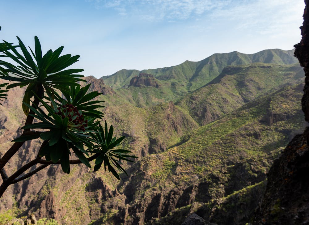
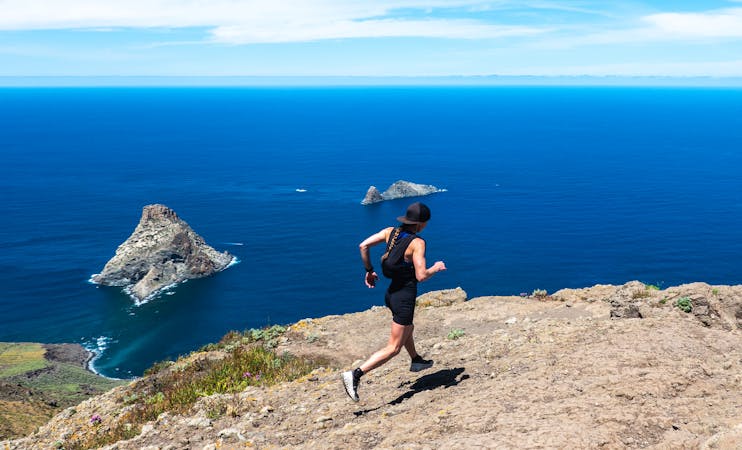
The trail eventually begins to ascend serpentine switchbacks before narrowing out further until you reach the Morro de la Galera. Take care here as the trail is particularly eroded in sections and the massive drop into the gorge below is enough to trigger some vertigo for those with a fear of heights. On a clear day, you can see the neighbouring island of La Palma. Below you is the Playa de Masca.
Tip: Bring plenty of water as, although short, it’s extremely dry on route and hot all year around.
Take this trail in the morning to escape the sun and keep to the shade.
Calculate extra time for the extra-technical terrain. If you want a flowing trail run, pick the Chinyero loop instead.
Difficult

Some trail sections have exposed ledges or steep ascents/descents where falling could cause serious injury.
Little chance of being seen or helped in case of an accident.
8.8 km away
Circumnavigate a volcano!
Easy Trail Running
10 routes · Trail Running