9.1 km away
Via Alpina Green Route C13: Kandersteg to Adelboden
Tough uphill climbs, zigzagging descents, and of course, magical views!
Difficult Hiking
- Distance
- 17 km
- Ascent
- 1.4 km
- Descent
- 1.2 km
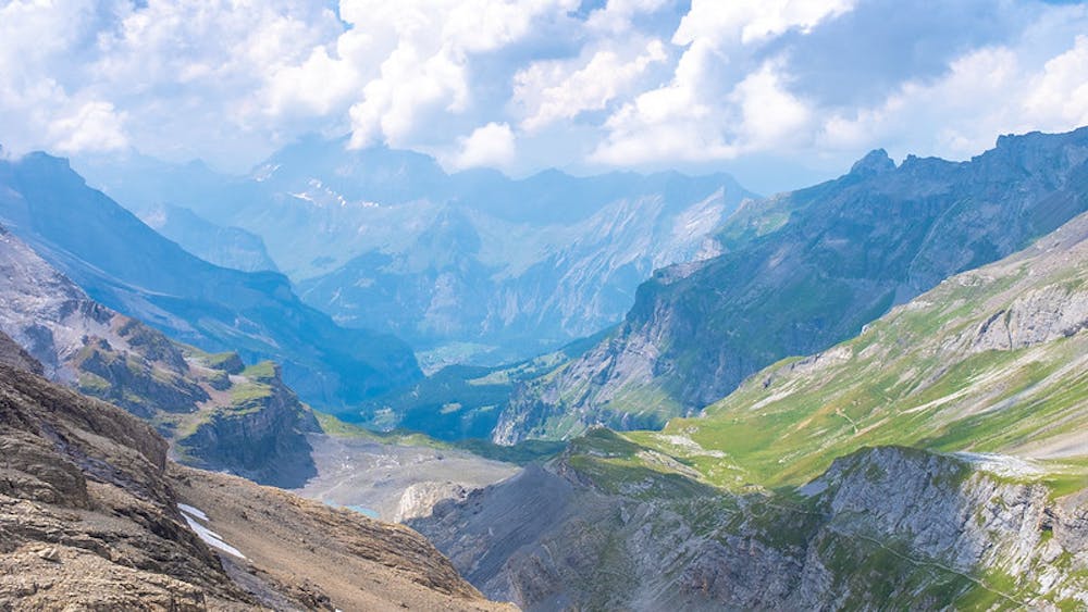
This stage features a climb up to the Hohtürli Pass, the highest point on the Via Alpina trail through Switzerland.
Hiking Difficult

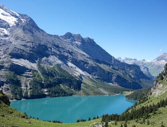
This is a tough 14.5km hike with many ups and downs. Starting at the Gries Alp, walk through the wood and then across meadows to the hut above Bundstäg. The trail leads you through many hairpin bends as it climbs up through woodland to the Underi Bundalp huts and across meadows, along a stream to Oberi Bundalp, where you’ll be rewarded with beautiful views down into the Kiental valley and over to the Sefinenfurgge pass. From here, cross a stream and follow the trail uphill on a pastureland ridge to Schnattweng. From here, the trail then heads over boulder-strewn slopes into a gully. Cross meadows and then continue through sparse mountain woodland past rocky ledges to the gorgeous and glistening Oeschinensee lake. From the lake, follow one of the trails along the Öschinenbach stream all the way down to the valley floor, and along the road to Kandersteg train station.
Difficult
Hiking trails where obstacles such as rocks or roots are prevalent. Some obstacles can require care to step over or around. At times, the trail can be worn and eroded. The grade of the trail is generally quite steep, and can often lead to strenuous hiking.

The trail contains some obstacles such as outcroppings and rock which could cause injury.
Away from help but easily accessed.
9.1 km away
Tough uphill climbs, zigzagging descents, and of course, magical views!
Difficult Hiking

15 routes · Hiking