8.6 km away
Via Alpina Green Route C14: Adelboden to Lenk
The final stage of the Via Alpina Green Route!
Moderate Hiking
- Distance
- 13 km
- Ascent
- 651 m
- Descent
- 923 m
Tough uphill climbs, zigzagging descents, and of course, magical views!
Hiking Difficult

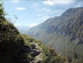
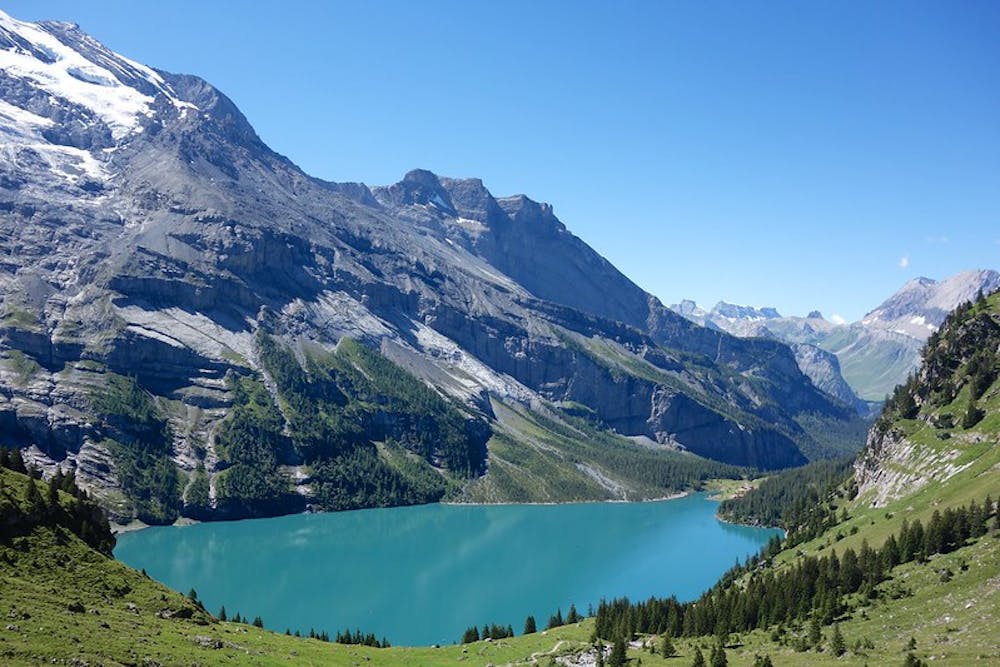
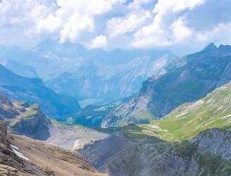
From Kandersteg head in a south direction along the railway line, and then up to Usser Üschine hamlet by following the Alpbach stream through a wood. From the hamlet, you need to be prepared to a steep climb, passing two huts before coming over a rock ledge. Above the ledge, walk over the alpine terrace to the Alpschele huts, where you’ll be greeted by a wonderful view over the Balmhorn group, the Doldenhorn, the Blüemlis Alp, the Oeschinensee lake, and the Hohtürli gap. Follow the path stretching out against the Chly Lohner, which then heads uphill over scree and grass-covered terrain. Cross the wide detritus cone pass the mighty rock faces of the Gross und Chly Lohner to reach the Bunderchrinde pass. Its that classic hiking combination of a tough climb with rewarding views: In the east, you’ll see the main chain of the Bernese Alps and the mountains of the Kiental Valley, while to the west lies the sunny Adelboden pastureland in the beautiful Engstligental valley at the foot of the wild Gsür and the Albristhorn peaks. Now comes a steep zigzagging descent all the way down across rocky paths and through an alpine valley all the way to Adelboden.
Difficult
Hiking trails where obstacles such as rocks or roots are prevalent. Some obstacles can require care to step over or around. At times, the trail can be worn and eroded. The grade of the trail is generally quite steep, and can often lead to strenuous hiking.

The path is on completely flat land and potential injury is limited to falling over.

Away from help but easily accessed.
8.6 km away
The final stage of the Via Alpina Green Route!
Moderate Hiking
9.1 km away
This stage features a climb up to the Hohtürli Pass, the highest point on the Via Alpina trail through Switzerland.
Difficult Hiking

15 routes · Hiking