6.6 km away
Approach to Tschierva Hut
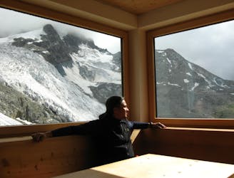
A steady walk in which can be MTB assisted, or via a horse drawn cart!
Difficult Hiking
- Distance
- 12 km
- Ascent
- 829 m
- Descent
- 15 m
HO75.02: Suvretta (St. Moritz) - Suvrettatal - Piz Nair
Hiking Difficult

This is a popular hiking route which is generally considered to be difficult. It's very remote, it features low exposure and is typically done between July and October. From a low point of 2 km to the maximum altitude of 3 km, the route covers 7.7 km, 1087 vertical metres of ascent and 3 vertical metres of descent.
HO75.02: Suvretta (St. Moritz) - Suvrettatal - Piz Nair
Difficult
Hiking trails where obstacles such as rocks or roots are prevalent. Some obstacles can require care to step over or around. At times, the trail can be worn and eroded. The grade of the trail is generally quite steep, and can often lead to strenuous hiking.

The path is on completely flat land and potential injury is limited to falling over.

Little chance of being seen or helped in case of an accident.
6.6 km away
A steady walk in which can be MTB assisted, or via a horse drawn cart!
Difficult Hiking
4 routes · Alpine Climbing · Hiking