2.7 km away
Motto della Croce and Motto d'Arbino
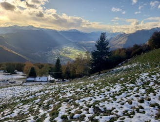
Staggering views, peaceful forests and traditional little mountain huts make this a classic hike
Difficult Hiking
- Distance
- 12 km
- Ascent
- 1.4 km
- Descent
- 878 m
Long mountain hike in the Arbedo valley and descend to Bellinzona.
Hiking Difficult

This is a very beatifull hike that start's from Arbedo and goes up all the valley to the new Gesero hut, and then goes all the way down to the rail station of Bellinzona, on the way up you see the laghetto d'Orbello (lake) and the monti di Cò, and almost at the top you go by at the alpe di gesero. On the way down you cross some great viewpoints like Sasso Guida and Motto della Croce. Its pretty a long hike with more than 1800 meter altitude diffrence, but overall its a safe hike. NOTE: On FATMAP the trail from laghetto d'Orbello to Alpe del Gesero is not yet shown, but on the spot its a very good market trail (Its the only one in the Arbedo Valley)
Difficult
Hiking trails where obstacles such as rocks or roots are prevalent. Some obstacles can require care to step over or around. At times, the trail can be worn and eroded. The grade of the trail is generally quite steep, and can often lead to strenuous hiking.

The trail contains some obstacles such as outcroppings and rock which could cause injury.
Away from help but easily accessed.
2.7 km away
Staggering views, peaceful forests and traditional little mountain huts make this a classic hike
Difficult Hiking