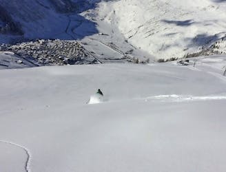
123 m away
Gemsgrat

A long ride on Gemsgrat (ridge) with a wide, open ride back on to the "Russi run"
Difficult Freeride Skiing
- Distance
- 1.3 km
- Ascent
- 23 m
- Descent
- 480 m
There's just a short hike to this easily accessible Couloir, which offers steep skiing and a quick return to the lift.
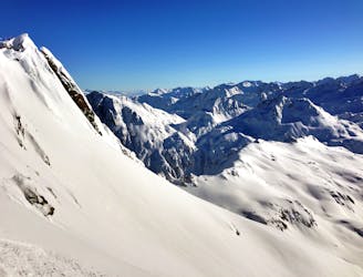
Freeride Skiing Severe

Whether it’s a warm up run or the pinnacle of your life on skis, the Gipfel Couloir gives you the big mountain feeling without the big hike in or the long road out. Follow the "Sonnenpiste" for 2 U-turns then head for the last pylon of the cable car, from where you have to walk for 2 minutes. From the top of the couloir you can see the run (Sonnenpiste) returning to the cable car. The first 100 metres are fairly narrow but definitely wide enough to make turns. Beware of sharks (rocks) trying to take you down. After the initial 100 metres the run opens so you can let the skis run or make your perfect pow turns. There is no getting lost on this line, just ski until you hit the groomers and get back to the tram for the next lap.
Severe
Steep skiing at 38-45 degrees. This requires very good technique and the risk of falling has serious consequences.

As well as the slope itself, there are some obstacles (such as rock outcrops) which could aggravate injury.
Away from help but easily accessed.
123 m away
A long ride on Gemsgrat (ridge) with a wide, open ride back on to the "Russi run"
Difficult Freeride Skiing
183 m away

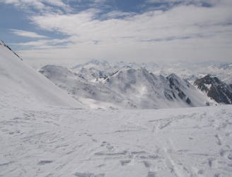
Very exposed on a ridge at the begining, nice slopes in the middle with a couloir at its end. The last part in the Unteralptal is very flat back to the village of Andermatt
Severe Freeride Skiing
200 m away
Over 100 deep snow descents | 3 Days
Moderate Freeride Skiing
486 m away

Many variants to explore close to a marked itinerary, all between 25 and 40 degrees.
Moderate Freeride Skiing
633 m away
A very popular line (because its easy) which requires a 15 minute hike with or without skins
Moderate Freeride Skiing
634 m away
A very long and easy 1500 metre downhill trip
Moderate Freeride Skiing
658 m away

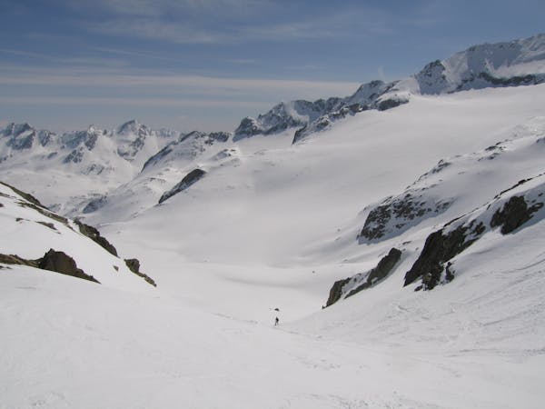
Two nice couloirs with a wonderful wide slope in between.
Severe Freeride Skiing
734 m away

A very popular 1300 metre downhill even for intermediate skiers. There are many, many variants to do.
Moderate Freeride Skiing
1.6 km away

Very steep at its beginning, then a long wide slope across little cliffs and dwarf alders. Many variants but a bit tricky to find the right way.
Severe Freeride Skiing
1.6 km away

600 metres of easy off-piste when the top of Gemsstock is closed.
Moderate Freeride Skiing

10 routes · Freeride Skiing
11 routes · Freeride Skiing