4.3 km away
Geissberg

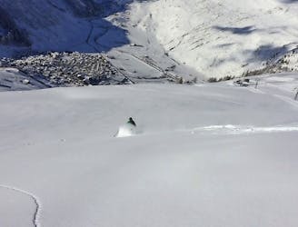
600 metres of easy off-piste when the top of Gemsstock is closed.
Moderate Freeride Skiing
- Distance
- 2.3 km
- Ascent
- 27 m
- Descent
- 802 m
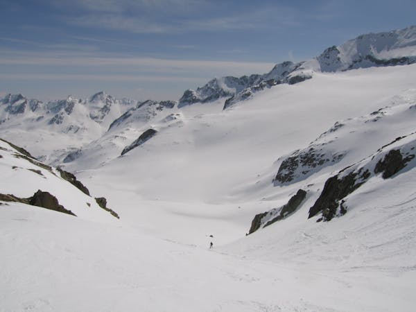
An itinerary run which is easy even with bad weather conditions.
Freeride Skiing Easy

On top of Gütsch, ski in the direction of the wind turbines and follow the yellow poles which mark the itinerary. The terrain is between 15 and 25 degrees. You follow a little valley before returning to the piste at "Im Loch". When there is enough snow you can cut again after about 200 metres on the path, in the direction to the intermediate station at Nätschen.
Easy
Wide gentle slopes at around 20 degrees or less.

Exposure is limited to that of the slope itself. Getting hurt is still likely if the slope is steep and/or the snow is hard.

Away from help but easily accessed.
4.3 km away
600 metres of easy off-piste when the top of Gemsstock is closed.
Moderate Freeride Skiing
4.4 km away

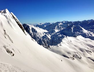
Very steep at its beginning, then a long wide slope across little cliffs and dwarf alders. Many variants but a bit tricky to find the right way.
Severe Freeride Skiing
5.5 km away

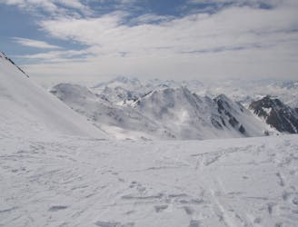
Many variants to explore close to a marked itinerary, all between 25 and 40 degrees.
Moderate Freeride Skiing
5.6 km away

Two nice couloirs with a wonderful wide slope in between.
Severe Freeride Skiing
6 km away

There's just a short hike to this easily accessible Couloir, which offers steep skiing and a quick return to the lift.
Severe Freeride Skiing
6 km away

Very exposed on a ridge at the begining, nice slopes in the middle with a couloir at its end. The last part in the Unteralptal is very flat back to the village of Andermatt
Severe Freeride Skiing
6.1 km away

A long ride on Gemsgrat (ridge) with a wide, open ride back on to the "Russi run"
Difficult Freeride Skiing
6.1 km away
Over 100 deep snow descents | 3 Days
Moderate Freeride Skiing
6.6 km away
A very long and easy 1500 metre downhill trip
Moderate Freeride Skiing
6.6 km away
A very popular line (because its easy) which requires a 15 minute hike with or without skins
Moderate Freeride Skiing
11 routes · Freeride Skiing