130 m away
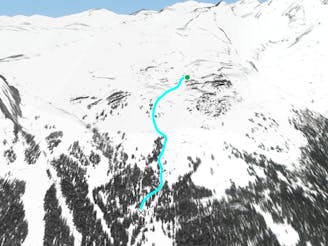
Chetseron

One of the classic lines with really easy access.
Moderate Freeride Skiing
- Distance
- 1.6 km
- Ascent
- 0 m
- Descent
- 521 m
very technical, extreme consequence with mistake.
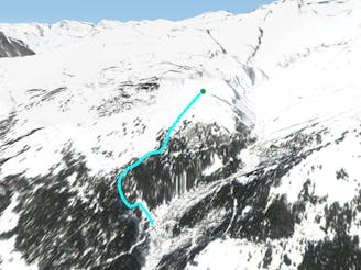
Freeride Skiing Severe

This is a popular freeride skiing route which is generally considered to be severe. It's remote, it features high exposure (e3) and is typically done between January and May. From a low point of 1.6 km to the maximum altitude of 2.1 km, the route covers 3.4 km, 220 vertical metres of ascent and 630 vertical metres of descent. It's graded 5.1 and Labande grade 5. You'll need rope to complete it safely.
amazing views with some mega snow but there is no access with conditions permitting. check wether report and avalanche bulletin properly before attempting.
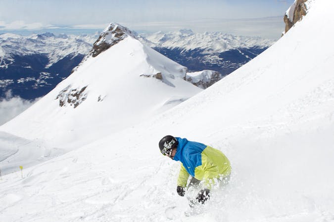
Severe
Steep skiing at 38-45 degrees. This requires very good technique and the risk of falling has serious consequences.

In case of a fall, death is highly likely.

Away from help but easily accessed.
130 m away
One of the classic lines with really easy access.
Moderate Freeride Skiing
1.2 km away

The first run of the day
Easy Freeride Skiing
1.3 km away
The most classic steep freeride run around Crans-Montana
Difficult Freeride Skiing
2.5 km away

Open easy run where you can ski fast and wide
Moderate Freeride Skiing
2.6 km away
Easy open run
Easy Freeride Skiing
3.2 km away
Forest- perfect for foggy days
Moderate Freeride Skiing
4.3 km away

Dream run in the forest
Moderate Freeride Skiing
4.8 km away

Wide classic line coming from the glacier
Difficult Freeride Skiing
5.1 km away

A classic off piste line, with easy access and no skinning needed.
Difficult Freeride Skiing
5.2 km away

Classiest run in Aminona sector
Difficult Freeride Skiing
11 routes · Freeride Skiing