6.5 km away
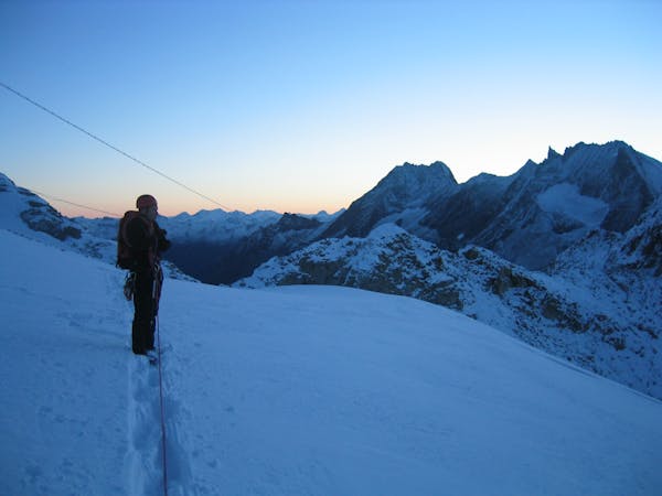
Approach to the Dent Blanche Hut
A long, tough climb to a spectacularly situated Swiss mountain hut.
Difficult Hiking
- Distance
- 8.1 km
- Ascent
- 1.7 km
- Descent
- 40 m
A lovely walk up a well marked trail, strenuous in its first half
Hiking Difficult

One of the many appeals of Arolla is the high valley base and relatively low summits. The combination of having no 4000m peaks and a relative lack of lift infrastructure, ensures that it never feels busy. It has long been popular with Brits and is an ideal base for introductory mountaineering. No bus loads of tourists looking for selfies in the lift queue, no expensive lift tickets, plus there are fewer acclimatisation issues (you are acclimatising in your bed in the village, rather than getting a headache in a hut over 3000m) and there is the simple appeal of getting up in the morning and setting off on foot to your destination, in this case the Aiguille Rouges Hut.
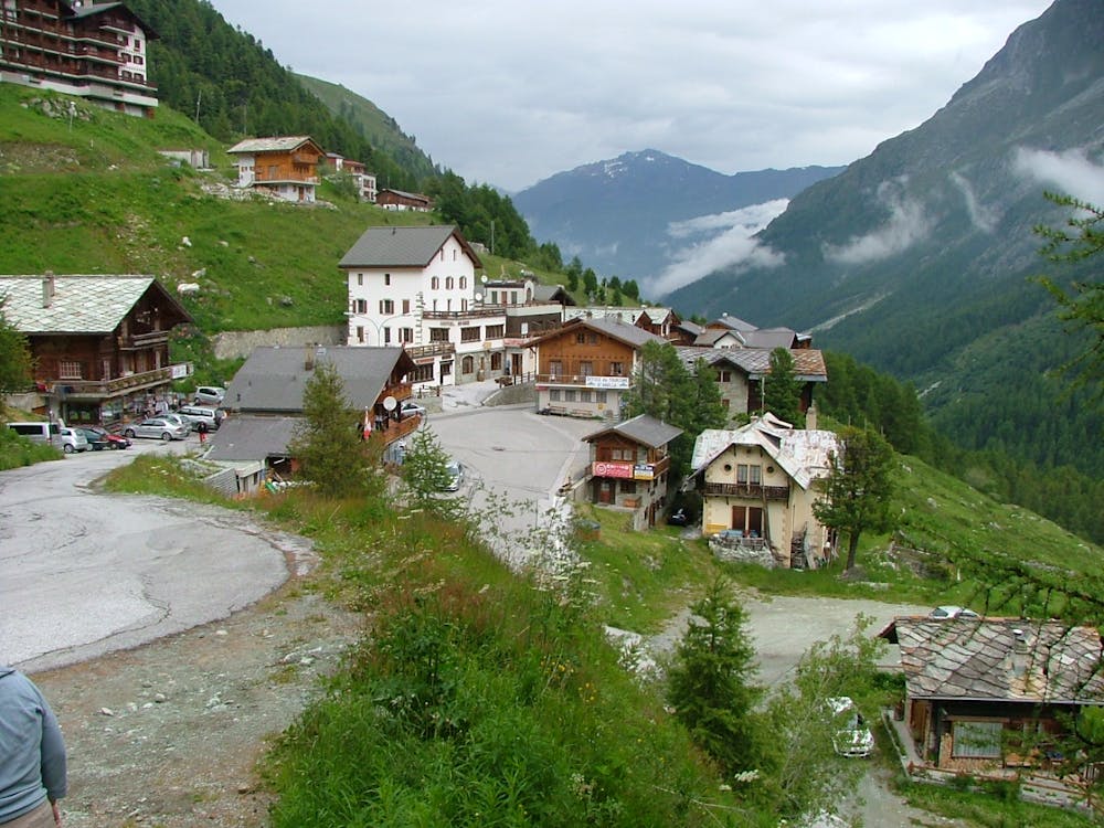
If you have come by car then you can park in the top of the village, a couple of zig zags above the main village square, in a car park near a drag lift. Alternatively, if you have driven from further afield, you could park 10 mins down the road at the hamlet of la Gouille at 1834m. This latter approach has the advantage that you walk past Lac Bleu on your approach, which will be pleasant to dip your toes into on the way down too. Both approaches are well signposted, the latter slightly longer.
From Arolla take the well-marked trail. There are various minor variations, but it is hard to get lost. On a hot day it is good to take it easy and have a break after the initial steep hot climb, at the summer hamlet of Pragra at 2476m. This is about the halfway point. From here the trail is less steep and does a long traverse on a rocky footpath, crossing several streams just below 2700m, which may be refreshing to either drink or splash your face with. The hut is at 2821m and is a traditional stone building, which finally (and thankfully!) had indoor toilets installed in 2019.
Difficult
Hiking trails where obstacles such as rocks or roots are prevalent. Some obstacles can require care to step over or around. At times, the trail can be worn and eroded. The grade of the trail is generally quite steep, and can often lead to strenuous hiking.

The trail contains some obstacles such as outcroppings and rock which could cause injury.
Away from help but easily accessed.
6.5 km away
A long, tough climb to a spectacularly situated Swiss mountain hut.
Difficult Hiking

10 routes · Alpine Climbing · Hiking
6 routes · Alpine Climbing · Hiking

20 routes · Alpine Climbing · Hiking