7.6 km away
Haute Route Glacier Trek Day 3 (Part 2) - Mauvoisin to the Cabane de Chanrion.
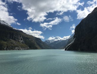
A lovely walk past the Lac de Mauvoisin up to a well-positioned hut.
Difficult Hiking
- Distance
- 10 km
- Ascent
- 1 km
- Descent
- 387 m
Total walking time: 7-8 hours, 700m of ascent.
Hiking Difficult

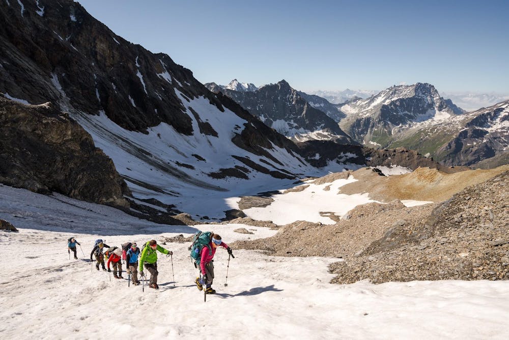
From the Chanrion hut, you head up the impressive Glacier d’Otemma which heads towards the Vignettes hut, your stop for the night. The vast expense of ice is surrounded by immense mountains and is in the heart of the Valais Alps. The Vignettes hut is located at 3157m altitude and offers breath-taking views of the surrounding mountains.
Difficult
Hiking trails where obstacles such as rocks or roots are prevalent. Some obstacles can require care to step over or around. At times, the trail can be worn and eroded. The grade of the trail is generally quite steep, and can often lead to strenuous hiking.
7.6 km away
A lovely walk past the Lac de Mauvoisin up to a well-positioned hut.
Difficult Hiking

9 routes · Alpine Climbing · Hiking