6.3 km away
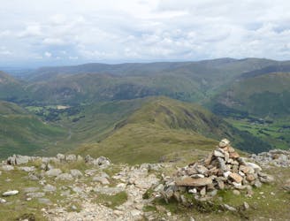
Hallin Fell
With a high start and a low summit this likeable mini fell must be one of the easiest ascents in the Lake District, by its standard route.
Moderate Hiking
- Distance
- 2.7 km
- Ascent
- 220 m
- Descent
- 220 m
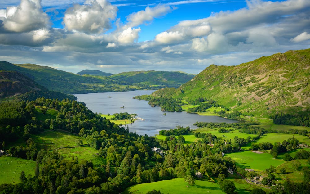
The Ullswater Way connects shoreline paths, woodland trails, fast land and popular lakeside villages to loop around Ullswater lake in the Lake District.
Hiking Moderate

The Ullswater Way is a long-distance hiking trail in the Lake District. This 32.2 km / 20 mile circular route starts and ends at Pooley Bridge, a small village on the eastern shore of Ullswater.
The trail takes you through some of the most beautiful and varied landscapes in the Lake District, including rolling hills, forests, and of course, Ullswater itself. Along the way, you'll pass through charming villages and hamlets, and have the opportunity to visit popular attractions such as Aira Force waterfall and Rydal Mount, the former home of William Wordsworth.
The trail is well-marked and easy to follow, with plenty of accommodation options available along the way, including campsites, bunkhouses, and hotels. It is suitable for hikers of all levels, although you should be in good physical condition as it can be strenuous at times.
Overall, the Ullswater Way is a fantastic way to explore the stunning scenery and rich cultural heritage of the Lake District, and is a must-do for anyone visiting the region.
Moderate
Hiking along trails with some uneven terrain and small hills. Small rocks and roots may be present.

Close to help in case of emergency.
6.3 km away
With a high start and a low summit this likeable mini fell must be one of the easiest ascents in the Lake District, by its standard route.
Moderate Hiking
7.4 km away
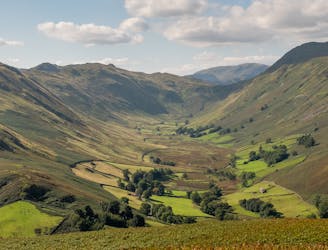
Place Fell rises alone, a hub-like point at the centre of a great arc of mountains running from Helvellyn and the Dodds to the High Street range.
Difficult Hiking