6.1 km away
Bishop Hill (461m) Circular from Holl Reservoir
A gentle day out with excellent views across Fife from the summit!
Moderate Hiking
- Distance
- 12 km
- Ascent
- 278 m
- Descent
- 278 m
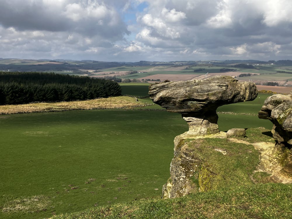
Fascinating rock formations and the highest peak in the county of Fife!
Hiking Moderate

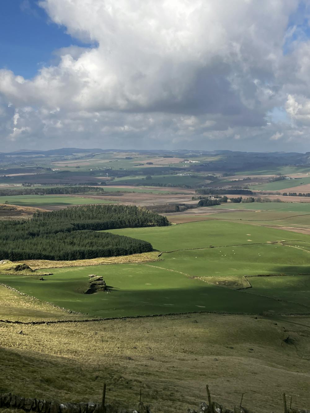
The cone shaped summit of West Lomond (522m) is the highest peak in the peninsula of Fife. A roughly 40-minute drive from central Edinburgh will land you in the historic Lomond Hills, making West Lomond the perfect day out from the hustle and bustle of the busy city. This route encompasses some beautiful rock formations – including the famous Bunnet Stane – and will be popular with the keen geologists among us. There are many routes and paths up West Lomond as it is a popular destination, but this roughly 2 to 4 hour circular hike will provide excellent views across the east coast of Scotland and leave the legs feeling worked.
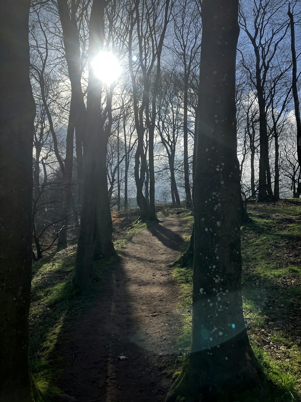
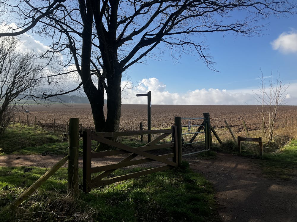
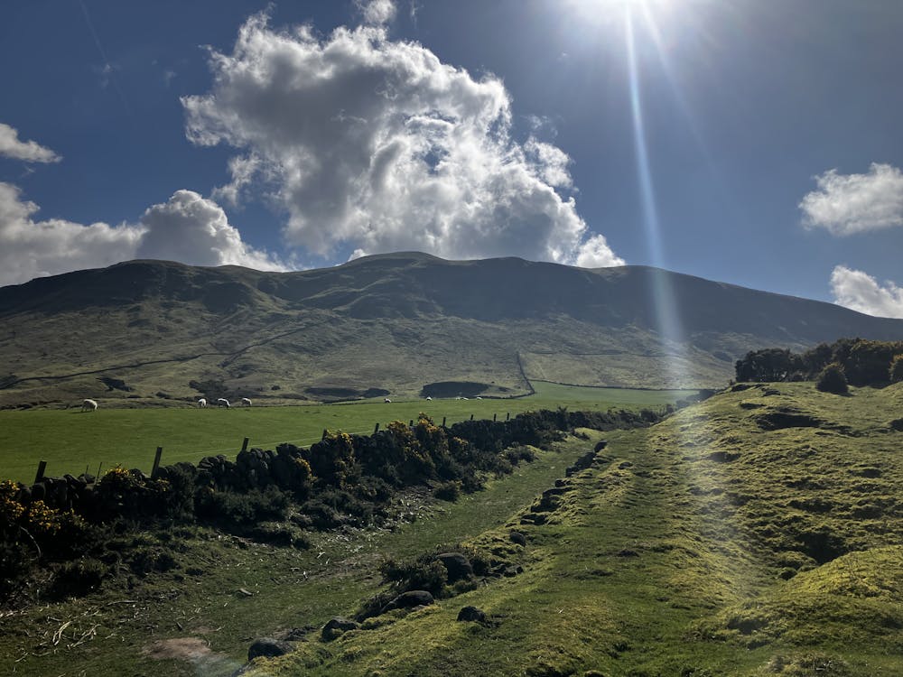
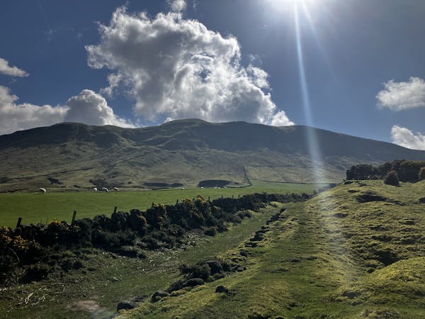
Park at the dusty layby on the side of the road. Head southwest down the road for some time. You will be flanked by farmers and their fields so make sure to move out of the way for passing farm equipment. Follow the GPX file until it turns left into a small row of trees after a popular car park. Follow this path up into Glen Vale and the views will start to appear.
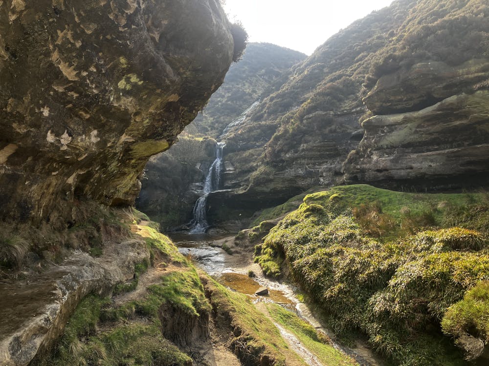
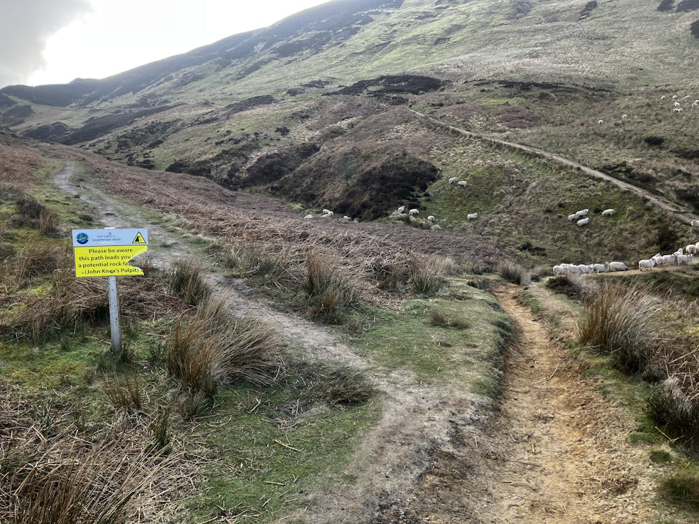
You will eventually approach a fork in the path and a yellow warning sign regarding John Knox’s pulpit. Travelling either left or right will bring you out at the same spot. Heading left (as per the GPX file) and ignoring the warning sign will allow you to explore a small but beautiful little waterfall and canyon of Glen Burn which is highly recommended.
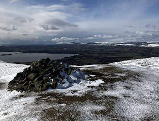
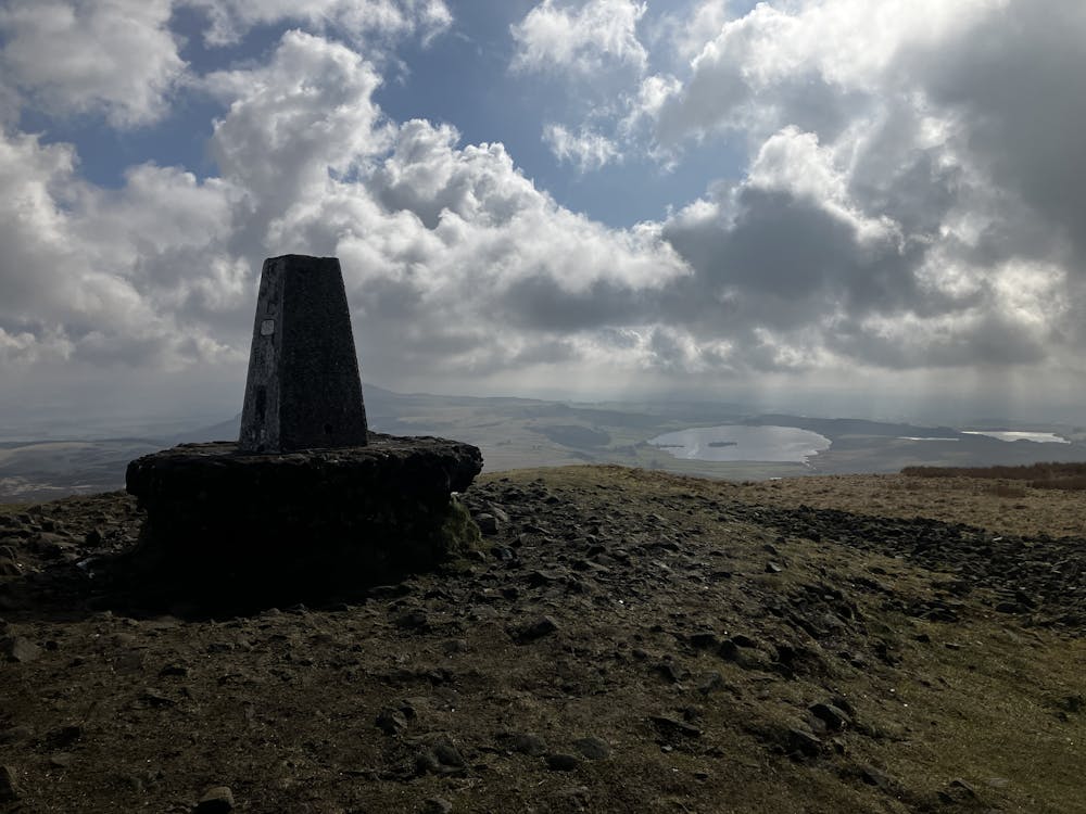
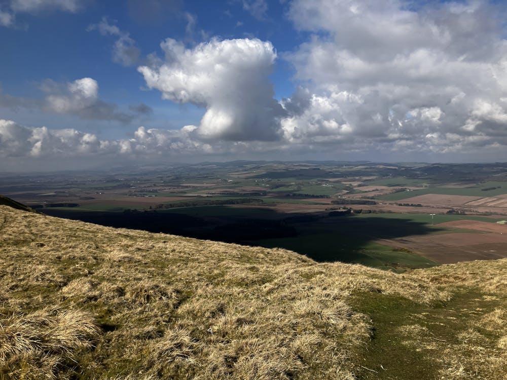
Proceed out of the canyon and reach another yellow warning sign at the top of the path. Turn left and follow a small trail leading off from the main path directly up the south face of West Lomond. Meander your way to the summit and enjoy 360-degree views of the Kingdom of Fife.
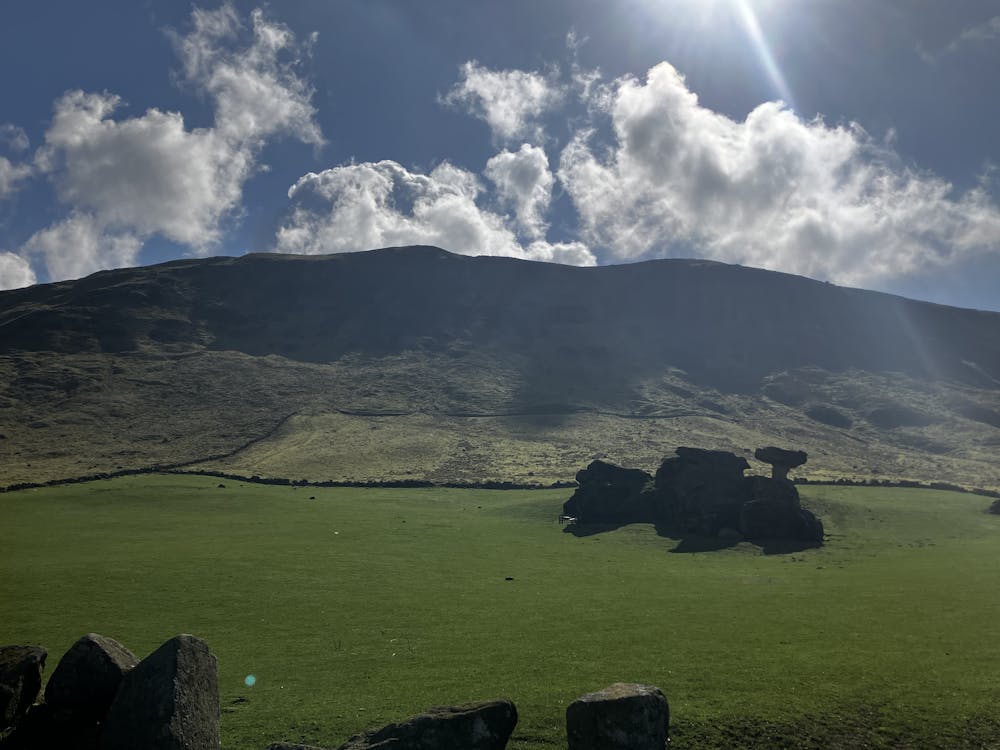
After a summit selfie and sandwich, head west and snake your way down the west facing aspect of West Lomond to stumble across the famous Bunnet Stane. This incredible rock formation is a must see and make sure to explore the small cave that is situated at its base. Follow the path north back to the car park and look back up at the simple but sturdy West Lomond summit.
This hike and guide were completed during spring weather conditions. This is just one opinion of this route. Make sure to do your own research by consulting local internet resources, mountain guides or guidebooks to evaluate other opinions so you can be best prepared for the terrain. A Guide by Red
Moderate
Hiking along trails with some uneven terrain and small hills. Small rocks and roots may be present.

The trail contains some obstacles such as outcroppings and rock which could cause injury.
Away from help but easily accessed.
6.1 km away
A gentle day out with excellent views across Fife from the summit!
Moderate Hiking
6.8 km away
Forests, summits, roads, public toilets and waterfalls - this lovely walk has it all!
Moderate Hiking
3 routes · Hiking