177 m away
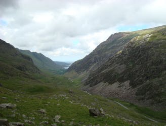
Glyder Fawr and Glyder Fach
One of Snowdonia's most classic hikes along one of its most scenic ridges
Difficult Hiking
- Distance
- 8.5 km
- Ascent
- 766 m
- Descent
- 766 m
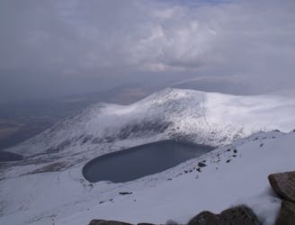
Spectacular views guaranteed from the southernmost peak in the Carneddau range
Hiking Moderate

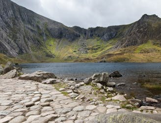
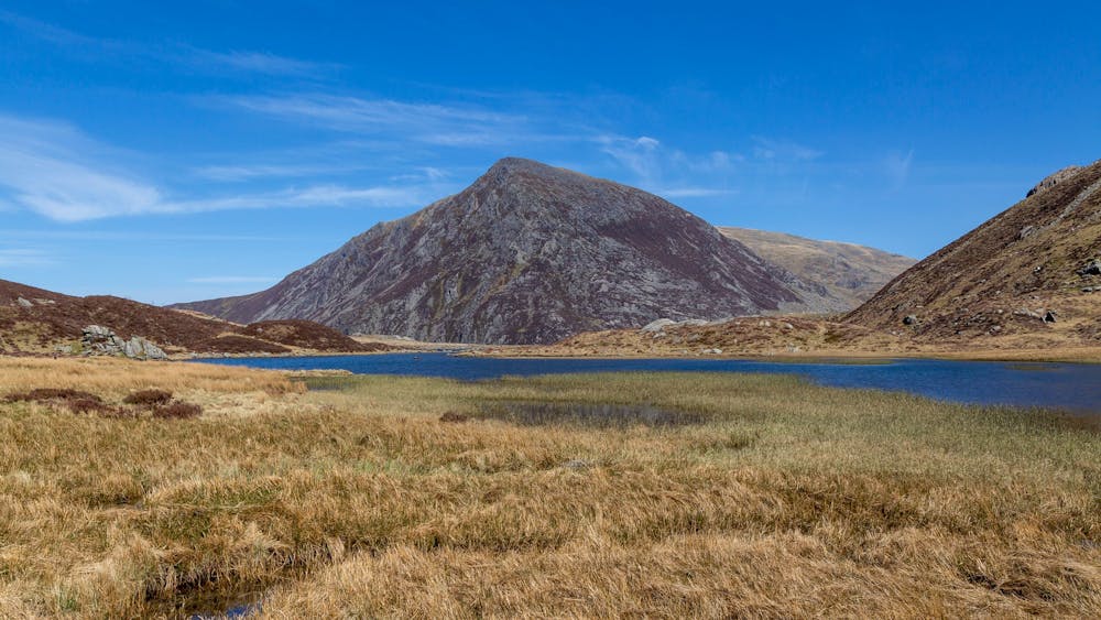
Pen Yr Ole Wen is the southernmost peak in the Carneddau range, towering high above Llyn Ogwen.
The sprawling Carneddau tend to be much quieter than its neighbouring range, the Glyderau, which makes them perfect for enjoying a bit of mountain solitude.
Pen Yr Ole Wen can be climbed as part of a longer route, heading along the broad ridge to bag the peaks of Carnedd Dafydd and Carnedd Llewellyn, but it can also be enjoyed all on its own if you are short on time. Climb this pyramidal peak on a clear day and you are guaranteed spectacular views out over Llyn Ogwen, mighty Tryfan and Cwm Idwal, which is flanked by the rising peaks of the Glyderau.
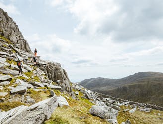
For the masochists out there, the most direct path to the summit is a brutal pull straight up out of Ogwen, climbing 675 meters in approximately 1.5km. The path is very eroded in places and there isn’t always a clear route, so give this one a miss unless you’re an experienced hillwalker who likes a challenge. A gentler route starts from Tal-y-Llyn Ogwen, following the Afon Lloer stream before reaching Ffynnon Lloer. Follow a path off to the left up the ridge which will lead you to the summit, marked with a cairn.
As featured here: https://mpora.com/hiking-and-trail-running/alternative-summits-to-snowdon/
Moderate
Hiking along trails with some uneven terrain and small hills. Small rocks and roots may be present.

The trail contains some obstacles such as outcroppings and rock which could cause injury.

Close to help in case of emergency.
177 m away
One of Snowdonia's most classic hikes along one of its most scenic ridges
Difficult Hiking
1.5 km away
Snowdon's horseshoe may have the majesty, but Ogwen's own circular classic boasts more and better scrambling.
Extreme Hiking
1.9 km away
If it’s a superb walk in relative solitude you’re after then folk in the know will point you at those big old lumps where scenes of genuine grandeur can also be won, but unlike the cheap thrills of their Ogwen brethren, the secrets of the Carneddau must be earned.
Difficult Hiking
5 km away
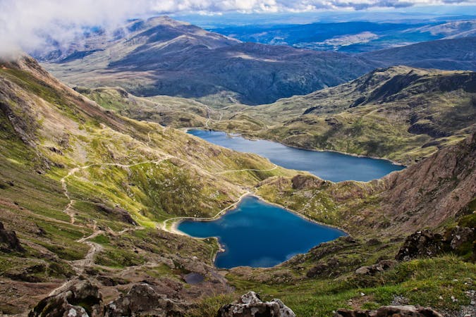
Perhaps it's only fitting that the highest mountain in Wales boasts the country's greatest all-day scrambly ridge traverse.
Extreme Hiking
5.8 km away
Hideously scarred and cruelly exploited it may well be, but Elidir Fawr is often the choice of the connoisseur when a quick 3000er is the order of the day.
Difficult Hiking
7.3 km away
A good challenge for any fit walker, which also is one of the best walks in Snowdownia.
Extreme Hiking
9.4 km away
When it comes to half day outings in Snowdonia, the ascent of Moel Siabod via the ridges that enclose Cwm y Foel is up there with the very best.
Moderate Hiking

18 routes · Alpine Climbing · Hiking
10 routes · Hiking