2.4 km away
Steall Falls
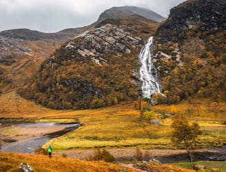
A short trip to one of the Glen Nevis natural wonders
Moderate Hiking
- Distance
- 3.3 km
- Ascent
- 141 m
- Descent
- 141 m
A shorter, easier alternative to the neighbouring Ring of Steall - but no less worthwhile.
Hiking Extreme

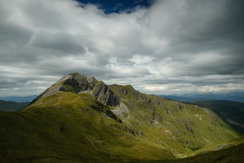
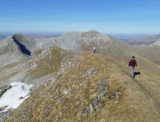
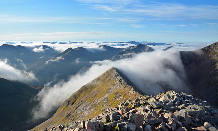
The westernmost of the Mamores make a striking pair, the dramatic sharp peak of Stob Ban contrasting nicely with sprawling, corrie-bitten Mullach nan Coirean. From Glen Nevis, the horseshoe of the two summits covers some enjoyable ridge walking ground. With a smattering of scrambling in summer and more than a hint of mountaineering in winter, this is a shorter, easier alternative to the neighbouring Ring of Steall - but no less worthwhile.
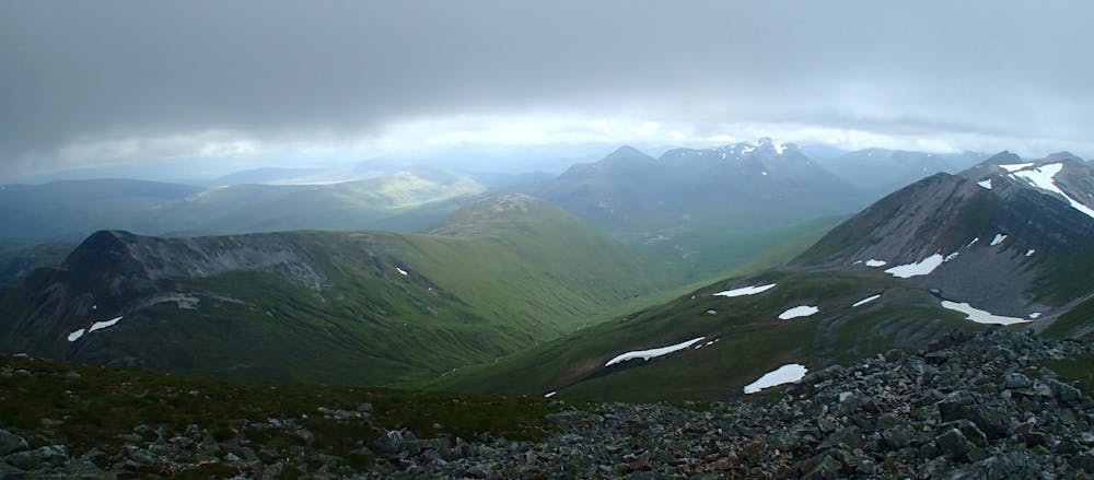
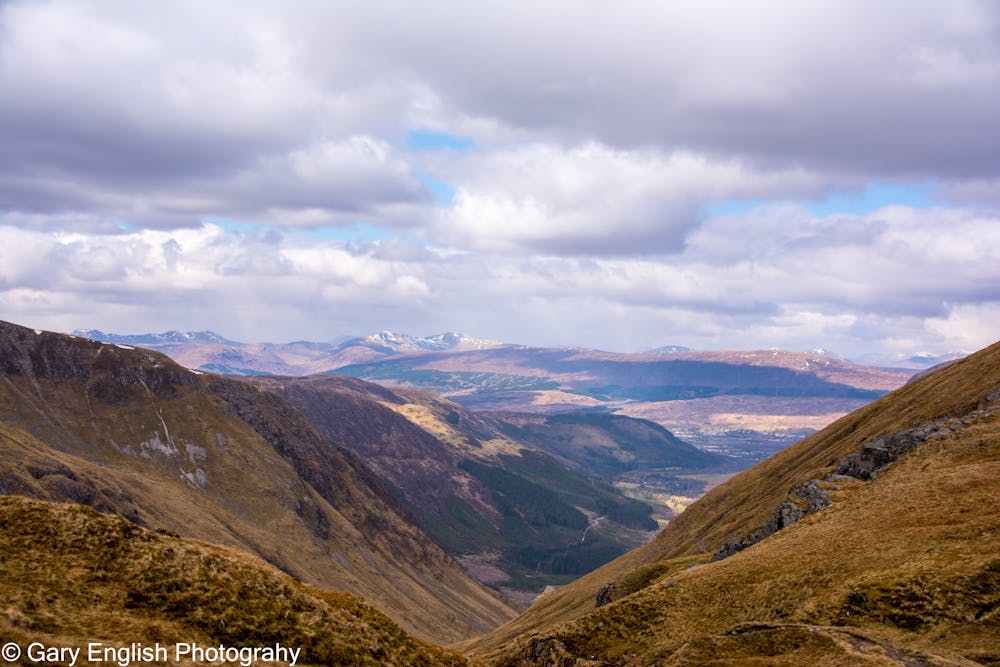
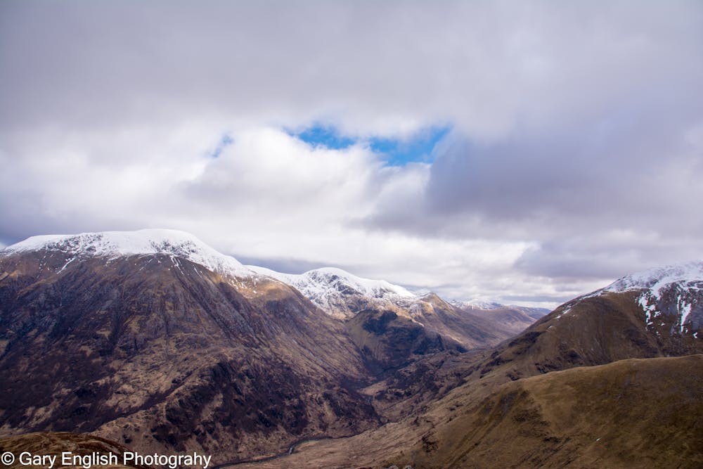
From the road in Glen Nevis a 4WD track (not marked on maps) climbs south towards Sron Dearg, the terminal nose of Stob Ban's north ridge. The track soon dwindles to a footpath, which bears a little right for the steep climb onto Sron Dearg. Once you've gained easier ground above the nose head south along the grassy ridge crest, with great views of the deep corries on either side, and back over Glen Nevis to The Ben.
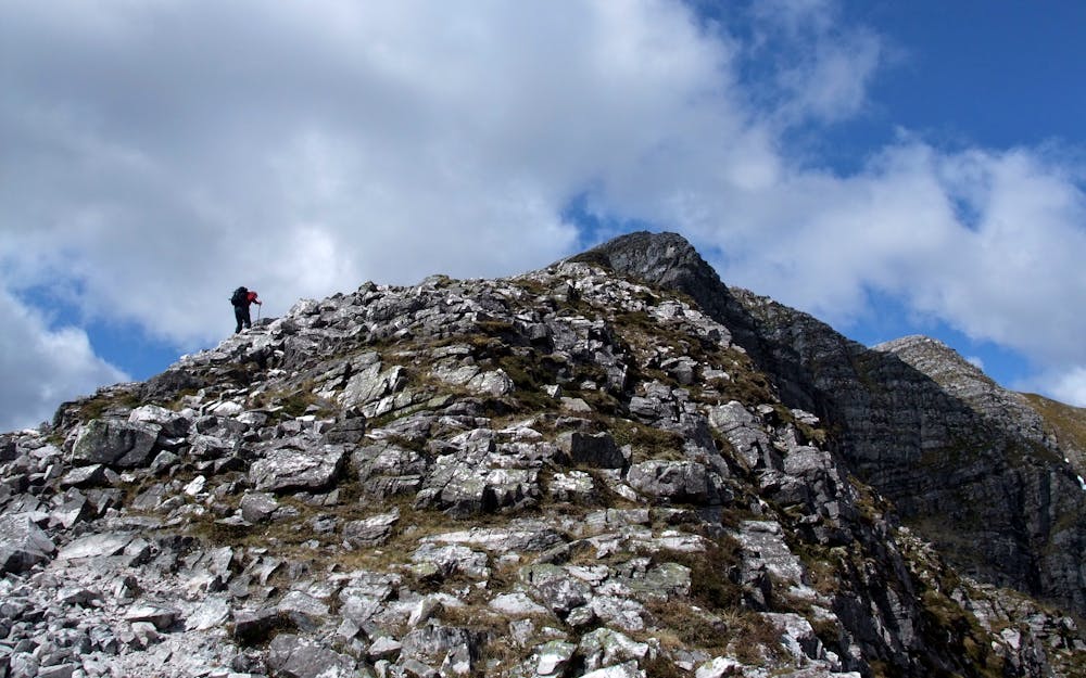
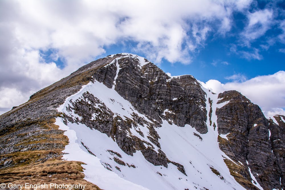
Beyond a broad and more or less level area rises the craggy buttress of the upper ridge. Follow the crest throughout, with some easy - if airy - scrambling at first. The initial steep buttress soon eases onto gentler ground (albeit still interesting, in winter), leading to a junction with the main Mamores ridge. A steady plod up the quartzite boulders that cap Stob Ban now brings you to the summit cairn on the edge of the mountain's precipitous east face (take care if the edge is corniced).
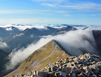
Return to the top of the north ridge, then continue west along the main spine of the Mamores where some enjoyable ridge walking awaits. Follow the rocky rim of Coire Dearg up onto a long nameless top with a short scrambly descent at its far end. Soon reach the cairn at point 917m.
The ridge now broadens considerably. Easier ground leads on along the edge of Coire Dearg, over another minor top, down into a little saddle and then up to the big cairn at the summit of Mullach nan Coirean.
Head north, then stay with the cliff edge as it curves right to join the mountain's east-northeast ridge. This gives an excellent descent. Once on the lower ridge below Coire Riabhach bear northwest to descend a horribly eroded path beside a fence running down to the edge of the Glen Nevis forestry. Cross a stile into the woods and follow the obvious trail down to a junction with a forestry track. Turn right onto this, then stay left at the next track junction. At a hairpin bend turn onto a well-trodden path down beside a burn to the road in Glen Nevis.
© Dan Bailey - UKHillwalking.com, Apr 2014
Extreme
Scrambling up mountains and along technical trails with moderate fall exposure. Handholds are necessary to navigate the trail in its entirety, although they are not necessary at all times. Some obstacles can be very large and difficult to navigate, and the grades can often be near-vertical. The challenge of the trail and the steepness of the grade results in very strenuous hiking. Hikes of this difficulty blur the lines between "hiking" and "climbing".
2.4 km away
A short trip to one of the Glen Nevis natural wonders
Moderate Hiking
4.1 km away
A contender for the title of grandest ridge walk in the country, the Carn Mor Dearg (CMD) Arete straddles that fine line between rambling and scrambling.
Extreme Hiking
4.2 km away
A long and challenging classic ridge walk with a feeling of remoteness.
Extreme Hiking
5.2 km away
The classic route up the UK's highest mountain
Difficult Hiking
7.6 km away
This final stage of the route nicely rounds off the WHW, running from the attractive wooded shores of Loch Leven and over the desolate high pass of the Lairig Mor beneath the southern flank of the Mamores.
Moderate Hiking
9.5 km away
A fine trail or hiking loop taking in some of the highest peaks the UK has to offer
Difficult Hiking
8 routes · Hiking

18 routes · Alpine Climbing · Hiking