Talybont and Pontsticill Reservoir Route

A great wilderness figure of 8 cross country route which is 90% traffic free, incorporating some tough climbs & open mountainside.
Difficult Mountain Biking
- Distance
- 22 km
- Ascent
- 768 m
- Descent
- 385 m
This is one of the all time classic Brecon Beacons mountain bike routes which has it all.
Mountain Biking Difficult

Public pay vehicle parking is available at Henderson Hall in Talybont on Usk (opposite the black & white canal swing bridge).
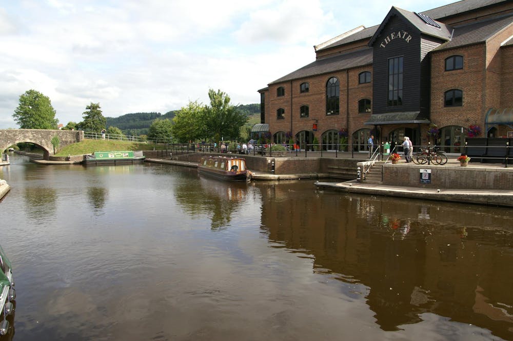
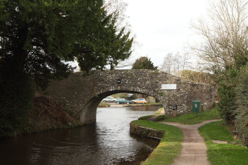
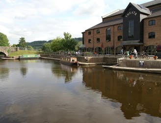
After exiting the car park go up to the swing bridge, then turn left onto the canal. You will shortly reach the White Hart pub where you exit the canal, turn right and up and over a hump back bridge over the canal following a dirt track. You will then reach the start of the Brinmore Tramroad where there are various displays describing its history and usage which are well worth stopping to read. The track at the start is flat but can be bumpy, and is walled by hedges either side, after passing through a few gates (make sure you close them) enter the forest where you will start to gradually climb and the surface can be looser in places. See if you can spot evidence of where the tram tracks used to be. After exiting the forest you will come to a junction which is signposted Tramroad straight on to your left or Taff trail to your right.
At this point there are numerous routes and distances that can be chosen (see other Talybont on Usk tramroad routes). Take the Tramroad sign to your left and continue climbing on a sometimes rough & loose track through the forest. Upon exiting the forest cross straight over a forest road and continue into the forest again climbing where the track gets narrower. Pass through a gate with the reservoir still on your right and just as you exit the forest there is a short, steep and very rocky ascent to negotiate, select a low gear get your speed up and keep pedaling. Choose your line wisely.
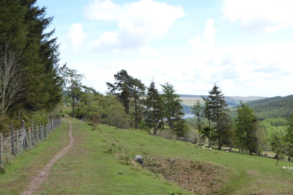
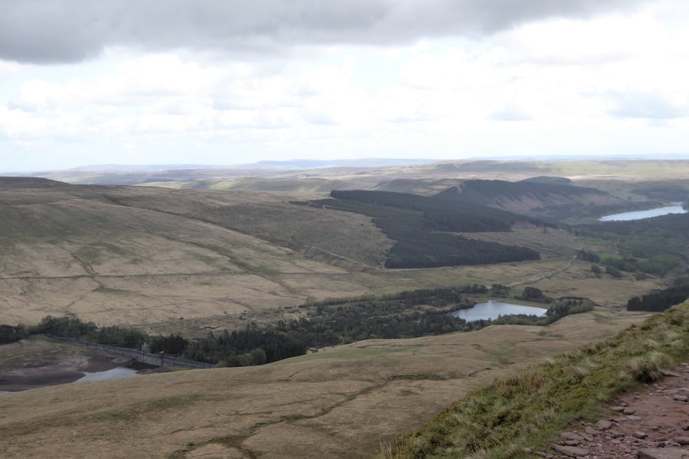
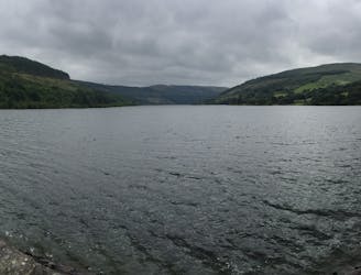
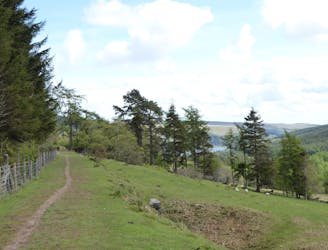
When you reach the top turn right onto the gravel track and follow this through a number of muddy wet areas until you start climbing on some rough rocky sections. At this point you can see the track snaking uphill along the side of the mountain. Climb some more & then stop and turn around. Awaiting you is a breathtaking view over the valley, the reservoir and to the rolling pastures below. After catching your breath, continue climbing. Go through a gate in a saddle between two mountains and see if you can climb the rocky steps in front of you. At the top turn right onto some muddy sunken tracks (often used by 4x4 drivers) and follow this wet and muddy track as it undulates across the mountain to a gate by a forest (see the Talybont & Pontsticill reservoir route as an alternative continue along track instead of going through the gate into the forest).
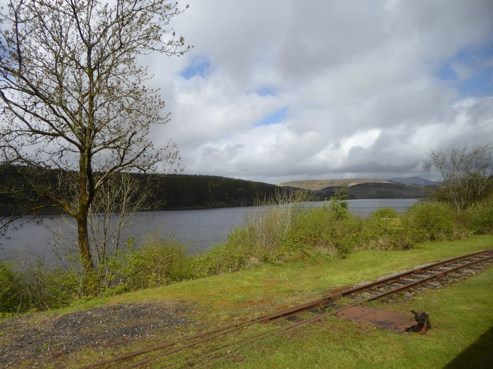
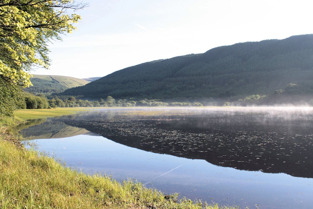
Go through the gate, then take the track taking a right turn then a left turn at junctions. The fun starts here with a superb rocky slab & loose descent through the forest (be careful it can be slippery here). Continue downhill eventually reaching a road by Dolygaer outdoor centre and turn right at the bottom. Follow the road and go over the bridge that’s intersects Pontsticill reservoir. Take the right turning on the road signed for Talybont and after a while you will reach a fork. Don’t turn down right towards the tearooms but continue straight on the Taff trail. The road starts climbing here, and whilst not steep it always feels like a real slog. Eventually you will see Neuadd reservoir. A green barrier is over the road, and you need to take the rough stony track on the right which you can see snake up the valley.
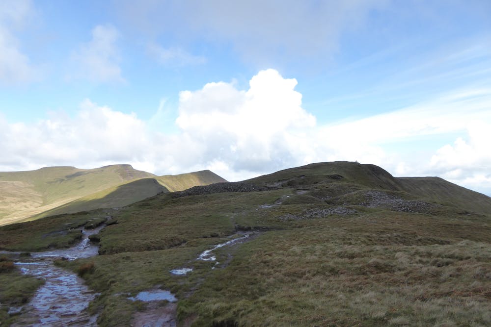
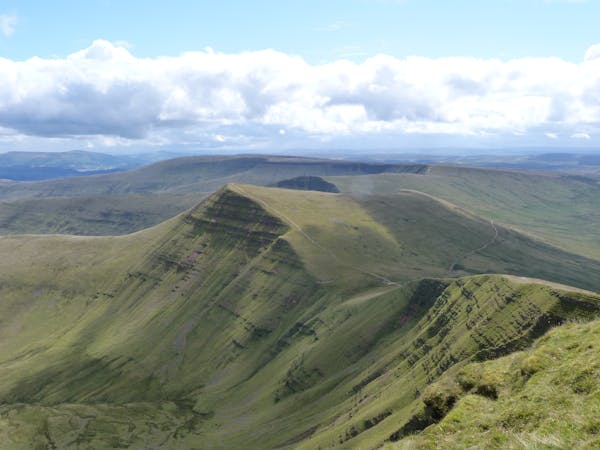
The three mountains you can see to your right are the highest peaks in the Brecon Beacons including Pen y Fan. Continue on this track until you reach a gate where you will be presented with a very steep and loose descent down to a stream - this section is perfectly rideable but take it easy. Hike-a-bike up the other side and continue riding along the track until you reach a gate and the foot of mountains either side of you.
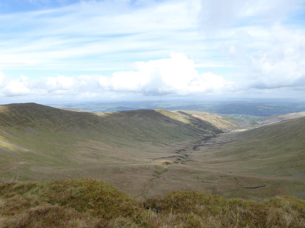
You have now reached the place the ride is named after; “The Gap”. Have a break and get yourself prepared for a superb, rocky and fast descent. As you go through the gap, it gets very rocky with drop offs and slabs, turn the corner and after a while the size of rocks reduce a bit and the track gets wider. When you reach the first stream crossing, stop and take a look back at where you have come from, it's an awesome view as is the one in front of you. Continue on the undulating track then go downhill again, watching you don’t get caught out by the water bars crossing the track. Again the route gets steeper and grassier and faster and eventually ends at the corner of some stone walls and a gate.
Go through the gate (again on very loose and rocky) before you reach a country lane. Take this downhill, turn right at the junction and watch out for the farm dogs shortly after this as they like to chase & scare you! Continue on the road until it gets flat and you will reach Pencelli where you can either pick up the canal back to Talybont or continue along the road to Talybont.
There are many variations to this route but this is our favourite. The terrain can be challenging, especially in bad weather conditions, and it is essential to be fully prepared with clothing, food, tools etc. It's only for experienced mountain bikers
Difficult
Mostly stable trail tread with some variability featuring larger and more unavoidable obstacles that may include, but not be limited to: bigger stones, roots, steps, and narrow curves. Compared to lower intermediate, technical difficulty is more advanced and grades of slopes are steeper. Ideal for upper intermediate riders.
A great wilderness figure of 8 cross country route which is 90% traffic free, incorporating some tough climbs & open mountainside.
Difficult Mountain Biking
A traffic free route taking in the Brecon canal, Taff Trail & an old Tramroad and stunning scenery
Easy Mountain Biking
A challenging route with some tough climbs taking in the Brecon canal, Taff Trail & an old tramroad
Moderate Mountain Biking
8.4 km away
A very scenic family route, or useful as a link between Brecon and the trails around Talybont on Usk.
Easy Mountain Biking
7 routes · Mountain Biking · Hiking