6.1 km away
Byron Glacier Trail
Walk to see a glacier and snow caves in a steep-sided, boulder-filled valley.
Easy Hiking
- Distance
- 2.9 km
- Ascent
- 131 m
- Descent
- 131 m
A super scenic hike that earns a view of Portage Glacier, and perhaps an icy dip in the lake.
Hiking Moderate

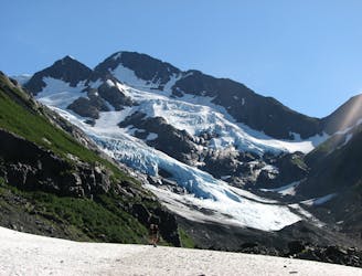
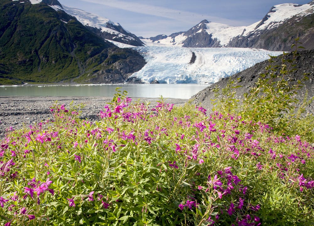
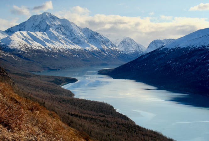
Portage Glacier is a famous sight in the Chugach Mountains near Whittier. The tongue of the glacier descends to a milky blue lake, and chunks of ice can often be seen calving off into the water. The best way to see the calving is by boat, on tours that operate daily from the west end of the lake. The glacier is at the east end, however, and not easily visible because of the lake’s crescent shape and steep surrounding slopes. To glimpse the glacier without riding the boat, you can hike the Portage Pass Trail from Whittier instead. The trail will earn you phenomenal views of the glacier and the lake, as well as the ocean near Whittier, plus more glaciers on the mountainsides and waterfalls streaming from them. Upon reaching the lake at the end of the trail, you can dip your feet or even go for a swim among icebergs detached from the glacier.
Get there by driving through the Whittier tunnel (a bit of an adventure all its own), then jostling for parking at the Portage Pass trailhead. Starting the hike, you’ll enjoy a brief, flat warmup before the trail pitches steeply upward. There are some loose rocks, but for the most part it’s good footing on the sustained ascent of 750 feet to the pass. Along the way, don’t forget to turn around and admire the expanding view over Prince William Sound. Once on top, you’ll suddenly see the glacier––looming huge and framed by snowy peaks on the other side of a valley.
A muddy puddle usually occupies the top of the pass. Work your way around this, and negotiate some natural rock steps to continue on the trail. You can also follow side trails to better higher outcrops, finding even better views off both sides of the pass. Many people choose to turn around here, but the trail continues down the other side to reach the lake.
The incline on the other side is more gradual. The trail descends first to flat ground beside a small lake, then drops again to reach Portage Lake. Expect slick rocks, mud, snow, and running water on the trail through early summer. It dries out and becomes easier by mid summer, however. Vegetation grows thick on these well-water slopes, but the trail makes a corridor through the thickets. Eventually you’ll emerge on the stony beach of the lake, and views are unobstructed to the glacier on the other side. It’s possible to bushwack farther along the shore to get closer to the wall of ice, but keep safety in mind in regards to wildlife, and to the possibility of ice calving and creating waves.
Sources: https://www.alaska.org/detail/portage-pass-trail https://www.fs.usda.gov/detail/chugach/home/?cid=stelprdb5251250
Moderate
Hiking along trails with some uneven terrain and small hills. Small rocks and roots may be present.

The trail contains some obstacles such as outcroppings and rock which could cause injury.
Away from help but easily accessed.
6.1 km away
Walk to see a glacier and snow caves in a steep-sided, boulder-filled valley.
Easy Hiking
10 routes · Gravel Biking · Hiking · Road Biking