Lost Lake Out-and-Back
One of the most rewarding MTB rides on the Kenai Peninsula.
Difficult Mountain Biking
- Distance
- 22 km
- Ascent
- 900 m
- Descent
- 900 m
An epic-length loop on some of Alaska's most famous singletrack.
Mountain Biking Severe

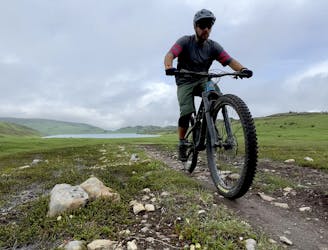
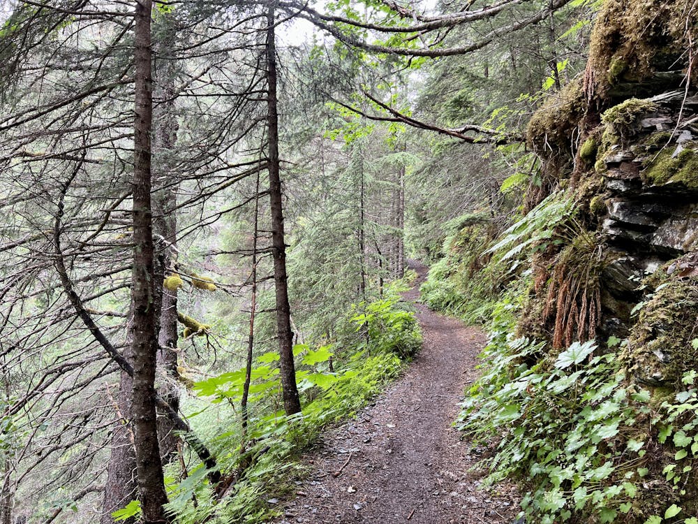
The Lost Lake Trail has long been renowned as one of Alaska's classic backcountry mountain bike rides, and it's absolutely a must-ride if you're in the region! The ride begins from a trailhead outside the town of Seward by climbing through the deep Alaskan rainforest.

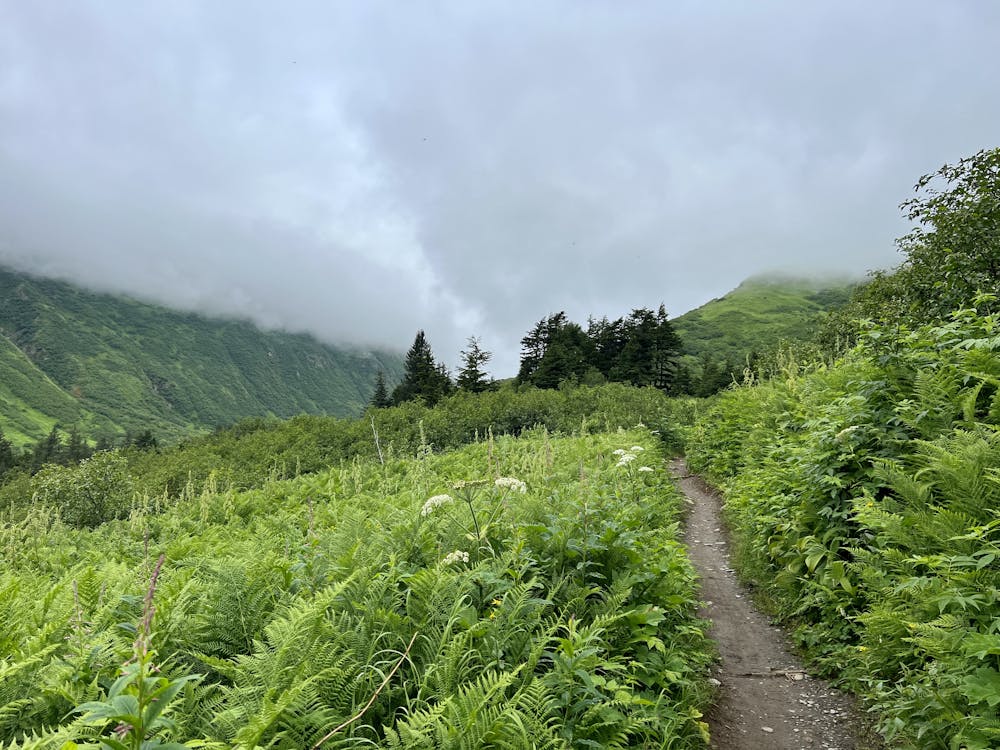
The first few switchbacks on the ascent include some large technical features that you may have to hike your bike up, but this isn't indicative of the rest of the climb. While there are a few more big features on the way up, overall the trail tread is very rideable and manageable. In fact, while the climb up the mountain ascends consistently, gaining almost 2,000 vertical feet to the high point, the grades are all quite climbable on a mountain bike. This is probably one of the features that made Lost Lake a classic ride for cross country mountain bikers many years ago.
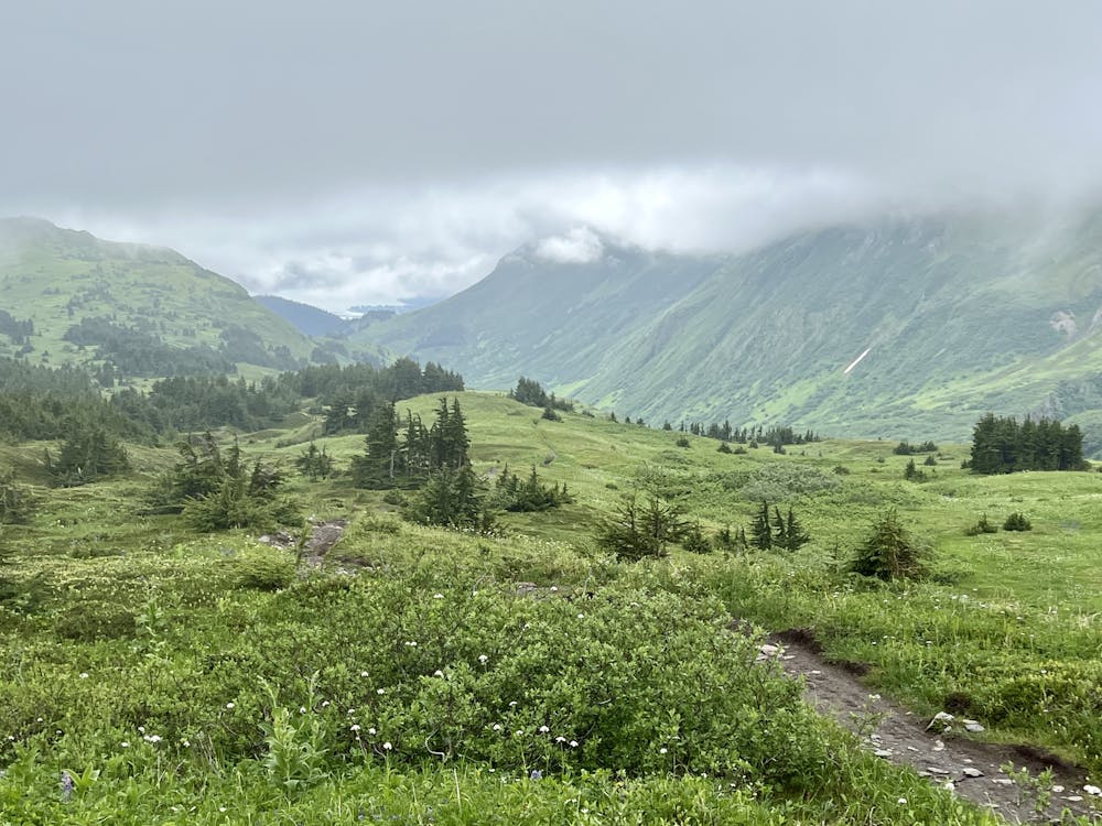
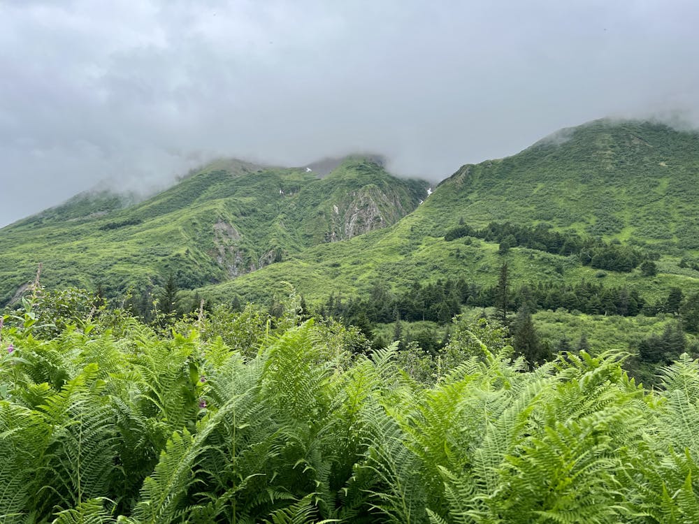
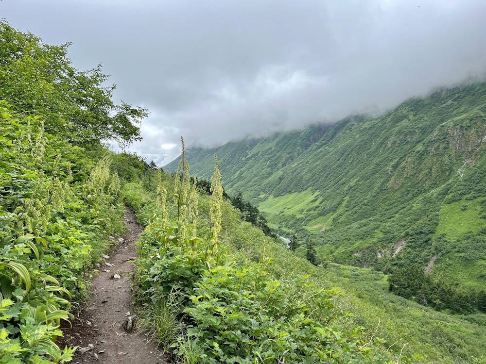
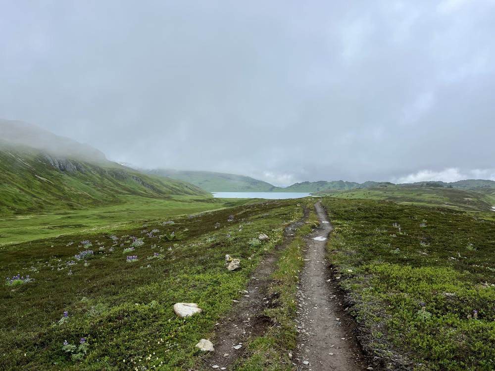
After several miles of climbing, you'll break out above treeline and, on a clear day, enjoy stupendous views of the glacier-covered mountains around you. Most notably, Mount Ascension rises to a height of 5,710 feet above sea level and towers almost directly above the trail!
However, getting a clear day on the Kenai Peninsula is a rarity, so you need to be prepared to pedal up into low-hanging clouds that obscure the view and that may very well rain on you on any given day. But that's all part of the adventure when braving the Alaskan wilderness!
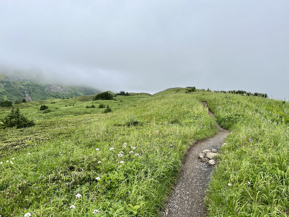
You'll pedal for miles above treeline, enjoying long-range views if the clouds are high enough. But even if they aren't, the alpine tundra is often covered in colorful wildflowers in the summertime, providing their own unique micro beauty.
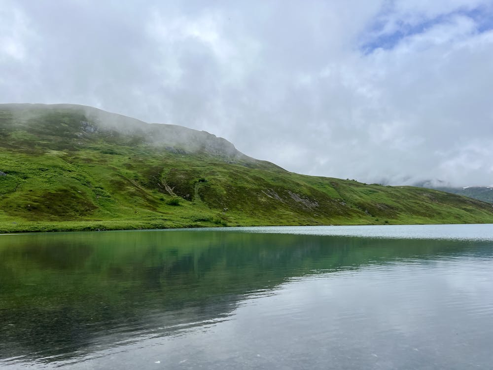
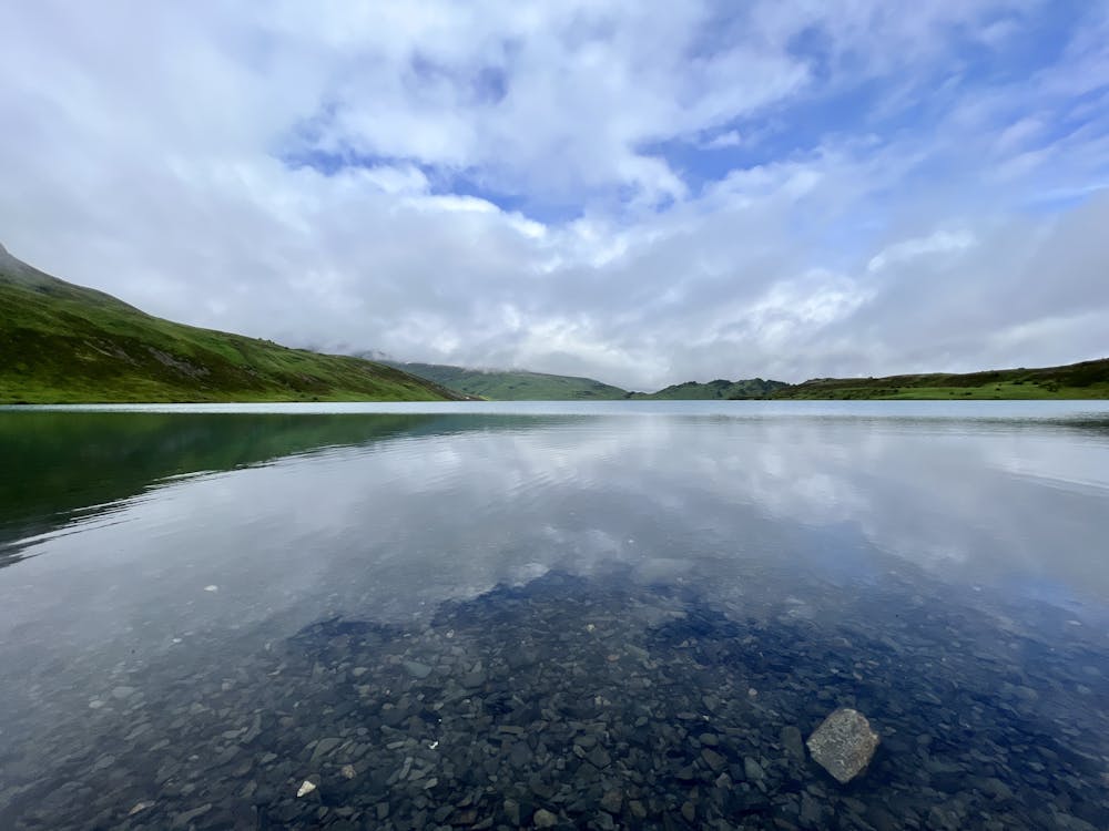
This route tops out on a ridge and then descends almost 300 vertical feet back down to reach the shores of Lost Lake. The views from the shore are stunning! Above and beyond the long-range mountain views, Lost Lake itself is surprisingly large for being tucked away so high in the mountains, and the water is crystal-clear. Enjoy some delightful solitude on its shores before carrying on with the loop.
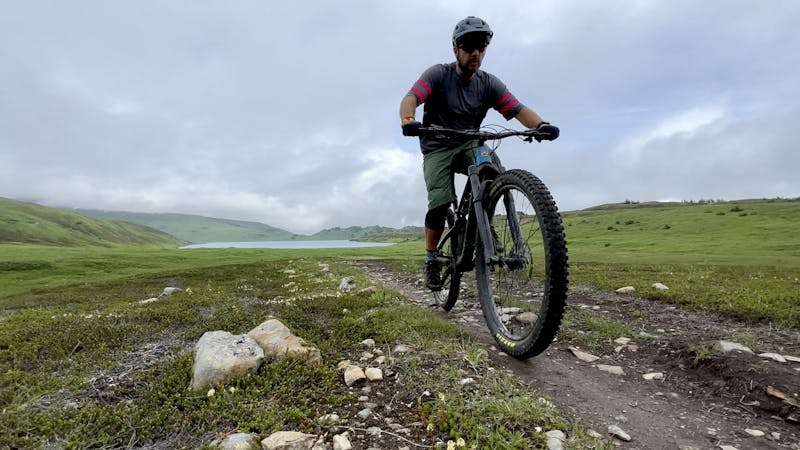
The route shown here is an epic 32-mile loop that descends the Primrose trail and utilizes two sections of the Iditarod National Historic Trail (INHT) to loop back to the Lost Lake trailhead. If you're feeling uncertain about your ability to complete the loop, it's a good idea to turn around at Lost Lake and return to the trailhead the way you came. The full loop still has a ton of challenges to throw at you!
If you choose to carry on, you'll soon be rewarded with the rowdy descent down the Primrose Trail. This technical descent is renowned as one of the best downhill rips on the Kenai Peninsula. Most of the trail follows an old mining road and is steep, eroded, and filled with technical obstacles. "The top section has some very technical parts that are common to walk," writes Kellie Okonek. "That said, they’re all rideable without mandatory air if one has good bike handling skills! After the initial super techy section, the trail mellows somewhat and most riders can clear the rest. It stays super fun, however, with root features and beautiful forest with good dirt," she continues. Drop that saddle, pull up your pads, and get ready to grip it and rip it!
Before you reach the shores of Kenai Lake, you'll take a right onto the Meridian Lakes section of the INHT. The rest of the ride traverses much lower elevations than the Lost Lake trail, meaning that you'll be spending a lot of time pedaling through the rainforest. There aren't many major climbs to tackle, but you'll have to power up a series of short, steep grunts and rip back down again.
When you reach the Seward Highway, take a left along the highway and look for the Bear Lake INHT section picking up on the right in roughly 3/4 of a mile.
The Bear Lake trail is yet another INHT segment that measures 7.5 miles one-way. This section of trail also travels beneath the dense canopy and features some steep hills. Most notably, there's a fairly steep descent down to the shores of Bear Lake.
After passing Bear Lake, you'll have to use a series of roads and a portion of the bike path along the Seward Highway to make the connection back to the Lost Lake trailhead.
Sources: Alaska.org FS.USDA.gov KellieOkonek.com
Severe
Widely variable, narrow trail tread with steeper grades and unavoidable obstacles of 15in/38cm tall or less. Obstacles may include unavoidable bridges 24in/61cm wide or less, large rocks, gravel, difficult root sections, and more. Ideal for advanced-level riders.

Some trail sections have exposed ledges or steep ascents/descents where falling could cause serious injury.
Little chance of being seen or helped in case of an accident.
One of the most rewarding MTB rides on the Kenai Peninsula.
Difficult Mountain Biking
5 routes · Mountain Biking