Lost Lake Loop
An epic-length loop on some of Alaska's most famous singletrack.
Severe Mountain Biking
- Distance
- 52 km
- Ascent
- 2.2 km
- Descent
- 2.2 km
One of the most rewarding MTB rides on the Kenai Peninsula.
Mountain Biking Difficult

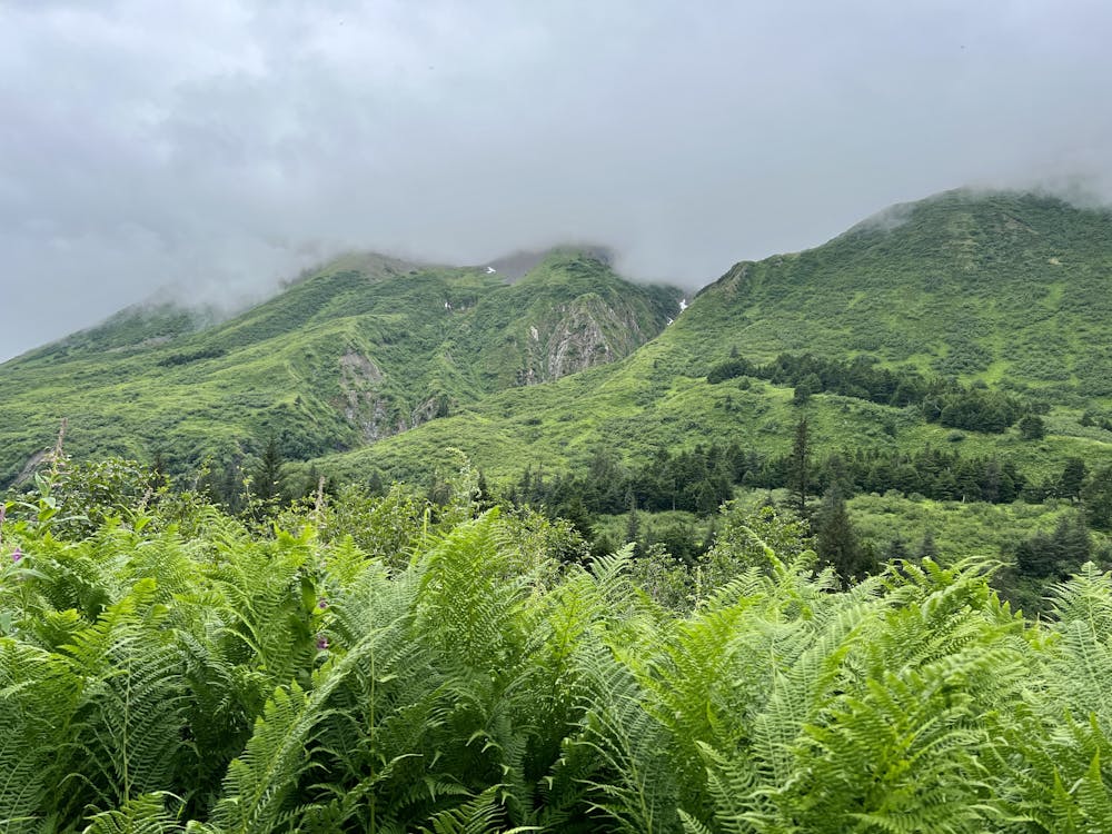
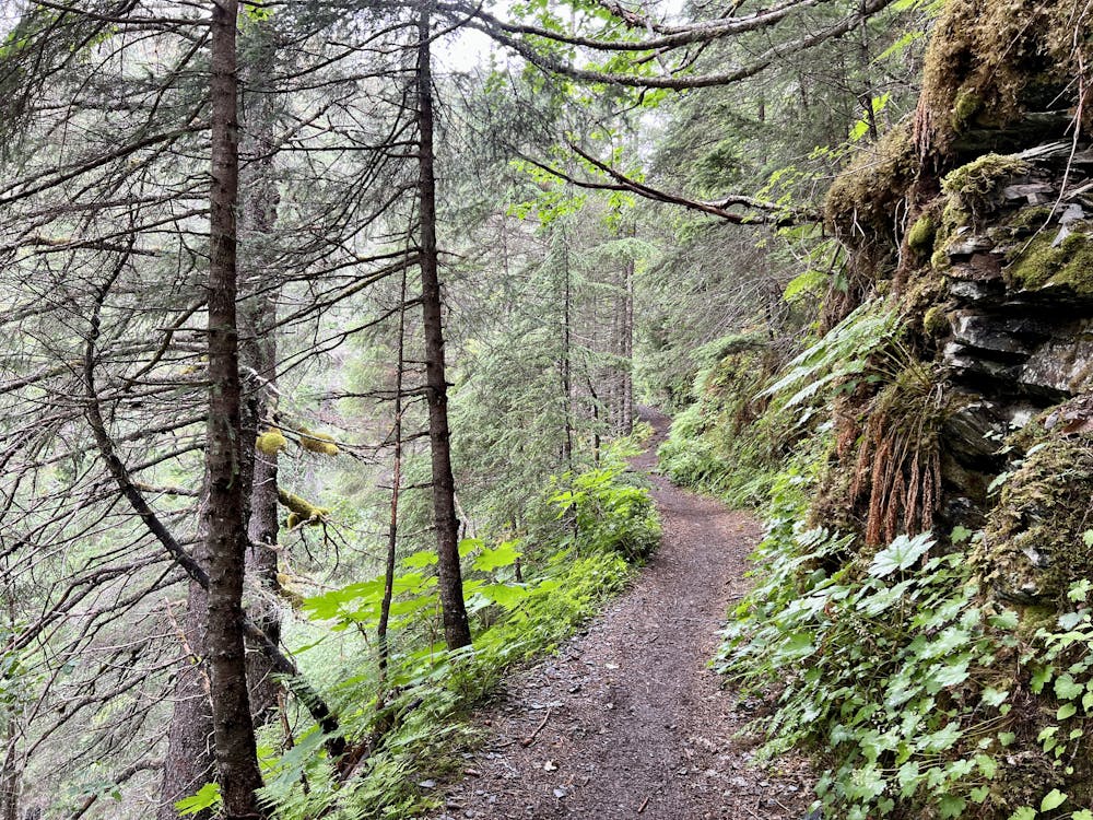
The Lost Lake Trail has long been renowned as one of Alaska's classic backcountry mountain bike rides, and it's absolutely a must-ride if you're in the region! The ride begins from a trailhead outside the town of Seward by climbing through the deep Alaskan rainforest.

The first few switchbacks on the ascent include some large technical features that you may have to hike your bike up, but this isn't indicative of the rest of the climb. While there are a few more big features on the way up, overall the trail tread is very rideable and manageable. In fact, while the climb up the mountain ascends consistently, gaining almost 2,000 vertical feet to the high point, the grades are all quite climbable on a mountain bike. This is probably one of the features that made Lost Lake a classic ride for cross country mountain bikers many years ago.
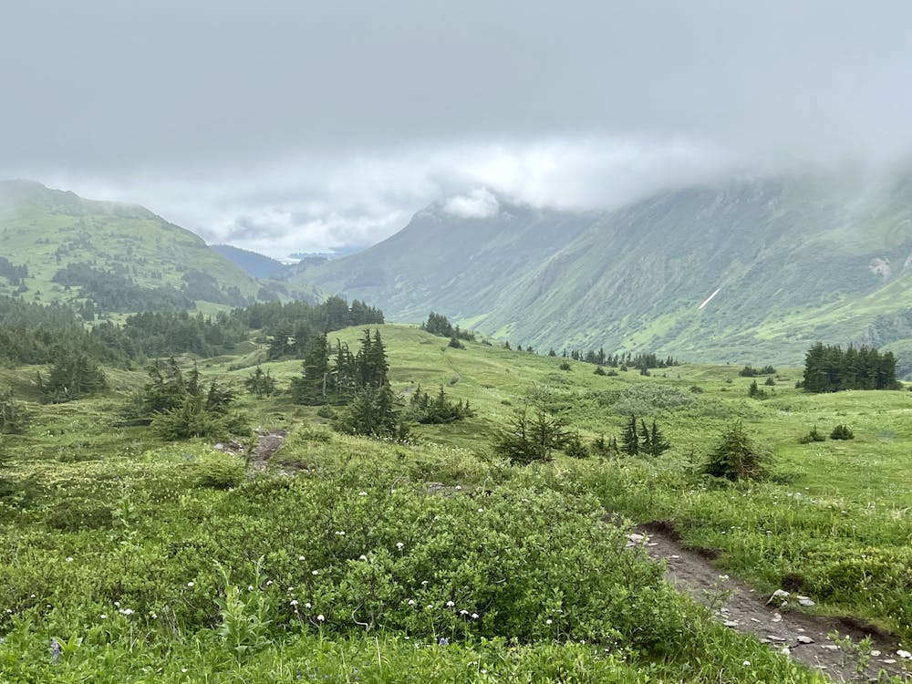
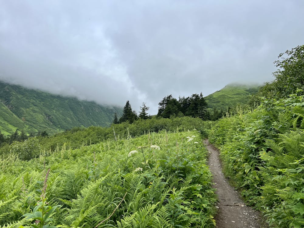
After several miles of climbing, you'll break out above treeline and, on a clear day, enjoy stupendous views of the glacier-covered mountains around you. Most notably, Mount Ascension rises to a height of 5,710 feet above sea level and towers almost directly above the trail!
However, getting a clear day on the Kenai Peninsula is a rarity, so you need to be prepared to pedal up into low-hanging clouds that obscure the view and that may very well rain on you on any given day. But that's all part of the adventure when braving the Alaskan wilderness!
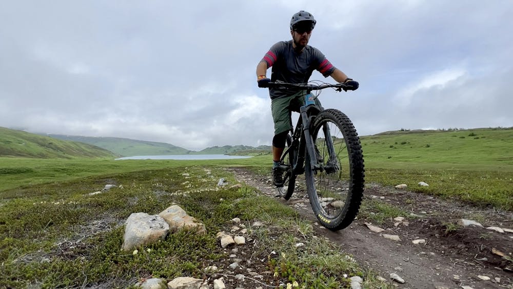
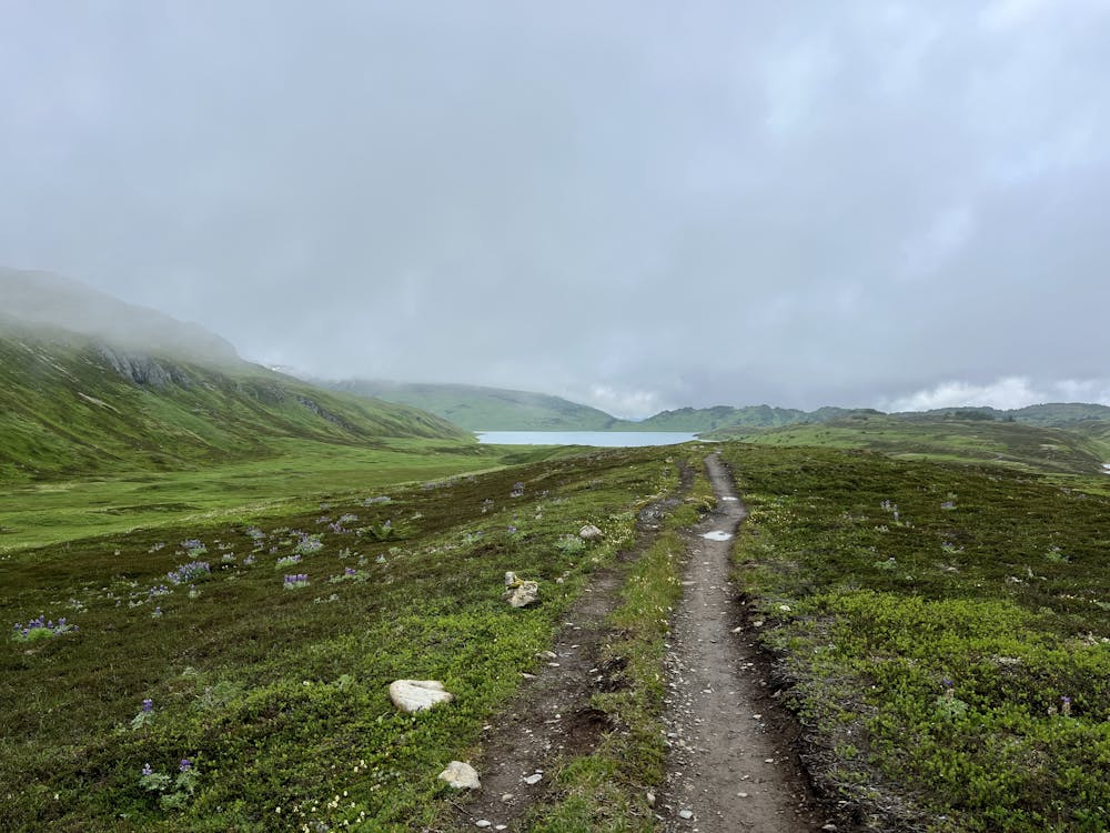
You'll pedal for miles above treeline, enjoying long-range views if the clouds are high enough. But even if they aren't, the alpine tundra is often covered in colorful wildflowers in the summertime, providing their own unique micro beauty.
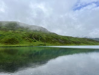
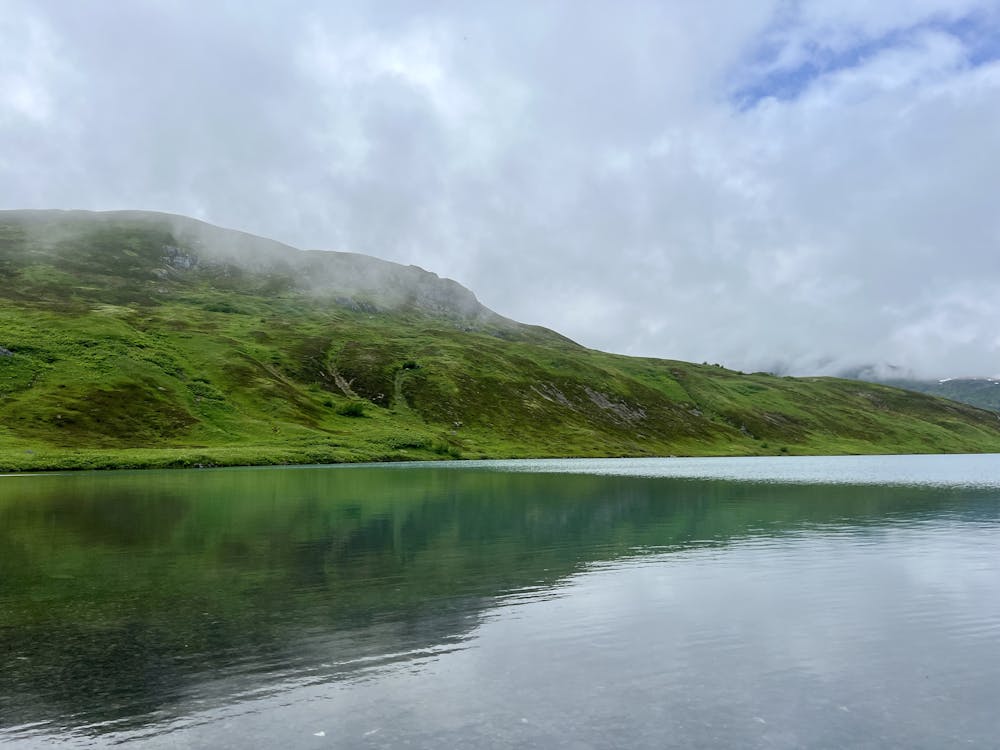
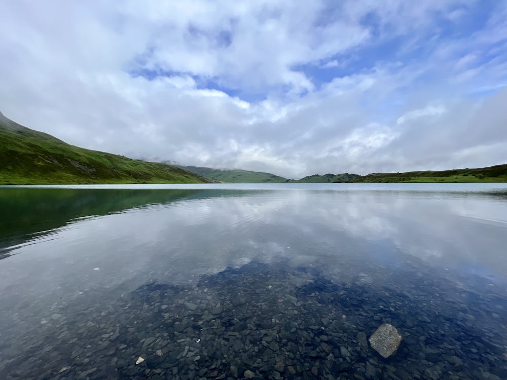
This out-and-back route tops out on a ridge and then descends almost 300 vertical feet back down to reach the shores of Lost Lake. It's well worth the effort to drop down to the lake and pedal back up, as the views from the shore are stunning! Above and beyond the long-range mountain views, Lost Lake itself is surprisingly large for being tucked away so high in the mountains, and the water is crystal-clear. Enjoy some delightful solitude on its shores before turning around and pedaling back up to the top of the mountain ridge.
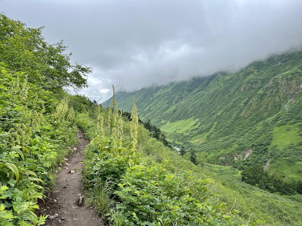
Once back on top of the ridge, it's time to descend! You have about 2,000 fantastic vertical feet of consistent downhill in front of you that will let you roll all the way back to the trailhead. While you might be expecting a high-speed descent, that never quite pans out on this return route. Due to the dense vegetation and twisting trail, the sight lines are never very long, which prevents you from really opening it up. In addition to the many hikers and uphill mountain bikers that you might encounter, there's also the possibility of running into wildlife or flying off one of the exposed cliff edges. Some of the twisty turns are non-obvious and definitely not bike optimized, and they can really sneak up on you when obscured by the undergrowth.
(Note: for a higher-speed downhill, descend the Primrose trail down the other side of the mountain. That requires setting up a point-to-point shuttle or pedaling an epic 32-mile loop.)
Despite the short sight lines, do your best to make the most of this descent and enjoy the rocking and rolling back down the mountainside. Lost Lake is a fabulous backcountry-style ride that's guaranteed to hold a fond spot in your memory for years to come!
Difficult
Mostly stable trail tread with some variability featuring larger and more unavoidable obstacles that may include, but not be limited to: bigger stones, roots, steps, and narrow curves. Compared to lower intermediate, technical difficulty is more advanced and grades of slopes are steeper. Ideal for upper intermediate riders.

Some trail sections have exposed ledges or steep ascents/descents where falling could cause serious injury.
Little chance of being seen or helped in case of an accident.
An epic-length loop on some of Alaska's most famous singletrack.
Severe Mountain Biking

5 routes · Mountain Biking