1.3 km away
Ford Canyon / Goat Camp Loop
This is arguably the most epic and remote hiking loop near Phoenix.
Severe Hiking
- Distance
- 25 km
- Ascent
- 738 m
- Descent
- 738 m
A remote and beautiful hike through the rugged White Tank Mountains.
Hiking Difficult

Simply referred to as "White Tanks" among locals, White Tank Mountain Regional Park provides one the best backcountry experiences around the valley. Less than an hour from downtown Phoenix, this quiet, secluded loop is highly sought after by those seeking solitude in the mountains.
The mountain range earned its name from the "number of depressions or "tanks" in the white granite near the base of the mountains", according to Wikipedia. Monsoon season occurs in the warmest months and is when you can typically find these "tanks" full of water. During the remainder of the year, they are often dry.
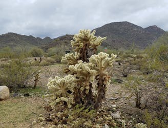
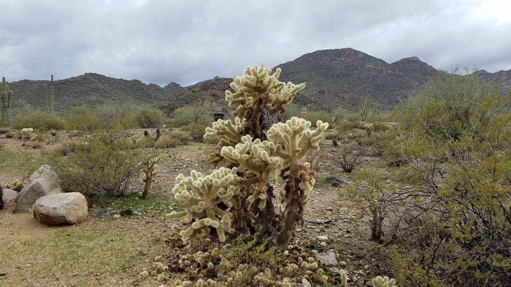
The most common way to hike this loop is from the trailhead on Ramada Way. Drinking water and restrooms are available. Near the trailhead, you can also find an abundance of weathered saguaro and teddy bear cholla - named for the almost "furry" appearance of their needles.
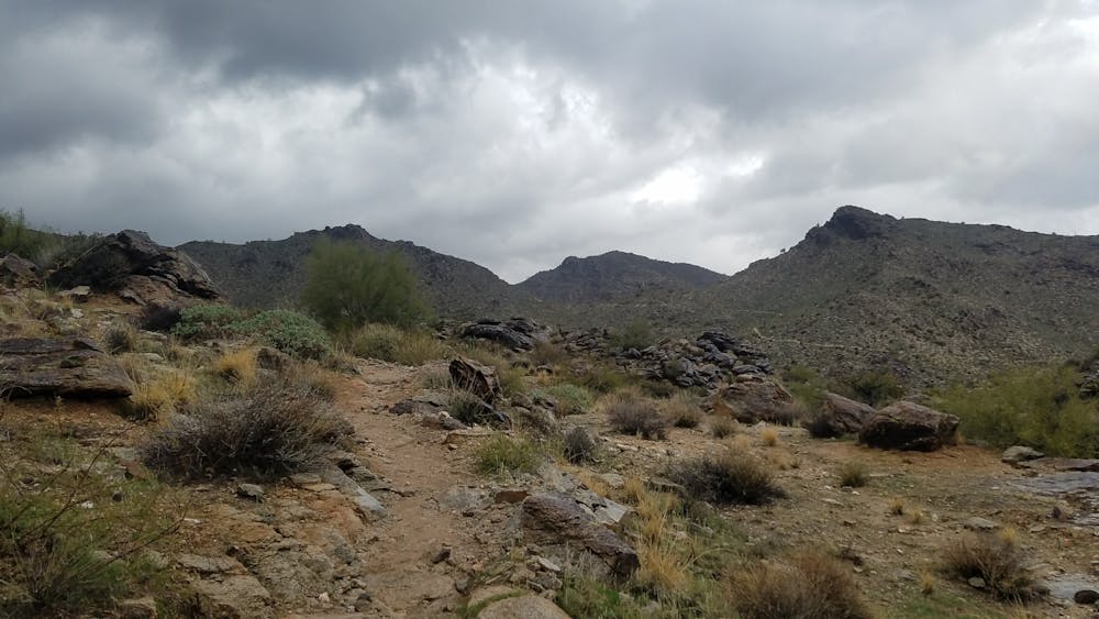
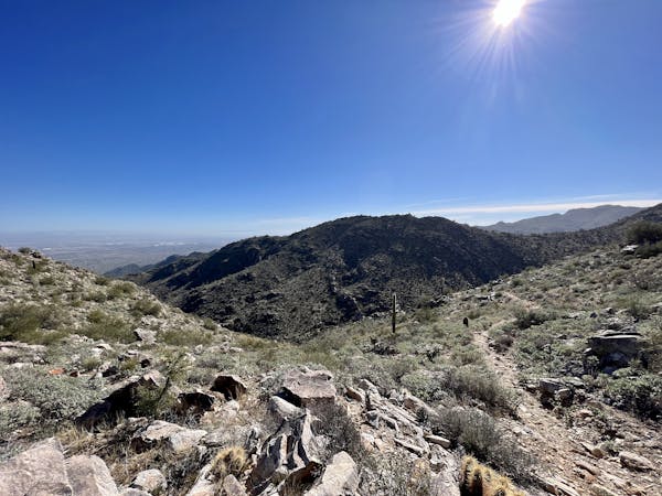
The hike begins with a series of switchbacks as the trail ascends quickly to a saddle. Jagged rock and shale define much of this hike, and unprepared hikers often turn around here after soaking in some views.
After a brief descent the trail leads to the intersection with Willow Canyon Trail. Take the opportunity to relax under the shade before continuing - it's the only notable spot on the trail to.
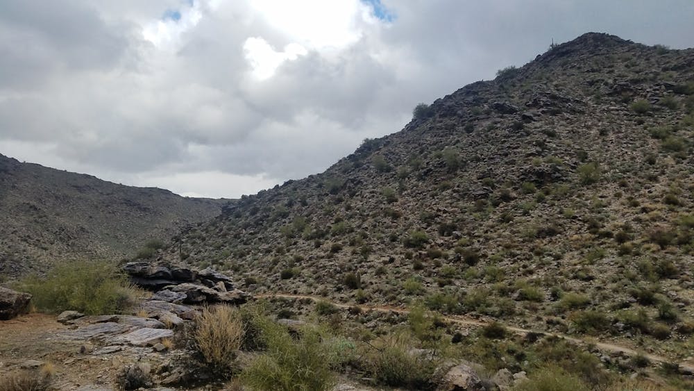
From here, you can complete the loop in either direction. Mesquite Canyon Trail is a steady ascent as the path hugs the contours of the mountain. In contrast, Willow Canyon Trail provides two steeper climbs separated by a traverse along a groove in the canyon wall. This is the most remote, and arguably the most unique section of the hike.
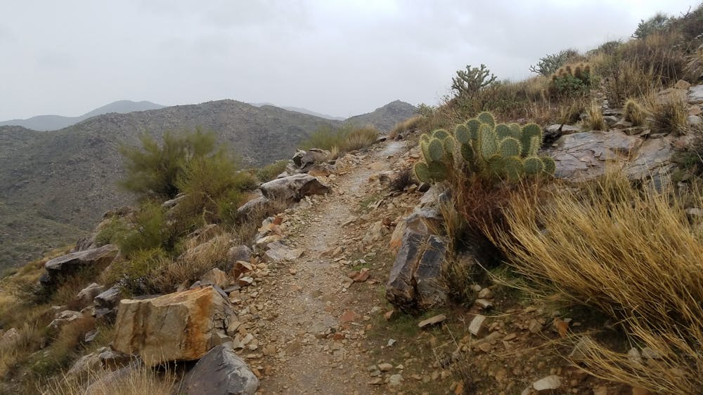
Overall, these exposed desert mountains provide incredible views all along the way. At times, you may even catch a distant glimpse of Phoenix from various spots within the canyon.
Difficult
Hiking trails where obstacles such as rocks or roots are prevalent. Some obstacles can require care to step over or around. At times, the trail can be worn and eroded. The grade of the trail is generally quite steep, and can often lead to strenuous hiking.

Some trail sections have exposed ledges or steep ascents/descents where falling could cause serious injury.
Little chance of being seen or helped in case of an accident.
1.3 km away
This is arguably the most epic and remote hiking loop near Phoenix.
Severe Hiking
1.4 km away

A family-friendly hike in White Tank Regional Park with ancient petroglyphs and a rock waterfall.
Moderate Hiking
16 routes · Hiking

6 routes · Hiking
6 routes · Mountain Biking · Hiking · Trail Running