5 km away
Tanque Verde Ridge to Tanque Verde Peak
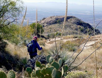
Go any distance up the mountain for a sampling of epic views, or make an overnight trip to enjoy the full platter.
Difficult Hiking
- Distance
- 26 km
- Ascent
- 1.4 km
- Descent
- 1.4 km
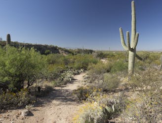
Short and sweet hike to an impressive viewpoint in a lesser-visited corner of Saguaro National Park.
Hiking Moderate

If you want to explore a hidden corner of Saguaro National Park, off the beaten path of the Cactus Forest Loop, head down to the Loma Alta Trailhead. It’s located at the end of a dirt road, several miles south of the main park entrance. Only two trails depart from there, and Ridgeview is the more scenic of them. It’s usually uncrowded, perfect for enjoying a brief hike with solitude in the desert.
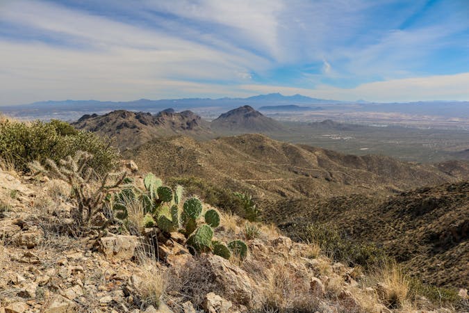
Ridgeview starts out the same as Hope Camp Trail, but soon bears left and begins to go uphill, climbing gently through a drainage. Cactus-covered slopes rise on either side, and the trail aims toward a rounded hill ahead. A final, steeper section ascends the rock-littered hillside, then reaches a knoll of bare stone on top. From there you can see in all directions. Rincon Peak dominates the skyline to the east, and the hulking slopes of Tanque Verde Ridge rise across a steep valley to the north. The view is especially nice late in the day, in the light of the sinking sun.
Sources: https://www.nps.gov/sagu/planyourvisit/saguarohiking.htm https://www.americansouthwest.net/arizona/saguaro/ridge-view-trail.html
Moderate
Hiking along trails with some uneven terrain and small hills. Small rocks and roots may be present.

The trail contains some obstacles such as outcroppings and rock which could cause injury.
Away from help but easily accessed.
5 km away
Go any distance up the mountain for a sampling of epic views, or make an overnight trip to enjoy the full platter.
Difficult Hiking
5.1 km away
Short loop hike from the Cactus Forest Drive—great for kids and nature lovers of all ages.
Easy Hiking
8.1 km away
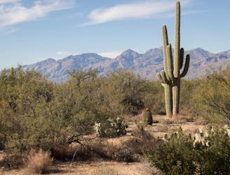
A scenic, varied, and uncrowded loop beginning in the Cactus Forest and climbing to higher views near the foot of the mountains.
Moderate Hiking
9.4 km away
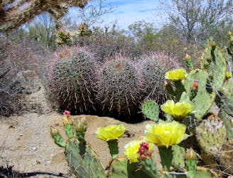
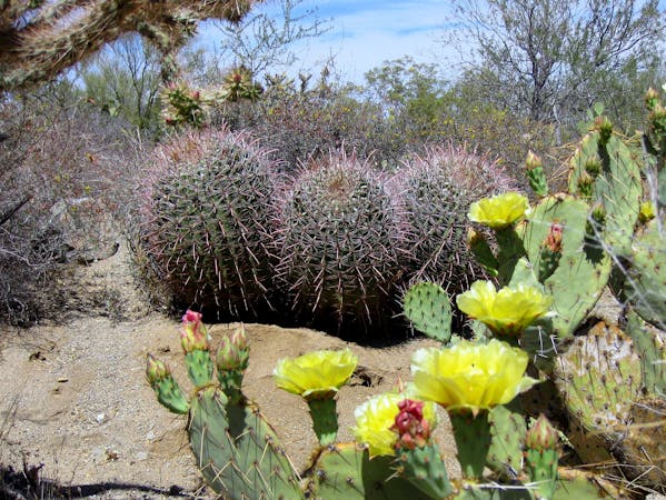
A relaxed stroll in the Cactus Forest, excellent for viewing desert plants, birds, and wildflowers.
Easy Hiking
5 routes · Hiking

9 routes · Hiking
6 routes · Hiking