5.7 km away
Wave Cave
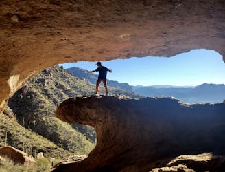
A short, popular hike to a unique rock formation.
Difficult Hiking
- Distance
- 4.8 km
- Ascent
- 271 m
- Descent
- 271 m
History and a stunning summit make this a classic hike
Hiking Difficult

On the edge of Phoenix lies this wonderful trip, which combines a huge amount into a relatively small distance. The initial part of the hike is easy, but it gets more tricky once past the famous hieroglyphs. If you go only as far as the hieroglyphs and then return to your car then the technical difficulty level of the hike drops considerably, as does the physical challenge.
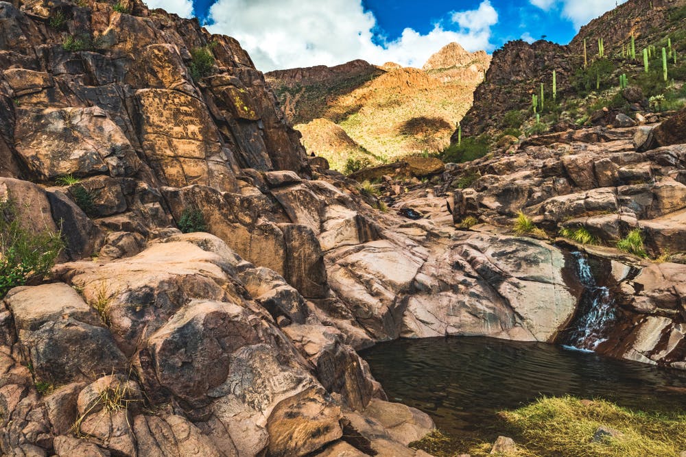
The trail climbs gently from the trailhead and winds through an ever-tighter canyon which contains some fabulous wildflowers and some year-round mini lakes. The hieroglyphs themselves are fascinating, and they are also an important archaeological site, so be careful not to alter them in any way. They're believed to be 1,500 years old and they've survived just fine so far - keep it that way!
In order to climb Superstition Mountain, carry on up the canyon and then follow the rounded, steep ridge to the summit via some straightforward scrambling. Soak in the huge Arizona views and then descend back to the car via the same route.
Difficult
Hiking trails where obstacles such as rocks or roots are prevalent. Some obstacles can require care to step over or around. At times, the trail can be worn and eroded. The grade of the trail is generally quite steep, and can often lead to strenuous hiking.

The trail contains some obstacles such as outcroppings and rock which could cause injury.

Little chance of being seen or helped in case of an accident.
5.7 km away
A short, popular hike to a unique rock formation.
Difficult Hiking
7.2 km away
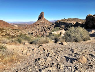
Hike to a view of Weavers Needle, the most recognizable peak in the Superstition Mountains.
Difficult Hiking
9.3 km away
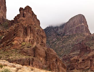
Climb to one of the best views in the Superstitions, up a steep canyon with rock scrambling required.
Severe Hiking

16 routes · Hiking