3.3 km away
36th Street -> Bittersweet Loop
Up-and-down cross country riding through the Tucson Mountains, right on the edge of the city.
Difficult Mountain Biking
- Distance
- 17 km
- Ascent
- 294 m
- Descent
- 294 m
A rugged, technical alternative to the classic Starr Pass.
Mountain Biking Severe

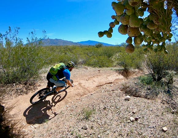
If you've ridden Starr Pass a few times and it's just not enough technical challenge for you, try on the Explorer and 360-View Loop instead! This 10-mile loop connects to Starr Pass, but it traverses much more technical, challenging trails.
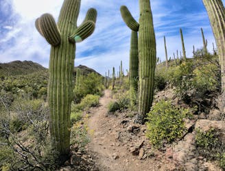
The route as mapped begins from the West Irvington Place trailhead and heads out on the Camaro Loop trail, swooping through the Sonoran Desert just on the edge of the city. After ducking under a four-lane highway via a small underpass (aka a drainage ditch), the route cuts through a neighborhood to finally reach Starr Pass.
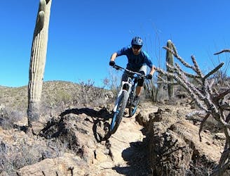
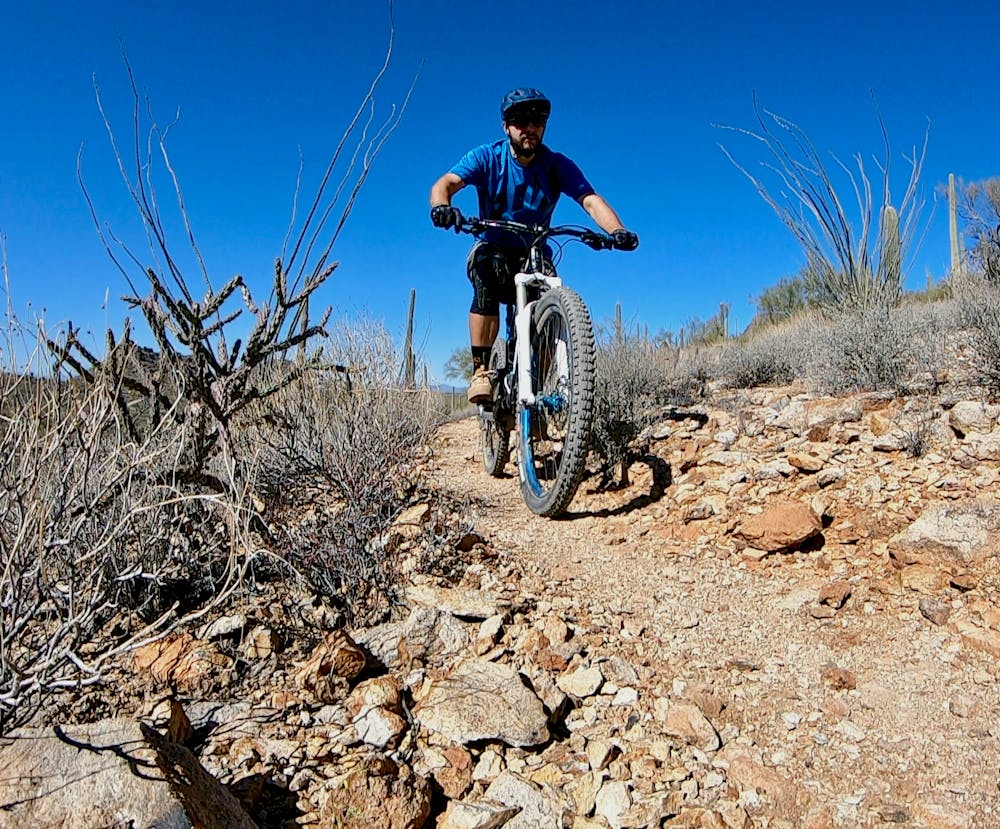
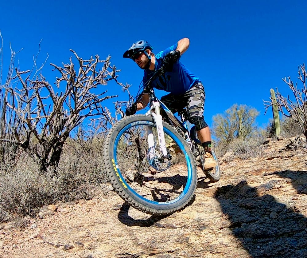
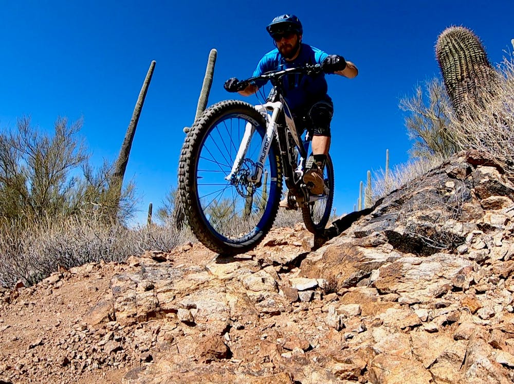
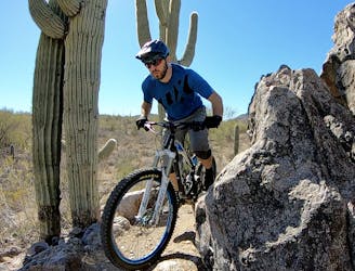
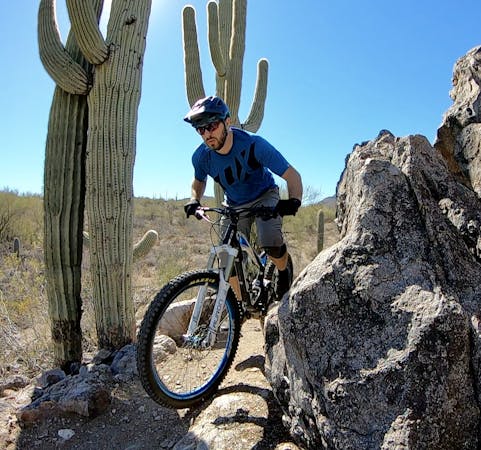
After reaching the top of the pass, take a left turn onto the Explorer Trail. Here the tech really begins! Explorer provides rugged, challenging singletrack with short, punchy climbs and steep, twisty descents. The rocks that provide the technical challenge are jagged and sharp, with rough protrusions just waiting to shred your sidewalls or pinch flat your tire. Where the trail descends off the backside of a low pass, the sharp rocks then mix with loose, rolling baby heads and shifting sand, providing a harsh, challenging descent that can make it difficult to pick up speed.
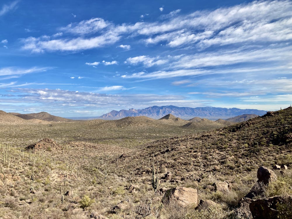
After crossing back under the highway, the route climbs back up a small ridge to reach the 360-View trail. As you can imagine, the views from this stretch of singletrack are absolutely stellar, but it provides some delightful chunk as well. The riding continues in the same vein as Explorer, although some of the features are a bit more rideable on this end of the trail system.
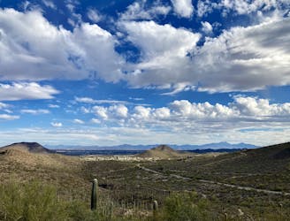
None of the miles come easily here, yet the beauty of this mountain range and the ability to pedal for miles and miles around and over these rugged peaks while still seeing the entirety of Tucson spread out below you is a unique and wonderful experience.
Severe
Widely variable, narrow trail tread with steeper grades and unavoidable obstacles of 15in/38cm tall or less. Obstacles may include unavoidable bridges 24in/61cm wide or less, large rocks, gravel, difficult root sections, and more. Ideal for advanced-level riders.

The trail contains some obstacles such as outcroppings and rock which could cause injury.
Away from help but easily accessed.
3.3 km away
Up-and-down cross country riding through the Tucson Mountains, right on the edge of the city.
Difficult Mountain Biking
5 km away
A well-rounded mountain bike ride through the gorgeous Tucson Mountains.
Difficult Mountain Biking
5 km away
For an epic route that tries to maximize the mileage found in the Tucson Mountain Range, try this 37-mile ride on for size.
Severe Mountain Biking
7.1 km away
A fun little trail system that's perfect for a quick after-work ride.
Severe Mountain Biking
10 routes · Mountain Biking
5 routes · Mountain Biking

32 routes · Mountain Biking · Hiking · Road Biking