1 m away
Tucson Mountains Epic

For an epic route that tries to maximize the mileage found in the Tucson Mountain Range, try this 37-mile ride on for size.
Severe Mountain Biking
- Distance
- 59 km
- Ascent
- 1.1 km
- Descent
- 1.1 km
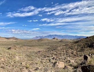
A well-rounded mountain bike ride through the gorgeous Tucson Mountains.
Mountain Biking Difficult

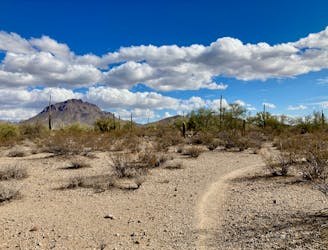
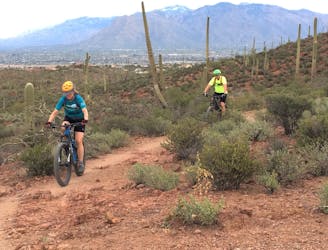
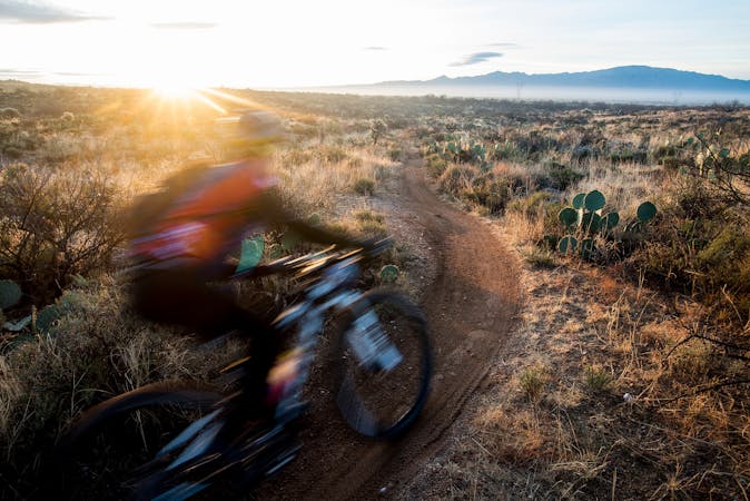
The Starr Pass Loop through Tucson Mountain Park provides a well-rounded mountain bike ride in an easily-digestible package. Neither too steep nor too flat, too technical nor too easy, this blue/black ride provides a delightful sample of the Tucson Mountains and the beauty that you can experience here.
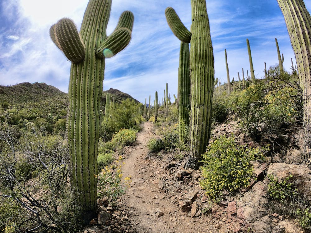
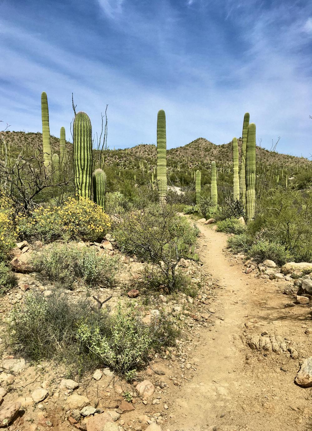
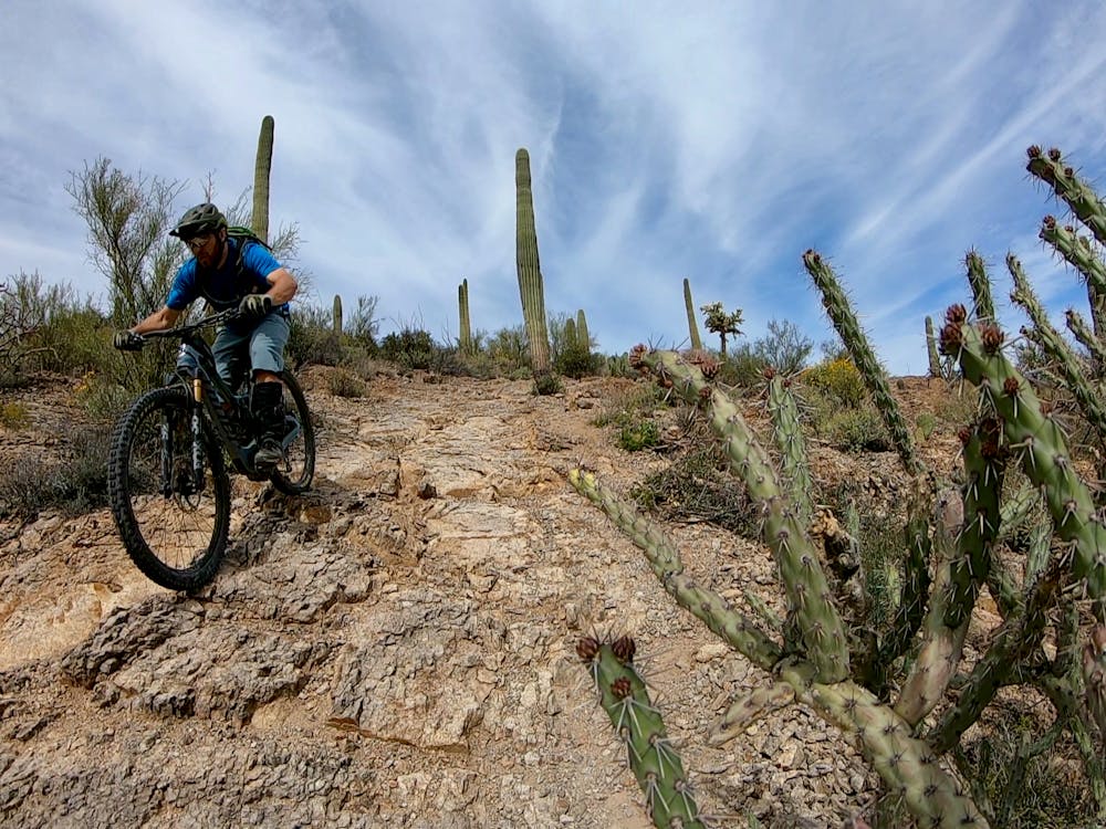
"The views around this loop are endless, and massive saguaro cacti line the way," writes adventure travel writer Brendon Voelker. "Smaller teddy bear cholla (named for their fuzzy appearance), and prickly pear cactus are also abundant. A wide array of desert wildlife also resides here, including countless snakes, lizards, tortoises, and even roadrunners."
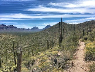
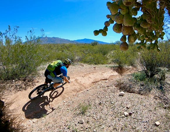
The route mapped here follows the Rock Wren trail from the trailhead to the eponymous Starr Pass Trail. Some of the most challenging rock sections on the route are encountered here on Starr Pass, early on in the ride. The technicality eases up as the ride progresses, so even if a few of the rocks are a bit over your head, take heart: it should get easier.
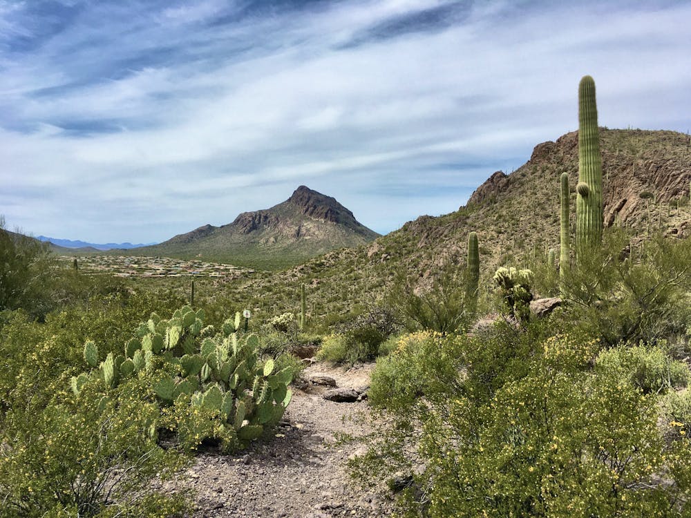
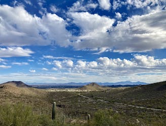
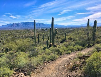
The trail eventually gains the top of the low pass between two steep mountains. From the top of the pass, the route drops gradually down the backside on the Sarasota Trail, wraps around the western side of the mountains to the Yetman Trail, and climbs back up a mild pass and the top of the primary descent.
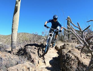
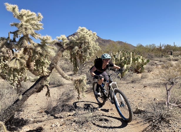
The main descent on Yetman is fast, flowy, and non-technical. The biggest challenges are not impaling yourself on a cactus and watching out for oncoming traffic, as this is a popular two-way trail. If you're willing to lean in close to the cacti, you can rail through the mildly-bermed corners at top speed!
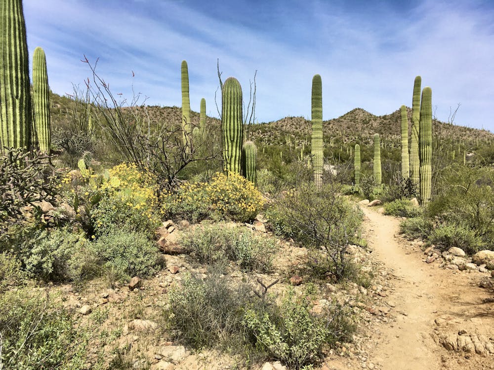
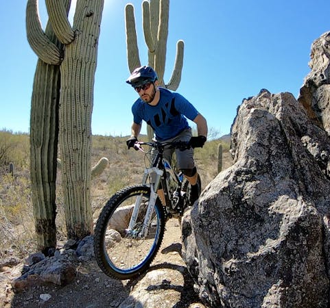
Once at the bottom of this descent, you'll find yourself at a four-way junction, with at least two viable options to return to the trailhead. The route mapped here takes the narrower and slightly more challenging singletrack alternative, but in this direction, you get to ride down a few rocky switchbacks instead of arduously pushing your bike up them.
While the route as mapped here—the most popular loop option in this region—is only a mere 8.5 miles long, it can easily be extended with the Explorer Trail leading to another series of loops to the south, or the Yetman trail continuing to either the northwest or the northeast. The Tucson Mountain Park trail system is extremely well-signed, making it easy for even a new visitor to Tucson to navigate through the network.
Difficult
Mostly stable trail tread with some variability featuring larger and more unavoidable obstacles that may include, but not be limited to: bigger stones, roots, steps, and narrow curves. Compared to lower intermediate, technical difficulty is more advanced and grades of slopes are steeper. Ideal for upper intermediate riders.

The trail contains some obstacles such as outcroppings and rock which could cause injury.
Away from help but easily accessed.
1 m away
For an epic route that tries to maximize the mileage found in the Tucson Mountain Range, try this 37-mile ride on for size.
Severe Mountain Biking
1.7 km away
Up-and-down cross country riding through the Tucson Mountains, right on the edge of the city.
Difficult Mountain Biking
2.6 km away
A fun little trail system that's perfect for a quick after-work ride.
Severe Mountain Biking
5 km away
A rugged, technical alternative to the classic Starr Pass.
Severe Mountain Biking
8.3 km away
Mellow singletrack with beautiful cacti and views of the Tucson Mountains.
Easy Mountain Biking
8.8 km away
A bite-sized beginner loop through towering saguaro cacti.
Easy Mountain Biking
8.8 km away
A classic, scenic desert mountain bike trail with challenging rock sections.
Moderate Mountain Biking
9.5 km away
Enjoy stupendous views of the Tucson Mountains and Saguaro National Park.
Severe Mountain Biking

37 routes · Mountain Biking
5 routes · Mountain Biking
10 routes · Mountain Biking

24 routes · Mountain Biking
5 routes · Mountain Biking
5 routes · Mountain Biking

32 routes · Mountain Biking · Hiking · Road Biking