3.1 km away
Airport Loop

Gorgeous loop around Airport Butte offering spectacular views of the valley.
Moderate Trail Running
- Distance
- 5.2 km
- Ascent
- 132 m
- Descent
- 133 m
An epic, high-exposure trail run with incredible views and extremely technical slickrock singletrack.
Trail Running Severe

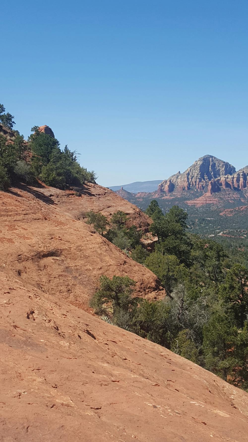
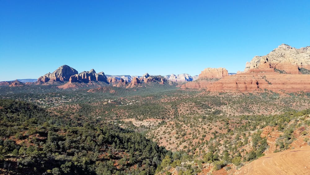
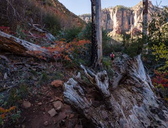
The Hangover Trail is the must-do trail run in Sedona. Contrary to its name, though, this run is one that you will want to save for another day if you had too many drinks the night before. Marked by white blazes painted onto the red rock, this 8-mile run is loaded with steep, quad-busting climbs rewarded with epic views of the stunning red landscape.
The best way to start the loop is from the main trailhead at the bottom of Schnebly Hill Road. The parking lot can hold a few dozen cars, but it can fill quickly during peak season or on holiday weekends. Take note of any parking or user fees noted at the trailhead.
The loop is a "lollipop" that begins and ends with Munds Wagon Trail. It crosses the road twice after leaving the parking lot and can be confusing to navigate. As an alternative, you could also run up the road instead. That said, it is open to vehicles and frequented by commercial sightseeing tours that drive visitors through the canyons in colorful jeeps.
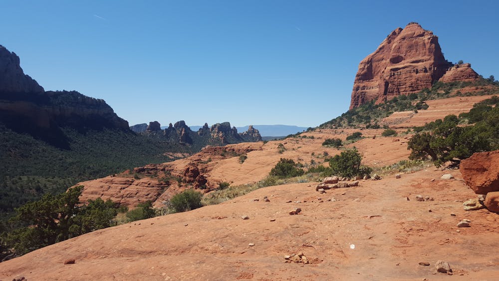
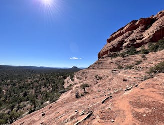
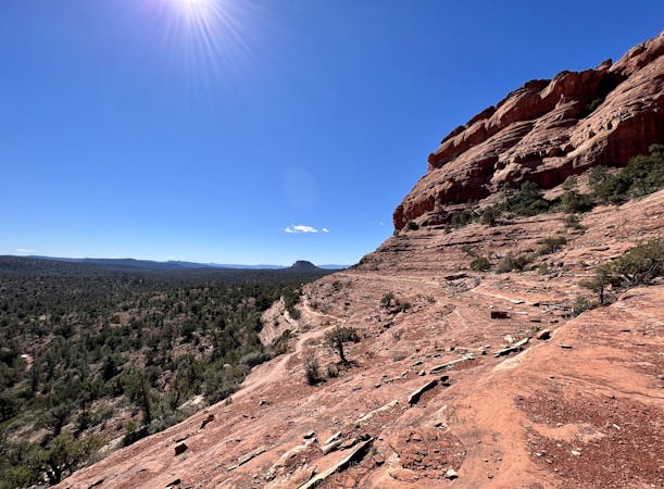
After crossing the road twice as you enter into the canyon, keep left and follow the sign for Cowpies Trail. It leads directly into Hangover Trail, which is where things really get fun. The next stretch skirts along southward-facing slickrock with views down into the canyon. While consequences may be higher for mountain bikers than trail runners, one fall or ankle roll could be dangerous.
The halfway point of the loop is a small plateau where there is a "gap" in the slickrock massif. The views are the best on the entire trail, so don't hesitate to stop and soak it in for a while. The trail then crosses onto a north-facing slope loaded with more views and even more technical terrain.
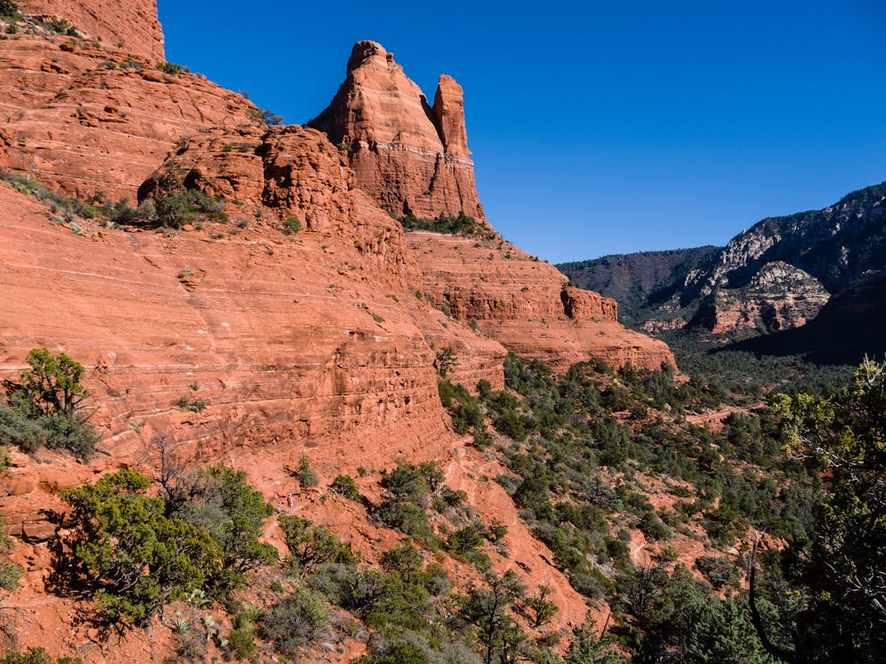
The second half of the trail is extremely technical and dangerous, more so than the first. Though there are more trees to give the illusion of safety, a bad fall would lead to a long fall down a slickrock face. Mountain bikers are often advised to walk this section due to the danger, and trail runners should heed the same warnings.
Worth noting, this run can be incredibly dangerous if you have never run on slickrock before. Hiking poles could be useful to help with traction, and familiar shoes are a must. There is no water available along the trail, either.
Severe

Some trail sections are extremely exposed where falling will almost certainly result in serious injury or death.

Little chance of being seen or helped in case of an accident.
3.1 km away
Gorgeous loop around Airport Butte offering spectacular views of the valley.
Moderate Trail Running
3.8 km away

A fantastic 5-mile loop around Brin's Butte.
Difficult Trail Running
4.3 km away

Enjoy a 360-degree red rock sensory experience on this incredible run!
Difficult Trail Running
6.6 km away
A view-heavy run to the highest point in the Sedona area.
Difficult Trail Running
7.1 km away

A beautiful loop on iconic Sedona trails.
Difficult Trail Running
7.7 km away
A long loop connecting Sedona trails both old and new.
Difficult Trail Running

17 routes · Hiking · Trail Running
10 routes · Trail Running
10 routes · Trail Running