2.7 km away
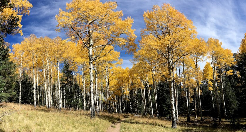
Airport Loop

Gorgeous loop around Airport Butte offering spectacular views of the valley.
Moderate Trail Running
- Distance
- 5.2 km
- Ascent
- 132 m
- Descent
- 133 m
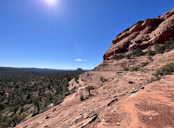
Enjoy a 360-degree red rock sensory experience on this incredible run!
Trail Running Difficult

This beautiful loop circumnavigates the Twin Buttes rock formation, crossing a low mountain pass along the way. Even so, this 3.8-mile run is quite aerobically moderate: it only gains 509 feet of vertical along the way, meaning that many prospective runners will be able to complete this loop.
You will have to arrive early to score a parking spot, though: the route as mapped begins on the Mystic trail off of Chapel Road. This trailhead is simply a narrow dirt pull out along the road, which means that it can easily fill up, even on weekdays. But if you arrive early enough to score a parking spot, you're golden! You could also begin this run from the Chapel itself if there's a parking spot to be had there. If you're game for some bonus miles, the Broken Arrow trailhead on the opposite side of the mountain also provides access to this network.
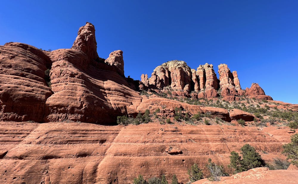
The running starts off easy, rolling up and down on the mostly-smooth Mystic trail. As you begin to turn right around the edge of the butte, you'll climb a bit to gain a rough, rocky bench-cut trail that traverses the north side of the buttes.
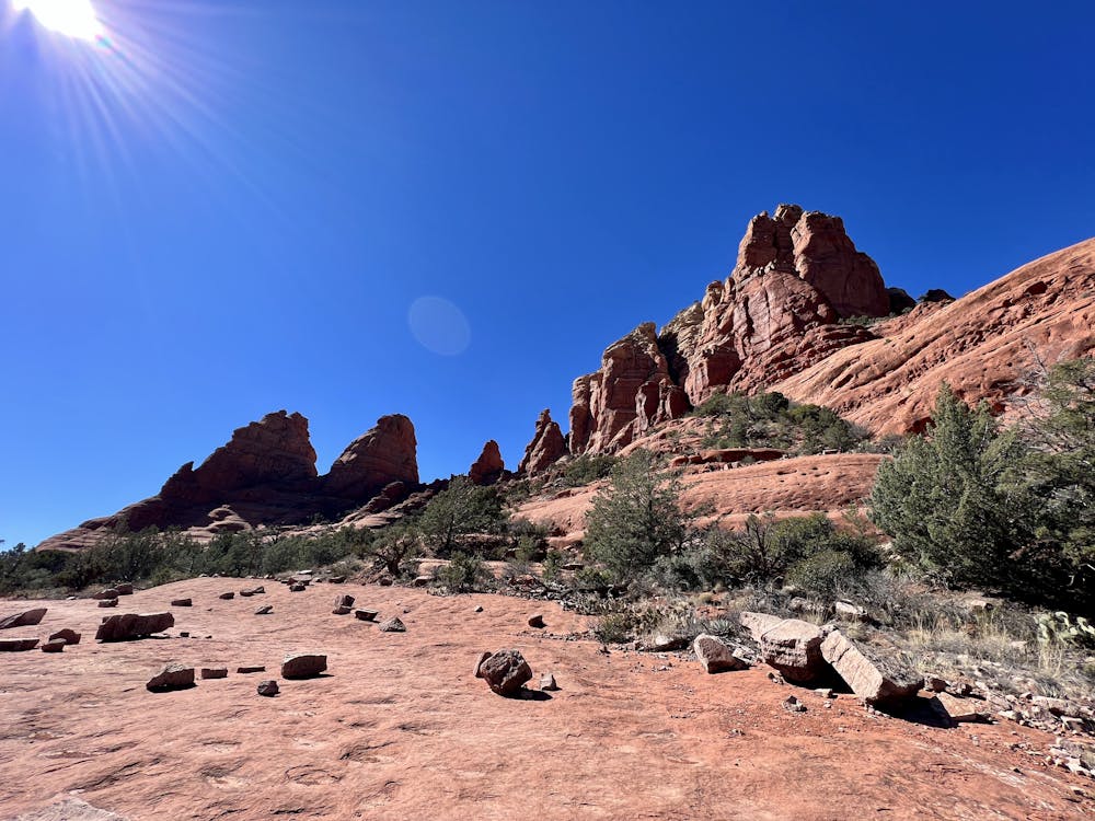
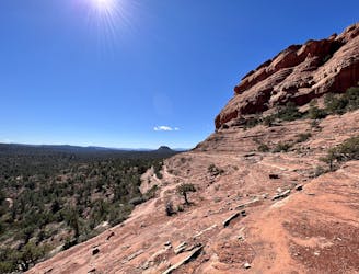
While you could theoretically run this loop in either direction, the clockwise direction marked here is highly recommended. As you begin traversing the north side of the ridge, you'll see why: this area is very popular with mountain bikers, and several of the trails on this side of the mountain are designated for one-way mountain bike traffic. When running the loop in this direction, you'll be traveling against the mountain bike traffic, so you can see the riders coming toward you. This is very important as these trails, known collectively as "The Hogs," are some of Sedona's famed double black diamond mountain bike descents. While running up the exposed slabs of bedrock, you'll inevitably get to watch riders try their luck on the steep, slippery, dangerous rock features that Sedona is famous for.
Seeing the bikers coming toward you on this section is doubly important, as The Hogs are one of the areas in Sedona where the trail signs note that both hikers/runners and bikers should yield to each other equally. While on most multi-use trails in the national forest, mountain bikers are supposed to yield to hikers, on some of the steep rock slabs found on The Hogs, it is impossible for bikes to stop—and the trail signs acknowledge this. So hikers and runners should be very aware of what's going on around them.
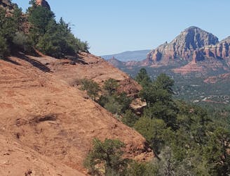
While you'll undoubtedly get a kick out of watching the riders try their luck on The Hogs' famous trails, the brief waves of bikers won't take away from the beauty of the area. As you run along exposed slabs of red rock and scale short (but steep) stone staircases, you'll enjoy stunning views across Sedona and Oak Creek to the north, with the red rock formations rising dramatically in the distance. A few exposed rock cliffs offer fantastic spots to stop and have a snack and simply soak in the view. The Acropolis is visible in the distance just north of downtown Sedona, but Munds Mountain and Lee Mountain form the intimidating skyline to the east. From the eastern reaches of the loop, you'll also gain an elevated view of Submarine Rock—yet another popular stop on the Pink Jeep tours.
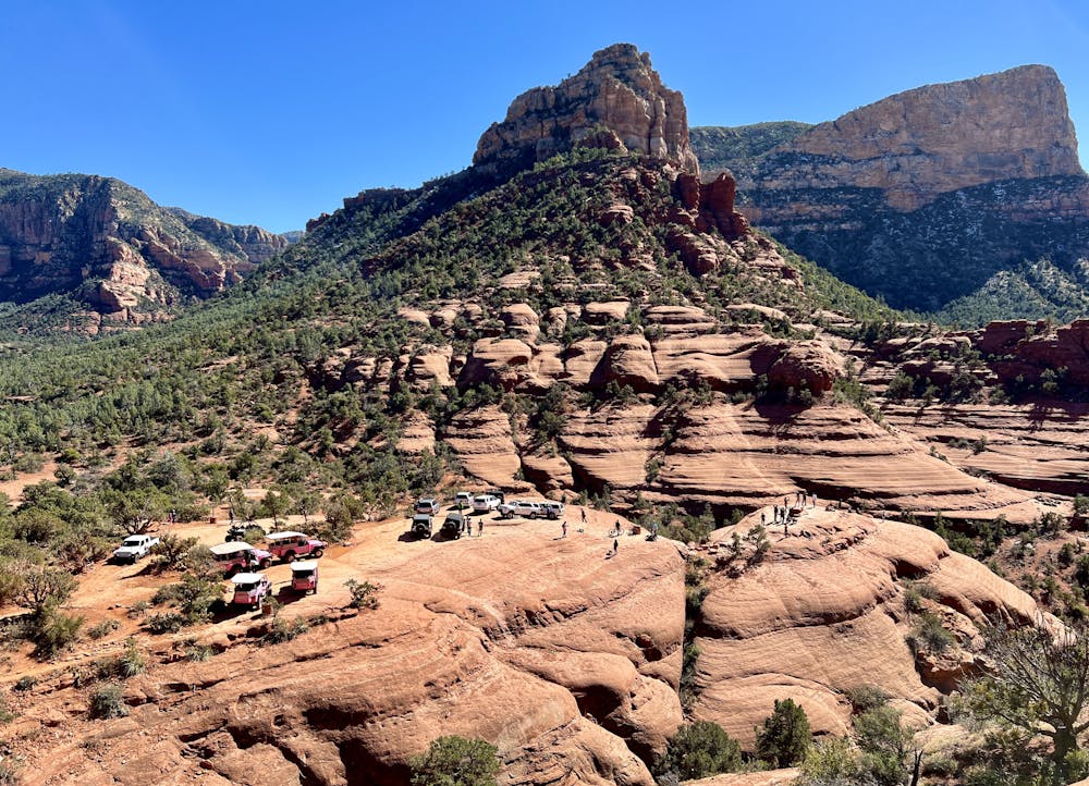
Eventually, you'll start to see more and more hikers as you approach Chicken Point, one of the most popular destinations served by the Pink Jeep Tours. While hordes of tourists inundate this beautiful viewpoint since you'll be on foot and spry of body, you have the choice to run high up on the rock cliffs above Chicken Point (near the Whiteline trail) to enjoy the vista in relative solitude, without having to wade through the crowds. Once you've savored this stunning mountain pass through the red rock cliffs, you'll have to run by the jeeps to head down the Little Horse trail to the Chapel Trail to complete your circuit of the mountain.
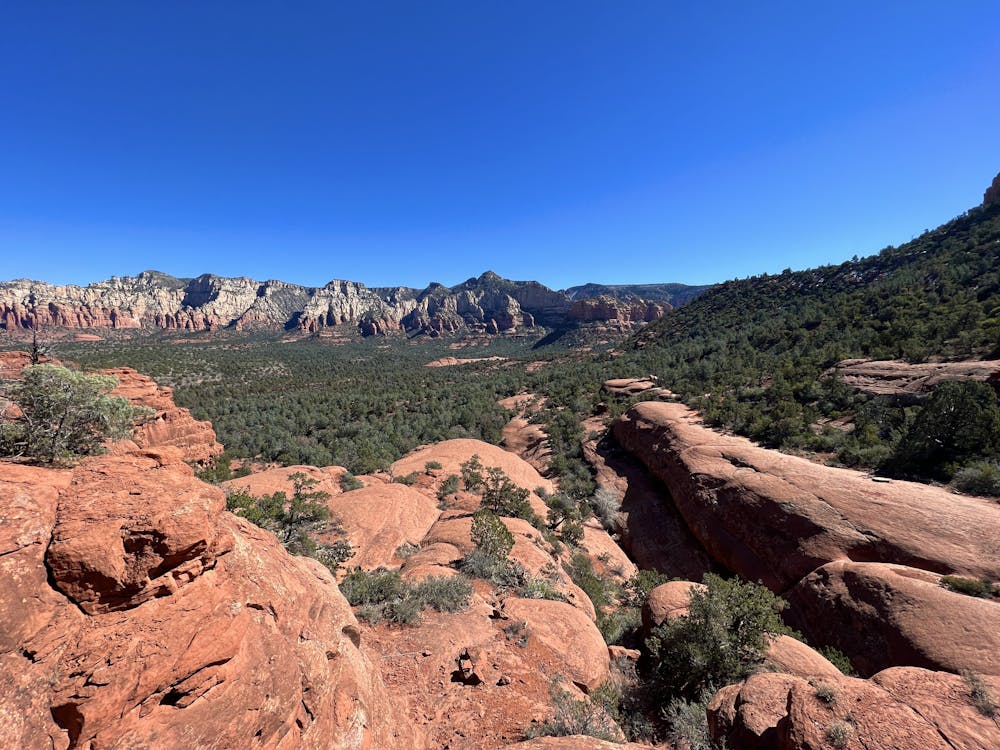
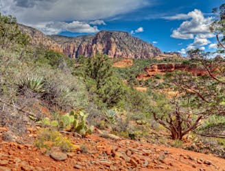
As you round the mountain and begin traversing the south side of the buttes, you'll note the soil, vegetation, and rock faces change ever due to the intensity of the sun. The views also transform, with a whole slew of other rock cliffs and views to enjoy as you switch to the opposite side of the mountain. Gibraltar Rock forms the opposite side of the pass at Chicken Point, and views into the distance reveal Courthouse Butte, Cathedral Rock, and more. On a loop run such as this one, you get to enjoy a full 360-degree sensory experience that is guaranteed to keep you engaged (and pulling your camera out) the entire time!
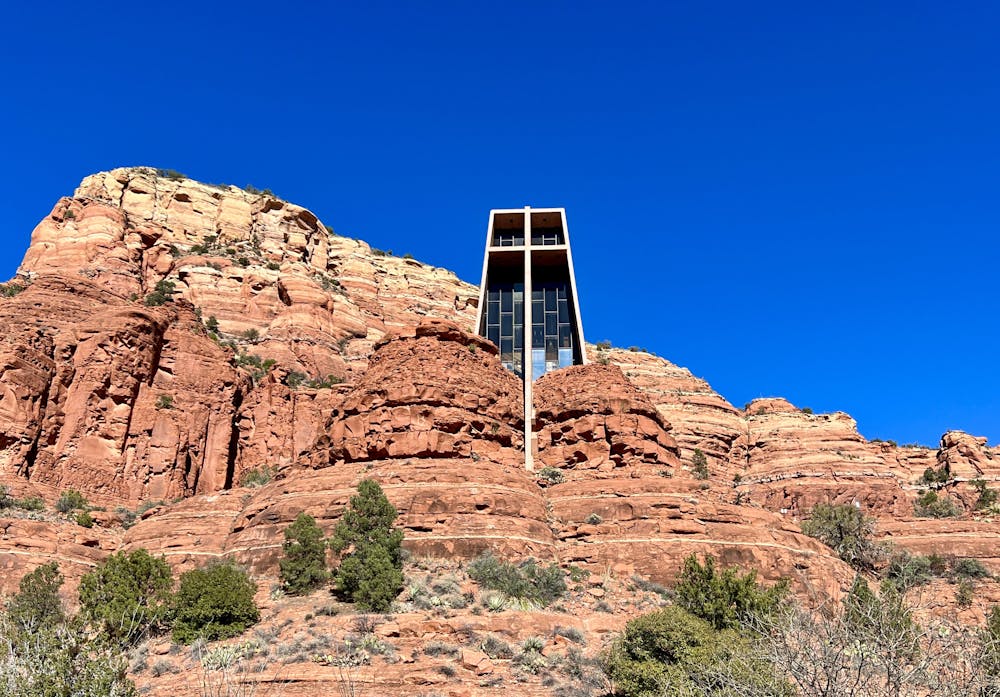
Upon reaching the Chapel, you can opt to head up and check out this stunning structure. The Chapel was designed and built as an extension of nature—not to dominate or destroy nature, but to blend into the natural environment in which it's found. Or, you can choose to skip the crowds and just finish the circuit. Unfortunately, for the last 0.4 miles you'll have to run along the busy paved road, but alas: there's no way around this. It's a small necessary evil for the fantastic loop run that you've just experienced!
Difficult

Some trail sections have exposed ledges or steep ascents/descents where falling could cause serious injury.

Away from help but easily accessed.
2.7 km away
Gorgeous loop around Airport Butte offering spectacular views of the valley.
Moderate Trail Running
4.3 km away
An epic, high-exposure trail run with incredible views and extremely technical slickrock singletrack.
Severe Trail Running
5.8 km away
A fantastic 5-mile loop around Brin's Butte.
Difficult Trail Running
6 km away
A long loop connecting Sedona trails both old and new.
Difficult Trail Running
7.8 km away

A beautiful loop on iconic Sedona trails.
Difficult Trail Running

17 routes · Hiking · Trail Running
10 routes · Trail Running
10 routes · Trail Running