2.5 km away
Syllamo: Scrappy Mountain Trail
The most technical trail in the Syllamo Trail system, with a long, fast descent at the start.
Severe Mountain Biking
- Distance
- 19 km
- Ascent
- 485 m
- Descent
- 486 m
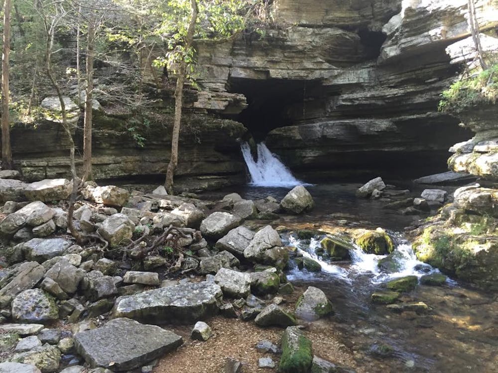
Bad Branch is the easiest—and flowiest!—trail in the Syllamo Trail System.
Mountain Biking Moderate

The Bad Branch Loop (BBL) is one of five trails in the Syllamo Mountain Bike Trail System. Together these interconnecting loops make up 50 miles of mountain bike trail that IMBA recognized as being an outstanding, destination-worthy mountain bike trail to assign it Epic status.
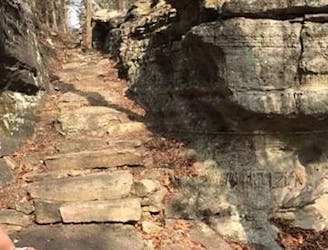
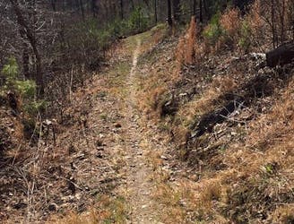
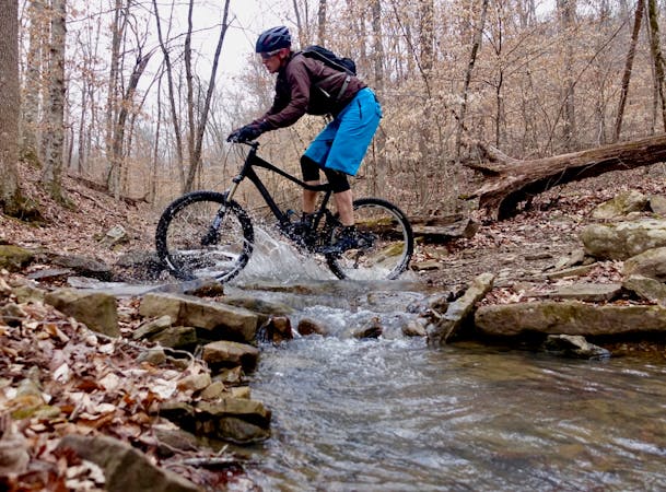
Most of the Syllamo trails are singletrack; however, there are sections where the trails follow old abandoned ATV trails. Over 70% of the trails are over rocky, rugged, and demanding terrain.
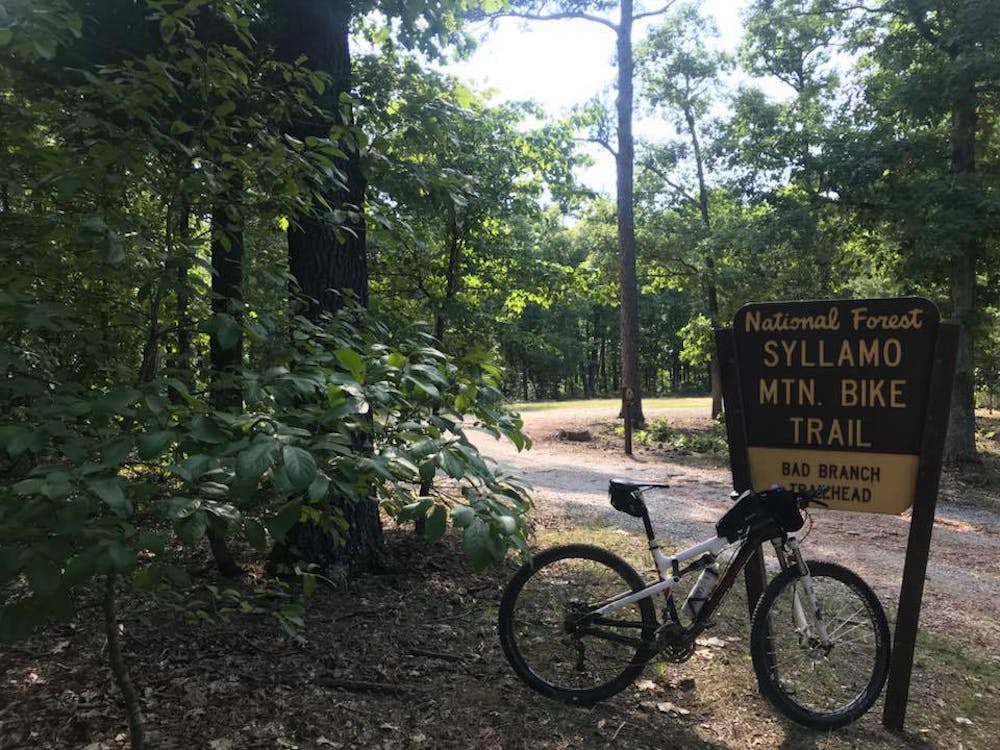
The trails can be accessed from four different trailheads, plus using a connector trail out of Blanchard Springs Recreation Area and Campground. Three trailheads are on Green Mountain Road and the fourth is on AR Highway 5 North.
The BBL trailhead is located on Green Mountain Road. The recommended direction to ride this trail is clockwise, so the fun part will come early, before you wear your legs out. There is a payback towards the end. The trail follows RED markers on brown carsonite posts.
This is the most recent trail constructed in the Syllamo Trail System, and this trail also requires the least amount of elevation gain. That helps make the BBL the most beginner friendly trail in the network.
Where some of the other trails followed ATV trails, the red BBL trail is all bench-cut and fast and flowy.
I have read several reports on the lack of maintenance for the Syllamo Trails in recent years. In defense of the trails, when considering the remote area of the state where the trails are located, and being situated in the heart of the Ozarks, there are no large cities to pull help from. However, as of the fall of 2018, with the volunteer efforts of people like Denny Hess and others, the trail is currently in pretty good shape. I have also heard there might be some financial support to pay crews to keep up the trails. So don’t base your decision to visit the trails on outdated reports.
Moderate
Mostly stable trail tread with some variability, with unavoidable obstacles 8in/20cm tall or less. Other obstacles such as rock gullies and steep sections may exist. Ideal for lower intermediate riders.

The path is on completely flat land and potential injury is limited to falling over.

Away from help but easily accessed.
2.5 km away
The most technical trail in the Syllamo Trail system, with a long, fast descent at the start.
Severe Mountain Biking
2.5 km away
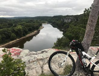
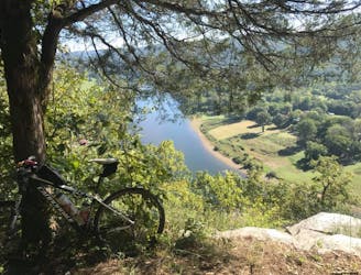
A flowytrail that rewards riders with some great bluff views.
Difficult Mountain Biking
5.4 km away
A flowy trail through the Ozark Mountain forest with lots of short climbs.
Difficult Mountain Biking
5.4 km away
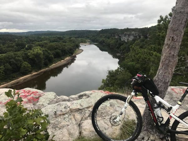
This short lollipop trail is a snapshot of the entire Syllamo Trail System, with some easy, rolling pine tree-lined sections, rocky trail, and bluffs with views.
Difficult Mountain Biking
9 routes · Mountain Biking
5 routes · Mountain Biking