5 m away
Syllamo: Bald Scrappy Trail
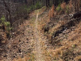
A flowy trail through the Ozark Mountain forest with lots of short climbs.
Difficult Mountain Biking
- Distance
- 11 km
- Ascent
- 312 m
- Descent
- 312 m
This short lollipop trail is a snapshot of the entire Syllamo Trail System, with some easy, rolling pine tree-lined sections, rocky trail, and bluffs with views.
Mountain Biking Difficult

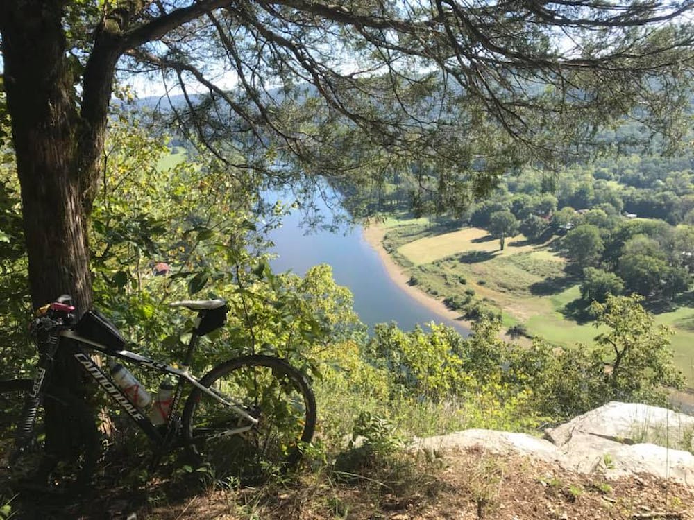
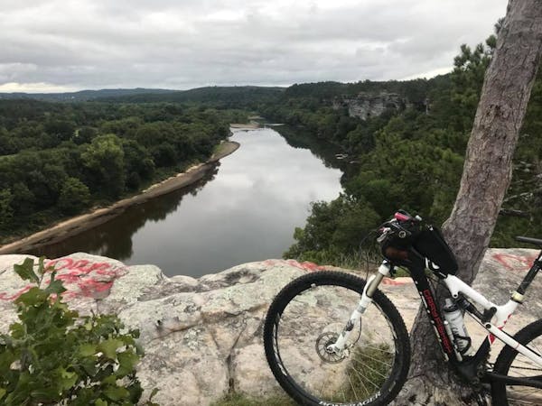
The White River Bluff Loop (WRBL) is one of five trails in the Syllamo Mountain Bike Trail System. Together these interconnecting loops make up 50 miles of mountain bike trail that IMBA recognized as being an outstanding, destination-worthy mountain bike trail to assign it Epic status.
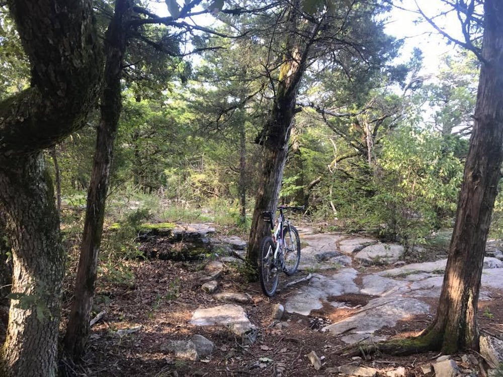
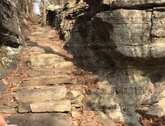
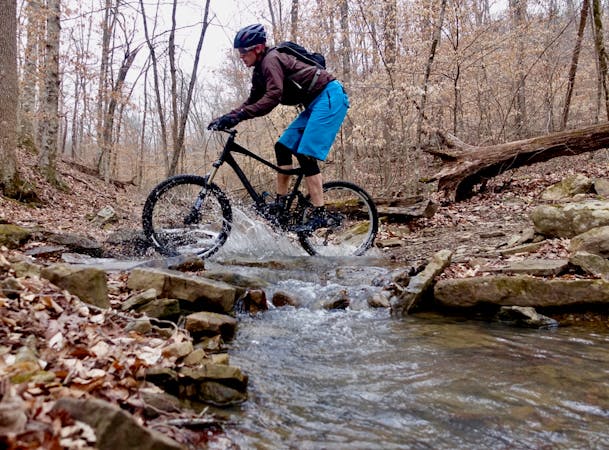
Most of the Syllamo trails are singletrack; however, there are sections where the trails follow old abandoned ATV trails. Over 70% of the trails are over rocky, rugged, and demanding terrain.
The trails can be accessed from four different trailheads, plus using a connector trail out of Blanchard Springs Recreation Area and Campground. Three trailheads are on Green Mountain Road and the fourth is on AR Highway 5 North.
The WRBL trailhead is located on Green Mountain Road. It is a short lollipop loop with GREEN trail markers on brown carsonite posts. After riding a short trail you will reach the beginning of the loop. The recommended direction to ride is counter-clockwise.
There are a few technical, rocky climbs to reach the picturesque bluff views of the White River and Sylamore Creek Valley, but your efforts will be well-rewarded.
Other than the climbs in the bluff sections, the remainder of the WRBL is flowy and fast through rolling pine tree-lined forest.
Difficult
Mostly stable trail tread with some variability featuring larger and more unavoidable obstacles that may include, but not be limited to: bigger stones, roots, steps, and narrow curves. Compared to lower intermediate, technical difficulty is more advanced and grades of slopes are steeper. Ideal for upper intermediate riders.

The path is on completely flat land and potential injury is limited to falling over.

Away from help but easily accessed.
5 m away
A flowy trail through the Ozark Mountain forest with lots of short climbs.
Difficult Mountain Biking
3 km away
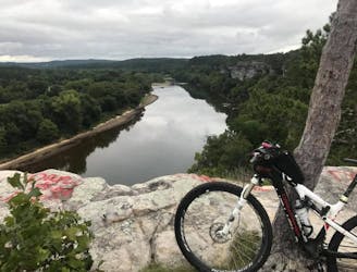
A flowytrail that rewards riders with some great bluff views.
Difficult Mountain Biking
3 km away
The most technical trail in the Syllamo Trail system, with a long, fast descent at the start.
Severe Mountain Biking
5.4 km away
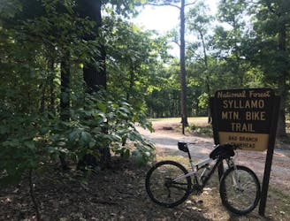
Bad Branch is the easiest—and flowiest!—trail in the Syllamo Trail System.
Moderate Mountain Biking
9 routes · Mountain Biking
5 routes · Mountain Biking