1 m away
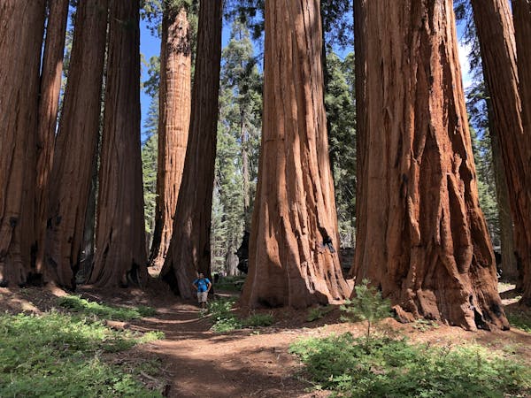
General Sherman Tree and the Congress Grove
Hike past the largest tree in the world!
Easy Hiking
- Distance
- 4.8 km
- Ascent
- 188 m
- Descent
- 188 m
This 7-mile hike rolls through groves of the largest trees on planet earth.
Hiking Moderate

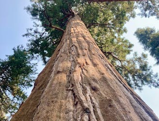
"You'll be massaging the kinks out of your neck after gaping upward at some of the world's largest sequoias," according to Backpacker Magazine. Indeed, these towering trees are truly a sight to behold, and this 7-mile loop puts the best and biggest sequoias in the world on full display.
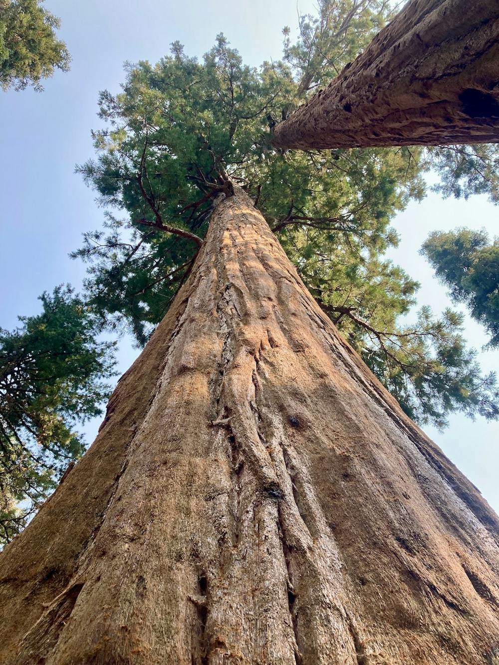
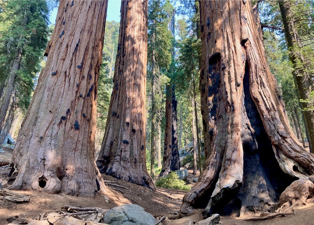
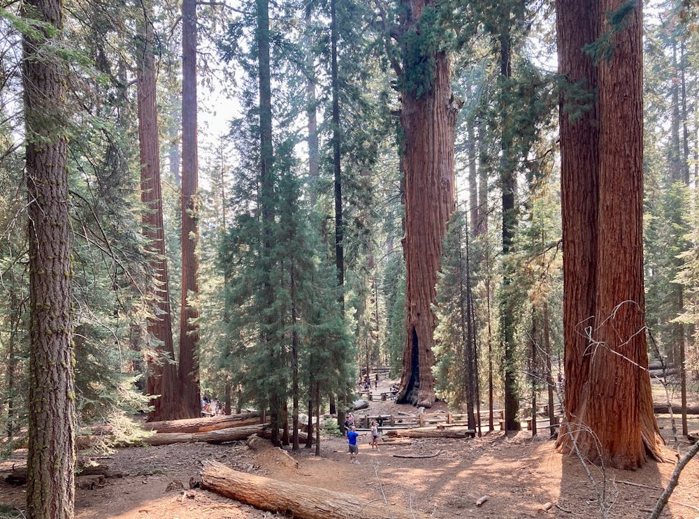
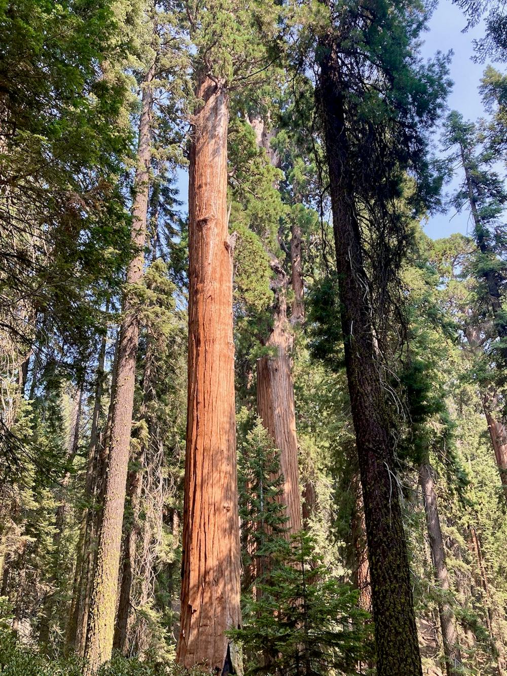
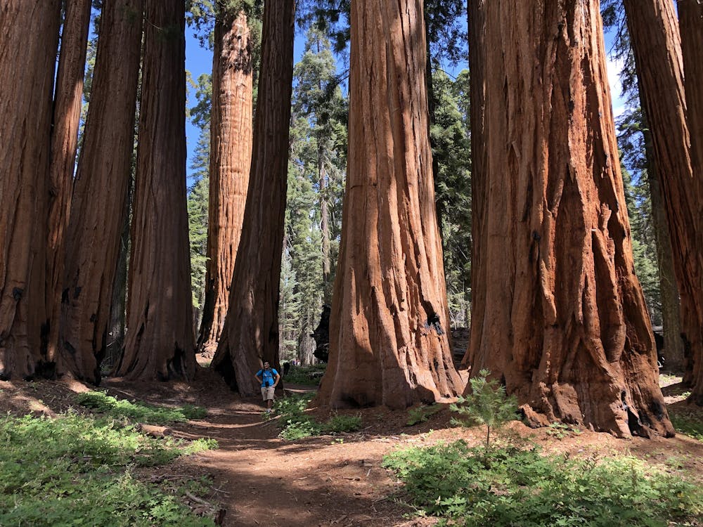
The route begins with the popular Congress Grove Trail. "The Congress Trail is a popular paved loop that starts at the General Sherman Tree, the largest in the world, and goes about a mile south to an impressive collection of immense sequoias, a few of which look just as big as the Sherman Tree, and some unusual clusters of sequoia," according to RedwoodHikes.com. Since trail is easily the best place to enjoy spectacular groves of Sequoias in Sequoia National Park, it is exceedingly popular.
While the entire Congress Grove (split into the House and the Senate) is spectacular, the towering General Sherman Tree is the focal point of, arguably, the entire national park. "The General Sherman Tree is the world's largest tree, measured by volume," according to the NPS. "It stands 275 feet (83 m) tall, and is over 36 feet (11 m) in diameter at the base. Sequoia trunks remain wide high up. Sixty feet above the base, the Sherman Tree is 17.5 feet (5.3 m) in diameter."
Once you depart the Congress Grove Trail and head for the more remote (respectively) reaches of the Giant Forest Loop, the crowds will thin out significantly. Even though you'll leave the crowds behind, the towering sequoias will be your constant companions for many miles. In the farthest reaches of the loop, you'll pass other notable sights, including Tharp's Log Cabin and Crescent Meadow.
Moderate
Hiking along trails with some uneven terrain and small hills. Small rocks and roots may be present.

The path is on completely flat land and potential injury is limited to falling over.

Away from help but easily accessed.
1 m away
Hike past the largest tree in the world!
Easy Hiking
1.8 km away
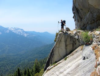
Widely regarded as one of the most incredible day hikes in the USA!
Difficult Hiking
3.1 km away
One of the most popular hikes in Sequoia National Park leads to stunning 360-degree views of the region.
Moderate Hiking
3.3 km away
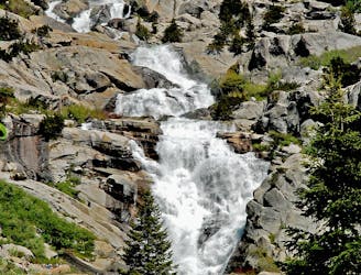
At 1,200 feet tall, Tokopah Falls is the tallest waterfall in Sequoia National Park.
Moderate Hiking
3.3 km away
A committing crossing of California's Sierra Nevada with the option to summit Mt. Whitney.
Difficult Hiking

25 routes · Alpine Climbing · Hiking

5 routes · Alpine Climbing · Hiking
7 routes · Alpine Climbing · Hiking

14 routes · Hiking